The Côte Saint-Amador in Bailleul-Neuville

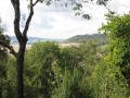
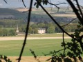
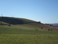
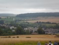
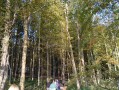
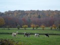
A lovely walk that will take you past Bailleul-Neuville Castle and through part of the Hellet Forest. You can also enjoy the lovely view over the Béthune valley and Mesnières-en-Bray Castle from the Côte Saint-Amador.

Details

367859
Creation:
Last update:
Last review:
  • Walking
    Activity: Walking
  • ↔
    Distance: 12.27 mi
  • ◔
    Average duration: 6h 45 
  • ▲
    Difficulty: Moderate

  • ⚐
    Back to start: Yes
  • ↗
    Ascent: + 1,302 ft
  • ↘
    Descent: - 1,302 ft

  • ▲
    Highest point: 712 ft
  • ▼
    Lowest point: 308 ft

Photos

Description of the walk

Start from the car park at Place de l’École, next to the town hall.

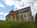
(S/E) Turn left onto Rue du Presbytère, passing the church on your left. At the end of the street, turn left onto the D117.

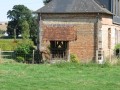
(1) Walk past the château on your left. Leave Rue du Bout d’En Haut – a dead-end street – on your left and continue for about 150 metres.

(2) Take the path on the left and carry on straight ahead, passing under a power line.

(3) At the top of the hill, at the junction, ignore the paths on the right and continue along the path that branches off to the left. At the next junction, by the bus stop, follow the tarmac road to the right. Follow this road (Rue de Duranville) as far as Baillolet.
Walk past the church.

(4) After the school, turn right onto Rue du Hellet, then onto Rue du Vau Roux. Ignore two turnings on the right and continue to the end of the street.

(5) At the bend, follow the path opposite. Stay on the main path as it enters the forest. Ignore the path on the right after about 300 metres and carry on straight ahead.

(6) At the junction, turn right onto the path heading north-west. Follow this to the end; it turns left at the end to join the D117. Follow the D117 to the left for 200 metres.
.
(7) Take the path on the right at the edge of the forest and follow it to the junction with the D56. Cross over and continue straight ahead.
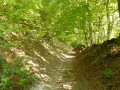
Continue along this path, which runs through a ravine, until it reaches the edge of the forest.

(8) Ten metres past the edge of the forest, take the path on the left at an acute angle. The first 150 metres are not maintained. Follow the path as it climbs through the forest and veers to the right at the top of the climb. You’ll come out onto a track; turn right and join the D97 after 10 metres.

(9) Cross the road and follow the path opposite, which is not very visible. At the next junction, turn left, then carry on straight ahead at the following junction.
About 100 metres further on, turn onto the path on the right that leads downhill and continue along the main path for 900 metres.

(10) At the junction on the plain (elevation 144), turn right. (If you carry on straight ahead, you can reach Mesnières-en-Bray and see its magnificent château).
Follow the nature trail which runs alongside a long cultivated field on your left, almost until the end of the bend to the right.

(11) A marked path on the right offers the chance to take a round trip to the remarkable viewpoint at Côte Saint-Amador.
Return to the nature trail and continue along it to the picnic area. Carry on to the right to leave the picnic area.
Follow the D97 to the right for 30 metres. Cross the road and, at the bend to the right, take the path on the left which descends into the plain towards the north-west.
Ignore the first path on the left which leads down to Mesnières-en-Bray and head for the T-junction.

(12) Take the path on the right, then the one that turns 90° to the left and joins the junction with the tarmac road. Continue to the right for about a hundred metres; you’ll be in La Gâte.

(13) Take the path on the right which leads into the forest. There is a memorial stone 10 metres ahead. At the next junction, follow theGR® to the left, which runs along the edge of the forest. Cross the D56 and continue along the path opposite. Stay on the main path.

(14) Take the fifth path on the left. There is a wooden chalet 20 metres ahead. Walk past it and, at the end, turn right.
At the junction, turn left to reach the corner where the paths meet at the edge of the forest. Take the path that runs along the edge of the forest to the right (north-west). Almost at the end of the path, turn right towards the small clearing and then left.

(15) At the end, at the junction, follow the path on the right. Stay on the main path; at the Y-junction, take the path on the left and continue to the road.

(16) Take the road to the right for 30 metres and follow the path to the left of the road. Stay on the main path.

(17) At the junction as you come out of the woods, follow the path on the right. When you reach the tarmac road, follow it to the left.
Head towards Bailleul-Neuville. At the junction, turn left and then right to return to the starting point (S/E).


Waypoints

  1. S/E : mi 0 - alt. 308 ft - Place de l’École
  2. 1 : mi 0.2 - alt. 338 ft - Castle - Château de Bailleul-Neuville
  3. 2 : mi 0.51 - alt. 344 ft - Path on the left
  4. 3 : mi 0.95 - alt. 443 ft - Junction
  5. 4 : mi 1.82 - alt. 377 ft - School on the left-hand side
  6. 5 : mi 2.22 - alt. 436 ft - Path opposite
  7. 6 : mi 3.19 - alt. 564 ft - At the junction, turn right
  8. 7 : mi 4.25 - alt. 502 ft - Path on the right
  9. 8 : mi 5.44 - alt. 489 ft - Junction: turn left at an acute angle
  10. 9 : mi 5.88 - alt. 709 ft - Crossing the D97
  11. 10 : mi 6.59 - alt. 472 ft - Marker 144, on the right
  12. 11 : mi 7.02 - alt. 492 ft - Point de vue remarquable du pays de Bray Côte Saint Amador
  13. 12 : mi 7.94 - alt. 335 ft - At the junction, turn right
  14. 13 : mi 8.44 - alt. 531 ft - La Gâte
  15. 14 : mi 9.42 - alt. 646 ft - Fifth path on the left
  16. 15 : mi 9.9 - alt. 659 ft - Junction
  17. 16 : mi 10.97 - alt. 584 ft - Turn right
  18. 17 : mi 11.38 - alt. 463 ft - At the junction, take the path on the right
  19. S/E : mi 12.27 - alt. 308 ft - Place de l’École

Notes

A good pair of walking boots.
There is a picnic area after (11), and a table at (12).
During the hunting season, check theNational Forestry Office website to find out the hunting periods in this part of the forest.

Worth a visit

Mesnières-en-Bray Castle.
Neufchâtel-en-Bray and its famous heart-shaped cheese.
There’s a paragliding spot near Londinières.
The Avenue Verte between Dieppe and Forges-les-Eaux.

Always be cautious and plan ahead when you're outdoors. Visorando and the author of this route cannot be held responsible for any accidents occurring on this route.

The GR® and PR® markings are the intellectual property of the Fédération Française de Randonnée Pédestre.

Reviews and comments

5 / 5
Based on 2 reviews

Reliability of the description
5 / 5
Ease of following the route
5 / 5
Route interest
5 / 5
Papa-Ours
Papa-Ours

Hello Bernard,

I’m going to suggest it as an outing anyway, because I really loved the route and the various views it offers.

Machine-translated

bernard popiol
bernard popiol

Thank you, David ‘Papa Ours’.
That’s a walk I need to update. It’s been a long time since I last did it.
Thanks for the info.
See you soon on a hike

Machine-translated

Papa-Ours
Papa-Ours
• Edited:

Overall rating : 5 / 5

Date of your route : Mar 13, 2021
Reliability of the description : ★★★★★ Very good
Ease of following the route : ★★★★★ Very good
Route interest : ★★★★★ Very good
Very busy route : No

Hello,

A lovely walk with a great variety of trails. Between point 8 and point 9, we were stopped by the landowner, who pointed out that we were on private property, but he let us carry on. After point 9, it was difficult to find the path leading to point 10, as the forest had been cleared.
But overall, it was a very interesting and thoroughly enjoyable walk. Thank you for introducing us to it.
Kind regards, David

Machine-translated

benoitrando
benoitrando
• Edited:

Overall rating : 5 / 5

Date of your route : Jun 16, 2018
Reliability of the description : ★★★★★ Very good
Ease of following the route : ★★★★★ Very good
Route interest : ★★★★★ Very good

An excellent route through fields and woodland, with very little tarmac. We had a lovely time in the Hellet Forest and enjoyed a breathtaking panoramic view of the Côte Saint-Amador (on a clear day).
Having cycled these routes quite often in Seine-Maritime, I find that Kélylamil, to the south, and Bernard Popiol, to the north, are to route descriptions what Swiss watchmakers are to the passing of time.

Thank you, Bernard

Machine-translated

jean benard
jean benard

We’ll be going on this walk in October; I’ll be able to tell you more then.
Kind regards.

Machine-translated

Other walks in the area

For more walks, use our search engine .

The GPS track and description are the property of this route's author. Please do not copy them without permission.