Limeuil – Les Eyzies-de-Tayac-Sireuil

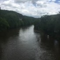
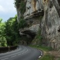
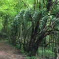
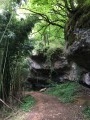
The final stage on theGR®6, heading towards Le Bugue and Saint-Cirq to the prehistoric caves of Les Eyzies, where you can discover magnificent views and lush green forests.

This walk is part of a multi-day hike: Les méandres de la Dordogne

Details

1140757
Creation:
Last update:
Last review:
  • Walking
    Activity: Walking
  • ↔
    Distance: 9.17 mi
  • ◔
    Average duration: 5h 10 
  • ▲
    Difficulty: Difficult

  • ⚐
    Back to start: No
  • ↗
    Ascent: + 1,109 ft
  • ↘
    Descent: - 1,440 ft

  • ▲
    Highest point: 614 ft
  • ▼
    Lowest point: 180 ft
  • ⚐ Country: France
  • ⚐
    Area: Périgord
  • ⚐ City: Limeuil (24510)
  • ⚑
    Start: N 44.912609° / E 0.89137°
  • ⚑
    End: N 44.941146° / E 1.008374°
  • ❏
    IGN map(s): Ref. 1936ET, 1936O
  • Hour-by-hour weather

Photos

Description of the walk

(S) Set off from the campsite in the forest. Head down towards the D703, follow it to the left before turning right towards Font Bessoune. Continue to the junction with a forest track.

(1) Turn right onto this path towards Lambertie, then head back up to the road. Follow the road to the right for about 150 metres.

(2) Just after a path branches off to the left, a few metres further on, turn left onto a narrower path through the woodland. At the junction, turn left onto the road, then right, leaving theGR®6.

(3) Follow a path on the left that descends through woodland, following the yellow markings towards Le Coteau. Please note that the path is narrow and very technical. Join theGR®6via the road on the right. Walk past the fire station and continue along Rue du Jardin Public to the roundabout. Turn right onto Rue de la République.

(4) Look for the steps on the left opposite the market halls and climb up Rue du Calvaire. Turn right onto Chemin de la Bessade and continue your ascent, following the red and white markings. At Boutenègre, turn left.

(5) At the stop sign, turn right onto the road towards Laval, then turn left onto a grassy track, just past the walnut trees, running alongside a fence.

(6) Turn left at the duck pond, then right onto the road after the Bois de Saint-Cirq. Continue towards Petit-Paris, then pass La Peyrière on your left and head for Suscanaval.

(7) At the crossroads, turn right onto a wide track, then leave theGR®6to the left onto a grassy path leading downhill. Pass a wash house on your left and continue to the road.

(8) At the cross, rejoin theGR®6towards Le Clauzel, then turn right to reach Les Plagnes.

(9) Turn left towards Bigayre.

(10) Turn right at a 90° angle. After the frog pond, turn left into the woodland onto a path leading uphill towards La Bruyère. Turn left onto the road, then right at the pylon until you reach the crossroads.

(11) Turn left at a 90° angle, then right and left again, staying on theGR®6. Head downhill and join the D47. Cross it and follow a path alongside the Vézère, leaving theGR®6, until you reach the canoe and kayak centre.

Pass under the D47 and rejoin theGR®6, then cross the Vézère. Continue along Avenue de Laugerie. Turn left in front of the Abri du Cro-Magnon onto the D47E leading to Les Eyzies de Tayac-Sireuil railway station (E).

Waypoints

  1. S : mi 0 - alt. 535 ft - Camping in the forest.
  2. 1 : mi 0.85 - alt. 289 ft - On the right
  3. 2 : mi 1.68 - alt. 564 ft - Path on the left
  4. 3 : mi 2.17 - alt. 558 ft - Path leading down to the left
  5. 4 : mi 2.8 - alt. 194 ft - Stairs on the left - Vézère (rivière)
  6. 5 : mi 3.74 - alt. 597 ft - At the bus stop, turn right towards Laval
  7. 6 : mi 3.96 - alt. 584 ft - Turn left after the duck pond
  8. 7 : mi 5.18 - alt. 486 ft - Turn right onto a wide path
  9. 8 : mi 5.56 - alt. 358 ft - Croix, towards Le Clauzel
  10. 9 : mi 5.99 - alt. 463 ft - Turn left towards Bigayre
  11. 10 : mi 6.49 - alt. 262 ft - Turn right at a 90-degree angle
  12. 11 : mi 7.77 - alt. 443 ft - Turn left at a 90° angle onto the road
  13. E : mi 9.17 - alt. 220 ft - Les Eyzies station in Tayac-Sireuil.

Notes

Drinking water available in Le Bugue and Les Eyzies.
Sturdy walking boots.
Return journey possible by train from Les Eyzies station via Bergerac station.

Worth a visit

Always be cautious and plan ahead when you're outdoors. Visorando and the author of this route cannot be held responsible for any accidents occurring on this route.

The GR® and PR® markings are the intellectual property of the Fédération Française de Randonnée Pédestre.

Reviews and comments

4.1 / 5
Based on 4 reviews

Reliability of the description
4.3 / 5
Ease of following the route
4.3 / 5
Route interest
3.8 / 5
dlws
dlws

Overall rating : 3.7 / 5

Date of your route : Aug 31, 2020
Reliability of the description : ★★★★☆ Good
Ease of following the route : ★★★★★ Very good
Route interest : ★★☆☆☆ Disappointing
Very busy route : No

The starting point: The car park is the one next to the school; there’s only one school, so why refer to ‘the old’ school?
The route isn’t very interesting and there are too many tarmac or road sections.

Machine-translated

jack33
jack33

Overall rating : 4.7 / 5

Date of your route : Sep 24, 2019
Reliability of the description : ★★★★★ Very good
Ease of following the route : ★★★★★ Very good
Route interest : ★★★★☆ Good

A lovely route, very hilly
Starting from Les Eyzies, the finish in the narrow streets of Le Bugue is charming

Machine-translated

braudjeanmarie1952
braudjeanmarie1952

Overall rating : 3.7 / 5

Date of your route : Oct 22, 2018
Reliability of the description : ★★★★☆ Good
Ease of following the route : ★★★☆☆ Average
Route interest : ★★★★☆ Good

A lovely walk. A difficult start – we had trouble finding a parking space for a 70-seater coach.

Machine-translated

YVONBONNEAU
YVONBONNEAU

Overall rating : 4.3 / 5

Date of your route : Jun 11, 2018
Reliability of the description : ★★★★☆ Good
Ease of following the route : ★★★★☆ Good
Route interest : ★★★★★ Very good

A REALLY LOVELY HIKE... LOTS OF ELEVATION GAIN AND PANORAMIC VIEWS

Machine-translated

Other walks in the area

For more walks, use our search engine .

The GPS track and description are the property of this route's author. Please do not copy them without permission.