Pich Waterfall

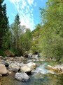
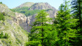
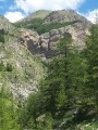
A lovely waterfall, in the heart of the Mercantour National Park.

Details

58016542
Creation:
Last update:
Last review:
  • Walking
    Activity: Walking
  • ↔
    Distance: 5.82 mi
  • ◔
    Average duration: 3h 50 
  • ▲
    Difficulty: Easy

  • ⚐
    Back to start: Yes
  • ↗
    Ascent: + 1,319 ft
  • ↘
    Descent: - 1,319 ft

  • ▲
    Highest point: 5,889 ft
  • ▼
    Lowest point: 5,463 ft

Photos

Description of the walk

From Val d’Allos le Village, you’ll need to head up to the higher parts of Super Allos, in the Bruisset area: you can park your car there, or continue a little further along the track to the ONF barrier on the Piste de Vacheresse.

(S/E) Set off from the track, follow it and carry on to the next junction.

(1) Turn right towards the Bois de Vacheresse, following the path towards the Cabanes du Talon. Cross a plateau with an old sheepfold (Ferme des Bois).

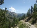
(2) Carry on straight ahead along a balcony path to the Ravin des Combes, where you’ll reach the heart of the Mercantour National Park and its gate.

(3) Carry on until you see the Waterfall du Pich on your left.

(4) Carry on until you reach the waterfall.

(5) Return to the starting point by following the same route back to (S/E).

Waypoints

  1. S/E : mi 0 - alt. 5,463 ft - Vacheresse Trail
  2. 1 : mi 0.26 - alt. 5,545 ft - Crossroads in the Bois de Vacheresse
  3. 2 : mi 0.75 - alt. 5,755 ft - Ferme des Bois
  4. 3 : mi 1.75 - alt. 5,866 ft - Heart of the Mercantour National Park
  5. 4 : mi 2.82 - alt. 5,705 ft - View of the
  6. 5 : mi 2.9 - alt. 5,801 ft - Cascade du Pich
  7. S/E : mi 5.82 - alt. 5,463 ft - Vacheresse trail

Notes

Bring drinking water and a packed lunch.
At certain times of the year, a herd may be present in these pastures.

Worth a visit

In the summer season, do take the time to stop off at the village of Allos with its bars and restaurants.
For activities, make the most of the leisure park, archery, tennis, the riding centre, paragliding, and more.
And, of course, there are plenty of other walking trails.
Enquiries: Val d’Allos Tourist Office: 04 92 83 02 81

Reviews and comments

4.6 / 5
Based on 3 reviews

Reliability of the description
4.7 / 5
Ease of following the route
4.7 / 5
Route interest
4.3 / 5
Val d'Allos
Val d'Allos

Hello User 13099635,

Thank you for your feedback.

Machine-translated

User 13099635

Overall rating : 4.7 / 5

Date of your route : Sep 07, 2026
Reliability of the description : ★★★★★ Very good
Ease of following the route : ★★★★★ Very good
Route interest : ★★★★☆ Good
Very busy route : No

A magnificent setting.
Thank you for this lovely walk.

Machine-translated

JMB06
JMB06

Overall rating : 4 / 5

Date of your route : Aug 11, 2025
Reliability of the description : ★★★★☆ Good
Ease of following the route : ★★★★☆ Good
Route interest : ★★★★☆ Good
Very busy route : No

Lowest point 1,665 m
Highest point 1797 m
Elevation gain stated in the guidebook: 402 m.
To be corrected

Machine-translated

Pouspous
Pouspous

Overall rating : 5 / 5

Date of your route : Sep 02, 2024
Reliability of the description : ★★★★★ Very good
Ease of following the route : ★★★★★ Very good
Route interest : ★★★★★ Very good
Very busy route : No

A lovely, fairly easy walk.

The starting point is a bit tricky to reach by car (unless you have a 4x4).
It’s best to use the car park before the stony path.
There are loads of tiny flies on the first section.
Spectacular views

Machine-translated

Other walks in the area

For more walks, use our search engine .

The GPS track and description are the property of this route's author. Please do not copy them without permission.