


Refine your search for walks in Cascade de Chaumie
Cascade de Chaumie walks


 Tourist office
 Easy
Walks near Cascade de Chaumie
 From Allos to Colmars via the Autapie ridge
 Visorando Member
 7.35 mi
 +659 ft
 -4,324 ft
 3h 55
 Moderate
 Departure from Allos (Alpes-de-Haute-Provence)
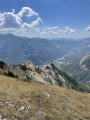
An easy hike starting from the Gros Tapi chairlift terminus. A ridge walk offering constantly stunning and unforgettable panoramic views of the Haut Verdon mountain ranges. An easy route with a final descent to Colmars through the forest on signposted paths. Best undertaken in summer whilst the chairlifts are operating.
Allos - Mont Pelat
 10.09 mi
+5,577 ft
-328 ft
9h 30
 Difficult
Departure from Allos (Alpes-de-Haute-Provence)
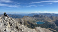
The first part of this two-day circular is challenging and breathtaking, taking you through the heart of Mercantour National Park from the village of Allos, via Lac d'Allos and its refuge, Mont Pelat, Lac du Trou de l'Aigle, Le Cimet and its many waterfalls, including Cascade du Pich and Les Bois de Vacheresse.
Lac d’Allos Mountain Hut – La Cantonnière Mountain Hut
 6.84 mi
+1,253 ft
-2,493 ft
4h 15
Moderate
Departure from Allos (Alpes-de-Haute-Provence)
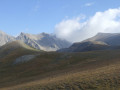
The final stage, which is longer than the other two, takes you back to the starting point.
Lac d’Allos – Tête de Valplane – La Cluite car park
 4.56 mi
+1,306 ft
-2,707 ft
3h 15
Moderate
Departure from Allos (Alpes-de-Haute-Provence)
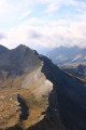
Alternative route to reach the Cluite car park from the Lac d’Allos refuge. The route passes via the Tête de Valplane, which offers breathtaking views of Lac d’Allos, the Cirque de l’Encombrette and the valley leading to Colmars. You are in the Mercantour National Park; there are regulations to be observed, and failure to do so may result in a fine of up to €1,500 – see the practical information.This route takes you off the marked trails; please read the reviews.
Mont Pelat - Allos via Le Cimet
 13.63 mi
+2,405 ft
-7,661 ft
8h 20
 Very difficult
Departure from Allos (Alpes-de-Haute-Provence)
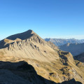
Second part of the circular. This second stage will take you to the village of Allos, starting from Mont Pelat, via the Trou de l'Aigle, the Cimet and its many waterfalls, including the Cascade du Pich and the Bois de Vacheresse.
La Foux D’Allos – Refuge de l’Estrop
 4.20 mi
+2,215 ft
-1,276 ft
3h 50
Moderate
Departure from Allos (Alpes-de-Haute-Provence)
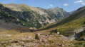
Thefirst stage of this two-day route. An easy day’s walk to get you properly warmed up for the next day’s stage. The ascent of the Baisse de l’Auriac is gentle. At the pass, there’s a magnificent view of the Tête de l’Auriac, the Bléone valley and the Mercantour.
Route from Val d'Allos la Foux to Val d'Allos le Seignus
 9.34 mi
+1,611 ft
-2,385 ft
5h 40
Moderate
Departure from Allos (Alpes-de-Haute-Provence)
A forest trail that will take you to the Val d’Allos Le Seignus ski resort.
Allos Mountain Hut – Petit Col du Talon – Bayasse
 15.80 mi
+3,504 ft
-4,836 ft
10 hrs
Very difficult
Departure from Uvernet-Fours (Alpes-de-Haute-Provence)
The third stage is very difficult due to its length of nearly 26 km, with a few technical sections – particularly when carrying a rucksack – which will put your body to the test. This is why I have classified this stage as ‘very difficult’. However, this stage is one of the most beautiful on this route: wild, technical, with stunning panoramic views.
You’ll cross pastures, wooded areas, mountain pastures and very rocky high-mountain sections between the two highest peaks of the Mercantour: Mont Pelat (3,051 m) and Le Cimet (3,020 m).
You’ll be crossing the northern part of the Mercantour National Park.
Allow between 8 and 10 hours for this challenging stage.
Refuge de l’Estrop – La Foux d’Allos
 7.71 mi
+3,517 ft
-4,452 ft
7 hrs
Very difficult
Departure from Prads-Haute-Bléone (Alpes-de-Haute-Provence)
Day2 of this route takes you to the summit of the Estrop, then back down to the Foux d’Allos resort via the Baisse de l’Aiguille. A very technical hike, featuring extensive and exposed scree slopes. The view from the summit is fantastic, taking in the whole of the Champsaur Range, the Écrins, the Queyras and the Mercantour. You’re sure to spot chamois, ibex and marmots. This stage requires sure-footedness.
From Les Louiqs to La Cantonnière via the Gialorgues and Roche Trouée passes
 9.77 mi
+3,428 ft
-2,910 ft
7h 30
Difficult
Departure from Entraunes (Alpes-Maritimes)
This final stage starts from the Refuge Ferran aux Louiqs and ends at the Refuge de la Cantonnière via the Col de Gialorgues and the Col de la Roche Trouée. You ascend the Vallon de l’Estrop, then descend after the Col de Gialorgues into the valley before climbing again via the three lakes of Giarlogues to the Col de la Roche Trouée. The route then descends along the right bank of the Ruisseau de Gorgias, finally rejoining the path from the first day along the Ruisseau de Sanguinière and arriving at the Refuge de la Cantonnière.