Les Woodies in Xertigny

An 8 km scenic route through the typical landscape of the Vôge, amongst pastures, fields and forests, passing through hamlets made up of old farmhouses, from the Aître valley to the ridges of Moyenpal.

Details

35295321
Creation:
Last update:
Last review:
  • Walking
    Activity: Walking
  • ↔
    Distance: 4.90 mi
  • ◔
    Average duration: 2h 35 
  • ▲
    Difficulty: Easy

  • ⚐
    Back to start: Yes
  • ↗
    Ascent: + 413 ft
  • ↘
    Descent: - 420 ft

  • ▲
    Highest point: 1,594 ft
  • ▼
    Lowest point: 1,194 ft
  • ⚐ Country: France
  • ⚐ City: Xertigny (88220)
  • ⚑
    Start/End: N 48.04689° / E 6.39709°
  • Accessible from the train station Gare de Xertigny.
  • ❏
    IGN map(s): Ref. 3419O, 3518OT, 3519OT
  • Hour-by-hour weather

Description of the walk

From Épinal, take the D434 towards Xertigny, then turn right in the centre of the village onto Rue du Canton de Firminy. Take the right-hand exit at the roundabout, then take the second street on the left (Rue de la Vallée de l’Aitre). Turn right at the first bend to reach the “Les Woodies” car park.

Yellow Rectangle markings along the entire route

(S/E) Walk anti-clockwise around the lake, passing the buildings before taking the path leading uphill to the right. Walk down Rue Georges Colnot on the left until you reach a junction.

(1) Stay on Rue Georges Colnot (D3), passing the care home. Then turn left for 100 m onto a path called “La Rue”, then turn right. The road runs alongside the right bank of the Aître stream, which lies below. Take the first dirt track on the right, which leads to Amerey and the railway line.

(2) Go under the railway bridge and through the woods. You’ll come to Chemin de Crochemont, which you should follow, keeping to the right, until it ends. Turn left onto Grand Rue d’Amerey, then turn right twice to stay on the same road until the third junction.

(3) Turn right onto Chemin de l’Usine before rejoining Grand Rue d’Amerey on the right. Walk through the village, staying on the same path, then, on leaving the village, rejoin the D3.

(4) Continue straight on uphill to the hamlet of Moyenpal.

(5) Turn right at the wayside cross, then left before thesecond wayside cross. Ignore the first track, which rejoins the road too soon, and take the next path leading uphill. At the end of this path, you’ll come to a crossroads.

(6) Turn left towards the level crossing, then, immediately afterwards, take the gently ascending dirt track. Ignore a road and, further on, reach the highest point of the walk.

(7) Stop at the highest point (486 m) and take in the view. Continue along the same track until you reach the Y-junction.

(8) Turn right at the silo to reach a crossroads. Keep left to return to the departmental road.

(1) Keep to the left and, following the route in reverse to the one taken on the way out, return to the starting point (S/E).

Waypoints

  1. S/E : mi 0 - alt. 1,532 ft - ‘Les Woodies’ car park (lodges)
  2. 1 : mi 0.26 - alt. 1,539 ft - Junction of the circular loop - Aitre
  3. 2 : mi 1.34 - alt. 1,414 ft - Railway line
  4. 3 : mi 1.85 - alt. 1,273 ft - On the right, the factory path
  5. 4 : mi 2.37 - alt. 1,201 ft - D3 - Aitre
  6. 5 : mi 2.8 - alt. 1,355 ft - Moyenpal
  7. 6 : mi 3.06 - alt. 1,391 ft - Crossroads
  8. 7 : mi 4.29 - alt. 1,594 ft - Highest point (486 m)
  9. 8 : mi 4.44 - alt. 1,585 ft - Sillo
  10. S/E : mi 4.9 - alt. 1,535 ft - ‘Les Woodies’ car park (lodges)

Notes

“Les Woodies” car park (lodges) at (S/E)

Thank you to the French Hiking Federation and Xertigny en transition for organising this walk and for the work carried out by their teams throughout the year to signpost and maintain these paths.

Worth a visit

Shortly after the “1 ”, at the corner by the care home, take a look at the foundation stone dated 1686, 40 years after the end of the Thirty Years’ War, which saw the total destruction of this area – then one of Xertigny’s two centres, alongside Le Thillot.

(3) At 65 Chemin de l’Usine: a farmhouse dating from 1703, built using stones from the former abbey. It was occupied by the Prussians in 1870. Note the barn door, the façade and the inscriptions on the right.

(5) Moyenpal: a farmhouse dating from 1712 with two dwellings and a shared barn (note the Cross of Lorraine on the cart entrance) and an adjoining bakehouse. Don’t miss the ‘Palis’ at the crossroads (standing stones from fences).

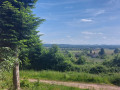
(7) Point 486, known as Croix de Mission (not marked on the map); look westwards: the Darney Forest, the Monts Faucilles towards Lamarche, 50 km away (same latitude), Mont Fourche (503 m), the Col du Poirier towards Vittel (433 m) and the Sion-Vaudémont plateau.

Reviews and comments

4.4 / 5
Based on 3 reviews

Reliability of the description
4 / 5
Ease of following the route
4.7 / 5
Route interest
4.7 / 5
petites jambes
petites jambes

Overall rating : 4.7 / 5

Date of your route : Jun 17, 2024
Reliability of the description : ★★★★☆ Good
Ease of following the route : ★★★★★ Very good
Route interest : ★★★★★ Very good
Very busy route : No

A very enjoyable and varied walk.

Machine-translated

Tinemau
Tinemau
• Edited:

Overall rating : 4.5 / 5

Date of your route : Jan 22, 2024
Reliability of the description : Not used / Not applicable
Ease of following the route : ★★★★★ Very good
Route interest : ★★★★☆ Good
Very busy route : No

A short, easy walk along main paths and minor roads, under a slightly overcast sky and in rather chilly weather.
There were still a few patches of black ice on the roads, which we carefully avoided.
We followed the signposts (Route No. 9) and the GPS track, which is really handy when you miss a sign because you’re chatting away. ;-)
Thanks to the author.

Machine-translated

Soisic
Soisic

Overall rating : 4.3 / 5

Date of your route : Jul 20, 2023
Reliability of the description : ★★★★☆ Good
Ease of following the route : ★★★★☆ Good
Route interest : ★★★★★ Very good
Very busy route : No

At the start, we had trouble finding the Woodies car park. It would be helpful to point out that it’s next to the stadium!
Thank you

Machine-translated

Other walks in the area

For more walks, use our search engine .

The GPS track and description are the property of this route's author. Please do not copy them without permission.