Ruaux – the Semouse Valley

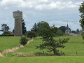
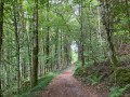
A lovely walk, mostly through deciduous woodland. Beautiful panoramic views, a few surprises, lovely vegetation – plenty to feast your eyes on.

Details

37371417
Creation:
Last update:
Last review:
  • Walking
    Activity: Walking
  • ↔
    Distance: 7.49 mi
  • ◔
    Average duration: 4h 05 
  • ▲
    Difficulty: Moderate

  • ⚐
    Back to start: Yes
  • ↗
    Ascent: + 745 ft
  • ↘
    Descent: - 735 ft

  • ▲
    Highest point: 1,768 ft
  • ▼
    Lowest point: 1,237 ft

Photos

Description of the walk

Start at the Grande Rue car park, near the church.

(S/E) Take the Grande Rue away from the church and turn left into Rue de la Poste.

(1) Turn left towards the Notre-Dame-de-Consolation Chapel.

(2) Retrace your steps.

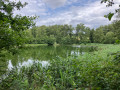
(1) Take the path on the left again. This path runs alongside a pond and then turns left at a right angle. After passing a cross, go down a grassy path in the middle of a meadow. This path turns into a tarmac road. Follow it until you come to a dirt track on your right, the entrance to which is bordered on the left by a copse of trees.

(3) Follow this path until you reach a road. Turn left onto it and continue until you come to a path entrance on your right, named Rue du Crime.

(4) Continue along this track, which takes a wide bend to the right. Ignore a track entrance on the right. Turn right at the next entrance and continue until you reach a right-angled bend leading to Clairefontaine.

(5) At this bend, turn left onto a small forest track. Carry on straight ahead until you reach the ruins of the Château des Fées.

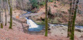
(6) Return to the path, which takes a fairly sharp right-hand bend, then, a little further on, a hairpin left-hand bend and begins to descend steeply. Continue down the slope to the Semouse.

(7) Take a short walk along the riverbank, then head back up and take the path on the left, which follows the course of the river from a distance and at a higher elevation. A long climb will take you to a crossroads.

(8) Follow the path on the left, signposted ‘viewpoint 100 m’. View of the hamlet of Semouse.

(9) Turn back.

(8) Take the path on the left again, which continues to climb, and cross the Tacot bridge

(10) Continue straight ahead uphill until you reach the D20 at Moulin de Ruaux.

(11) Turn carefully right onto the D20. Ignore the D20 bis which branches off to your right and carry on straight ahead until you come to a path on your right.

(12) Take this path, which runs mainly along the edge of fields. Cross a small road, continue for about 400 metres and turn right, following the signposts, to come out onto Rue du Mont.

(13) Turn right onto it, then take the first left you come to.

(14) Follow it until you reach Grande Rue, where you turn left until you reach the car park near the church (S/E).


Waypoints

  1. S/E : mi 0 - alt. 1,726 ft - Car park near the church
  2. 1 : mi 0.44 - alt. 1,729 ft - T-junction (out and back) towards the chapel
  3. 2 : mi 0.54 - alt. 1,745 ft - Notre-Dame-de-Consolation
  4. 3 : mi 1.56 - alt. 1,686 ft - Path, on the right
  5. 4 : mi 1.94 - alt. 1,601 ft - Junction. Rue du Crime, turn right
  6. 5 : mi 2.58 - alt. 1,598 ft - Junction. Path, on the left
  7. 6 : mi 3.03 - alt. 1,591 ft - Château des Fées
  8. 7 : mi 3.71 - alt. 1,237 ft - Semouse (rivière)
  9. 8 : mi 5.18 - alt. 1,535 ft - A/R junction. Pont du Tacot, viewpoint.
  10. 9 : mi 5.31 - alt. 1,430 ft - Viewpoint
  11. 10 : mi 5.56 - alt. 1,604 ft - Pont du Tacot
  12. 11 : mi 6.09 - alt. 1,621 ft - D20. Road junction
  13. 12 : mi 6.56 - alt. 1,736 ft - Junction. Path, on the right
  14. 13 : mi 7.27 - alt. 1,716 ft - Rue du Mont
  15. 14 : mi 7.36 - alt. 1,745 ft - Junction. Turn left onto the street
  16. S/E : mi 7.49 - alt. 1,726 ft - Car park near the church

Notes

  • There are two car parks on Grande Rue, on the left-hand side of Ruaux Church when facing the main entrance.
  • Several walks start from Ruaux. At the start, you’ll find signposts with rings of different colours. The colour we’re looking for is red, which becomes the only one after the Notre-Dame-de-Consolation Chapel (2). Be sure to return along the path you’ve just taken! Do not follow the signposts telling you not to go back.
  • In wet weather, some sections of the route can be quite muddy. Please wear suitable footwear.

Worth a visit

  • (S/E) Ruaux Church.
  • (6) the Château des Fées, a cluster of moss-covered rocks.
  • (7) a charming picnic spot on the banks of the Semouse.
  • (11) the Pont du Tacot, a remnant of an old railway line.

Reviews and comments

4.3 / 5
Based on 4 reviews

Reliability of the description
4.3 / 5
Ease of following the route
4.3 / 5
Route interest
4.3 / 5
pepinet
pepinet

Overall rating : 3.7 / 5

Date of your route : Jun 14, 2026
Reliability of the description : ★★★★☆ Good
Ease of following the route : ★★★☆☆ Average
Route interest : ★★★★☆ Good
Very busy route : No

A lovely route through the countryside. It’s best to follow the signposts as there have been a few changes. No difficulty

Machine-translated

Christecol
Christecol

Overall rating : 4 / 5

Date of your route : Jul 28, 2024
Reliability of the description : Not used / Not applicable
Ease of following the route : ★★★★★ Very good
Route interest : ★★★☆☆ Average
Very busy route : No

A lovely walk with some beautiful scenery. I felt like there was quite a lot of tarmac. The viewpoint (pi9) over Semouse isn’t all that impressive, though!

Machine-translated

alainkik
alainkik
• Edited:

Overall rating : 4.3 / 5

Date of your route : May 13, 2024
Reliability of the description : ★★★★☆ Good
Ease of following the route : ★★★★☆ Good
Route interest : ★★★★★ Very good
Very busy route : No

A very pleasant walk with beautiful scenery and complete tranquillity. We stopped for a picnic by the banks of the Semouse. There was a slight discrepancy between the route and the GPS in the hairpin bends before point 8, so we hesitated, retraced our steps and eventually took a short detour ‘off the beaten track’ for a few metres before easily finding our way back onto the right path.

Machine-translated

nibalie
nibalie

Overall rating : 5 / 5

Date of your route : Aug 21, 2023
Reliability of the description : ★★★★★ Very good
Ease of following the route : ★★★★★ Very good
Route interest : ★★★★★ Very good
Very busy route : No

A pleasant walk, well signposted with plenty of woodland paths and not much tarmac. Really enjoyable (the little detour to point 9 is of no interest, in my view)

Machine-translated

Other walks in the area

For more walks, use our search engine .

The GPS track and description are the property of this route's author. Please do not copy them without permission.