Le Rechentreux Route

This route, which runs mainly through woodland, offers a mix of idyllic paths and beautiful tree-lined avenues in the Rechentreux forest. The stream of the same name, upstream from the waterfall, runs alongside the walker.

Details

34745712
Creation:
Last update:
Last review:
  • Walking
    Activity: Walking
  • ↔
    Distance: 4.26 mi
  • ◔
    Average duration: 2h 10 
  • ▲
    Difficulty: Easy

  • ⚐
    Back to start: Yes
  • ↗
    Ascent: + 194 ft
  • ↘
    Descent: - 194 ft

  • ▲
    Highest point: 1,745 ft
  • ▼
    Lowest point: 1,529 ft
  • ⚐ Country: France
  • ⚐ City: Xertigny (88220)
  • ⚑
    Start/End: N 47.99829° / E 6.40176°
  • ❏
    IGN map(s): Ref. 3519OT
  • Hour-by-hour weather

Description of the walk

Look out for yellow rectangular markers numbered 3 along the entire route

From Plombières-les-Bains, take the D63 towards Xertigny. About halfway along the route, turn left onto the D20A and take the first path on the right, leading to the Gueu du Saut car park.

(S/E) At the Gueu du Saut car park, go down the steps, cross the bridge over the waterfall, then head up into the forest, following signpost no. 3. You’ll come to a junction with a forest track.

(1) Turn left into a beech forest. Stay on the track until you reach the forest gate.

(2) Turn left onto the old country lane running parallel to the recently gravelled track that follows the boundary of Xertigny Bellefontaine. This track joins the forest road one kilometre further on; continue straight ahead and, from this point, follow the edge of a plantation of Douglas firs, a conifer with excellent mechanical properties. You’ll come to the Moulin de la Semoule crossroads.

(3) Turn right into the Bois des Flammes, mainly populated by spruce trees, passing close to the hunting lodge. Continue to the forest gate.

(4) Turn right and walk for 300 metres until you emerge into an area of farmland and pasture near the village of Bellefontaine.

(5) At the crossroads in the hamlet of Le Rupt Guéné, turn left, then immediately right to reach a track.

(6) At the track, turn right to enter a beautiful forest avenue that stretches for over 2 km, crossing two wetlands on this plateau: the Petite Faigne and the Grande Faigne. This avenue first passes through a long stretch of coniferous woodland, then rejoins the deciduous woodland in its final third. At its end, the route joins the stony track marking the boundary between the two municipalities (the junction at the start of the circular route).

(2) Head straight on and return to the starting point by following the route in reverse (S/E).

Waypoints

  1. S/E : mi 0 - alt. 1,552 ft - Car park - Cascade du Gueu du Saut
  2. 1 : mi 0.06 - alt. 1,581 ft - Crossroads with track - Cascade du Gueu du Saut
  3. 2 : mi 0.42 - alt. 1,686 ft - Junction on the circular loop
  4. 3 : mi 1.15 - alt. 1,637 ft - Moulin de la Semoule crossroads
  5. 4 : mi 1.83 - alt. 1,745 ft - Crossroads
  6. 5 : mi 2.31 - alt. 1,729 ft - Crossroads
  7. 6 : mi 2.58 - alt. 1,693 ft - The Rupt Guéné
  8. S/E : mi 4.26 - alt. 1,552 ft - Car park - Cascade du Gueu du Saut

Notes

Thank you to the French Hiking Federation and Xertigny en transition for organising this walk and for the work carried out by their teams throughout the year to signpost and maintain these paths.

Worth a visit

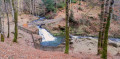
  • The Gueu du Saut waterfall, a 5-metre drop set amidst the woodland of a semi-shaded clearing. A picturesque spot ideal for children to play in the water.
  • ‘“A standing oak and a leaning fir would support the universe.”’ This maxim from the builders’ guild summed up the value of oak for vertical supports and softwood for the horizontal parts of roof structures.
  • The ‘Moulin de la Semoule’: The numerous watercourses of the Vôge river encouraged the development of small reservoirs designed to power machinery and relieve our ancestors of exhausting manual labour.
  • Wetlands: found throughout the region, wetlands are specific natural habitats that regulate hydrological systems and support a unique ecosystem comprising flora, fauna and soil composition.
  • The royal osmund: this magnificent fern, a remnant of the Ice Age, can be found in several places within the Xertigny area. Walkers, please respect the natural environment: do not leave any rubbish behind and do not take anything from the area.

Reviews and comments

4.5 / 5
Based on 2 reviews

Reliability of the description
4.5 / 5
Ease of following the route
5 / 5
Route interest
4 / 5
User 28047210

Overall rating : 4.3 / 5

Date of your route : Nov 10, 2025
Reliability of the description : ★★★★☆ Good
Ease of following the route : ★★★★★ Very good
Route interest : ★★★★☆ Good
Very busy route : No

Most of the route is through forest, so be careful if it has rained for several days beforehand, as some sections can become muddy.

Machine-translated

Katry
Katry

Overall rating : 4.7 / 5

Date of your route : May 27, 2024
Reliability of the description : ★★★★★ Very good
Ease of following the route : ★★★★★ Very good
Route interest : ★★★★☆ Good
Very busy route : No

An easy route, although it’s a bit muddy and slippery at the moment, due to ruts which I hope will disappear when the weather gets drier!

Machine-translated

Other walks in the area

For more walks, use our search engine .

The GPS track and description are the property of this route's author. Please do not copy them without permission.