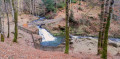
Gueu du Saut Waterfall

A walk through the forest along the Rechentreux Stream. A lovely spot for a picnic by the waterfall.

Details

19259196
Creation:
Last update:
Last review:
  • Walking
    Activity: Walking
  • ↔
    Distance: 1.49 mi
  • ◔
    Average duration: 0h 50 
  • ▲
    Difficulty: Easy

  • ⚐
    Back to start: Yes
  • ↗
    Ascent: + 190 ft
  • ↘
    Descent: - 197 ft

  • ▲
    Highest point: 1,611 ft
  • ▼
    Lowest point: 1,444 ft
  • ⚐ Country: France
  • ⚐ City: Xertigny (88220)
  • ⚑
    Start/End: N 47.992696° / E 6.403142°
  • ❏
    IGN map(s): Ref. 3519OT
  • Hour-by-hour weather

Photos

Description of the walk

Park at the junction of the D20A and the Route de Xertigny.

The route is marked by a Yellow Rectangle from the French Hiking Federation

(S/E) With your back to the D20A, take the path on the right and cross the wooden bridge over the stream. Continue along the ascending path until you reach the viewpoint overlooking the waterfall on your left.

(1) Return to the main path and head left until you reach a house. Go round it to the left along a path that is not very well marked.
Head downhill and continue to the left, past the sawmill below, until you reach the road to Xertigny.

(2) Take the path opposite and follow it until you reach a yellow sign indicating that you can turn left.

(3) Follow this descending path until you come out onto the D20A near the starting point (S/E).

Waypoints

  1. S/E : mi 0 - alt. 1,450 ft - Junction of the D20A and the Route de Xertigny - Semouse (rivière)
  2. 1 : mi 0.38 - alt. 1,565 ft - Cascade du Gueu du Saut
  3. 2 : mi 0.78 - alt. 1,555 ft - Route de Xertigny, path opposite
  4. 3 : mi 1.32 - alt. 1,588 ft - Junction, path on the left
  5. S/E : mi 1.49 - alt. 1,450 ft - Junction of the D20A and the Route de Xertigny

Worth a visit

Semouse Valley,
Augronne Valley,
Plombières-les-Bains; its spa, casino and miniature park.

Reviews and comments

3.8 / 5
Based on 4 reviews

Reliability of the description
3.5 / 5
Ease of following the route
3.8 / 5
Route interest
4 / 5
User 23687670

Overall rating : 3.7 / 5

Date of your route : Aug 06, 2026
Reliability of the description : ★★★☆☆ Average
Ease of following the route : ★★★☆☆ Average
Route interest : ★★★★★ Very good
Very busy route : No

As the house was completely fenced off, we turned round and headed back to the waterfall to rejoin the path that runs above the road.

Machine-translated

gazok54
gazok54 ★

Thank you for this feedback from the field.
How did you get in if the house is fenced off?
Is the footbridge accessible?
If you could provide me with some details, I’ll be able to update the description.
Thanks in advance.

Machine-translated

User 24054857

Overall rating : 3 / 5

Date of your route : May 16, 2026
Reliability of the description : ★★★☆☆ Average
Ease of following the route : ★★★☆☆ Average
Route interest : ★★★☆☆ Average
Very busy route : No

It’s impossible to walk past the house; there are fences with animals

Machine-translated

a-a-rouyer@hotmail.fr

Overall rating : 3.7 / 5

Date of your route : May 12, 2025
Reliability of the description : ★★★☆☆ Average
Ease of following the route : ★★★★☆ Good
Route interest : ★★★★☆ Good
Very busy route : No

The path may turn left at the house and end

Machine-translated

POULIN Gérard
POULIN Gérard ★

Hello Claudine,
Thank you for clarifying that. The comment has just been deleted.

Machine-translated

Claudine67
Claudine67

Overall rating : 4.7 / 5

Date of your route : Jan 01, 2024
Reliability of the description : ★★★★★ Very good
Ease of following the route : ★★★★★ Very good
Route interest : ★★★★☆ Good
Very busy route : Yes

The bridge has been repaired and is open for use again
So you can remove that little note

Machine-translated

Other walks in the area

For more walks, use our search engine .

The GPS track and description are the property of this route's author. Please do not copy them without permission.