The Grand-Bois route in Les Voivres

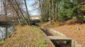
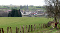
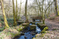
Come and explore the village of Les Voivres, just a few kilometres from Bains-les-Bains, and enjoy the fresh air amidst the rural village, ponds, fields and the Grand Bois forest.

Details

36175092
Creation:
Last update:
Last review:
  • Walking
    Activity: Walking
  • ↔
    Distance: 5.87 mi
  • ◔
    Average duration: 3h 00 
  • ▲
    Difficulty: Easy

  • ⚐
    Back to start: Yes
  • ↗
    Ascent: + 354 ft
  • ↘
    Descent: - 331 ft

  • ▲
    Highest point: 1,388 ft
  • ▼
    Lowest point: 1,148 ft

Description of the walk

From Bains-les-Bains, take the D434 towards La Chapelle-aux-Bois, then the D4 towards Les Voivres. Once in the village, park towards the centre, in the car park opposite the restaurant Le Pont des Fées.

Blue Ring signposting along the entire route
The route can only be walked in the direction indicated: Les Voivres – La Chapelle de Bonne Espérance – La Basse des Orges – Le Grand Bois – Étang Jean Français

(S/E) With your back to the restaurant, head to the right and take the road that curves left towards Étang Lallemand. Continue to the right then to the left, following the Blue Ring markings, and at the cemetery, turn right. Keep to the left on this path and follow it as far as the cross.

(1) Turn left then right to take the gently sloping path running alongside the forest. Continue to the junction of the paths.

(2) Turn right towards the Grande Fosse , whose fountain once served as a washhouse for the locals. Turn left at the first fork and you’ll very quickly reach a second one, at the Grande Fosse.

(3) Keep to the right. Carry on straight ahead, first uphill and then downhill, to reach the Chapelle de Bonne Espérance, which dates from the Second Empire and has been renovated by volunteers. After the chapel and the long descent along the road, you’ll reach a junction at La Basse des Orges.

(4) Carry on straight ahead towards Le Chaudiron. Further on, take the first road turning right, Rue du Chaudiron. Ignore a junction at the hamlet.

(5) Then turn left so as to pass between two ponds and continue along this winding road until it ends at a ‘Give Way’ sign at the hamlet of Beaulieu.

(6) Cross the road to continue along the Chemin de la Fontaine. When you reach the end of the street, turn left and stay on the road until you reach Le Grand Bois and its water tower.

(7) Take the road leading downhill on your right and follow it alongside the Étang du Grand Bois. At the crossroads, carry straight on to reach the Étang Jean Français.

(8) After the pond, turn right onto the path so that you’re looking down on the pond (with your back to it). Then wind your way along the edge of the forest until you find yourself between fields.

(9) Turn right and keep to the edge of the forest until you reach the first T-junction.

Please note that the signposting is barely visible during the summer months.

(10) Turn left to reach the car park (S/E).

Waypoints

  1. S/E : mi 0 - alt. 1,198 ft - Car park opposite Le Pont des Fées
  2. 1 : mi 1 - alt. 1,329 ft - Cross
  3. 2 : mi 1.57 - alt. 1,276 ft - Junction
  4. 3 : mi 1.77 - alt. 1,214 ft - La Grande Fosse
  5. 4 : mi 2.43 - alt. 1,165 ft - Basse des Orges
  6. 5 : mi 2.93 - alt. 1,194 ft - Le Chaudiron
  7. 6 : mi 3.52 - alt. 1,309 ft - Give way – Beaulieu
  8. 7 : mi 4.09 - alt. 1,388 ft - Grand Bois – water tower
  9. 8 : mi 4.79 - alt. 1,306 ft - Jean Français Pond
  10. 9 : mi 5.03 - alt. 1,332 ft - Turn right to follow the path alongside the forest
  11. 10 : mi 5.45 - alt. 1,306 ft - T-junction
  12. S/E : mi 5.87 - alt. 1,198 ft - Car park opposite Le Pont des Fées

Notes

Thank you to the Club Vosgien for organising this walk and for the work carried out by its teams throughout the year to signpost and maintain these paths.

Worth a visit

  • The Chapel of Bonne Espérance: built by Father Daubie, parish priest of Les Voivres, between 1857 and 1858, the ‘Chapelette’ – much loved by the people of Les Voivres – is situated on a small hill between the hamlets of La Grande Fosse and La Basse des Orges.

Napoleon III took an interest in it from the moment it was built. Indeed, he used to come regularly to take the waters at Plombières-les-Bains. He was welcomed and accompanied by Charles Demandre, master of the forges at La Chadeau. It was Demandre who introduced the imperial couple to the parish priest who had built the chapel. This is why the pretty bell of the ‘Chapelette’ bears the inscription ‘Napoleon, Imperial Prince – 1858’.

In 1990, it became the property of the commune of Les Voivres after a hurricane brought a tree crashing onto the roof, causing significant damage on 25 July 1990.

Reviews and comments

3.9 / 5
Based on 3 reviews

Reliability of the description
4 / 5
Ease of following the route
3.3 / 5
Route interest
4.3 / 5
Lours88
Lours88
• Edited:

Overall rating : 3.7 / 5

Date of your route : Feb 02, 2025
Reliability of the description : ★★★★☆ Good
Ease of following the route : ★★★☆☆ Average
Route interest : ★★★★☆ Good
Very busy route : No

A lovely walk following the recent heavy rain; the paths have almost disappeared beneath the accumulated water, and the Colose quarry looks like a swimming pool. From the Pont des Fées, there are trees on the path that aren’t usually there at this time of year. The section leading to the forge is very dangerous (trees, water).
For an afternoon walk, estimated duration 2½–3 hours
departure at 2.30 pm, return to the car at 6 pm as night falls
A walk best undertaken in fine weather, with caution

Machine-translated

MPT
MPT

Overall rating : 4 / 5

Date of your route : Oct 13, 2024
Reliability of the description : ★★★★☆ Good
Ease of following the route : ★★★☆☆ Average
Route interest : ★★★★★ Very good
Very busy route : No

We had a problem after the French pond. Could there be an issue with the signposting?
We did look for it, though. We walked back along the pond and then there was nothing
We ended up on the main land consolidation track between the fields.
Then we got back on the road towards the In Bô factory, heading for Les Voivres.
Otherwise, it’s a lovely route with superb views and beautiful, well-kept houses and gardens.

Machine-translated

Michel JACQUET
Michel JACQUET

Overall rating : 4 / 5

Date of your route : Aug 17, 2024
Reliability of the description : ★★★★☆ Good
Ease of following the route : ★★★★☆ Good
Route interest : ★★★★☆ Good
Very busy route : No

A lovely half-day walk. It takes you through a variety of landscapes – sometimes wide open with views stretching far into the distance, and at other times passing through some very charming hamlets.
A leisurely three-hour walk.

Machine-translated

Other walks in the area

For more walks, use our search engine .

The GPS track and description are the property of this route's author. Please do not copy them without permission.