The green lime trees around Herlin-le-Sec

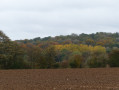
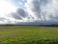
A short, picturesque walk in the Ternois region, taking in plains and woodland.

Details

2811802
Creation:
Last update:
Last review:
  • Walking
    Activity: Walking
  • ↔
    Distance: 8.00 mi
  • ◔
    Average duration: 3h 55 
  • ▲
    Difficulty: Moderate

  • ⚐
    Back to start: Yes
  • ↗
    Ascent: + 256 ft
  • ↘
    Descent: - 279 ft

  • ▲
    Highest point: 518 ft
  • ▼
    Lowest point: 348 ft

Photos

Description of the walk

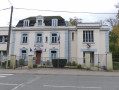
Park in the town hall square in Herlin-le-Sec

(S/E) Head south and leave the village.

(1) At the next junction with the water tower, turn right towards the west-south-west. At the next junction, keep left.

(2) At the fork in the road, keep straight on (south) along the road. Enter the woods.

(3) At the first junction, follow theGR®121Ato the left (red and white markings). Leave the woodland, ignore a path branching off to the left and continue north-east between the fields.

(4) Cross the D23 with care, take the road opposite (north-east) and pass through the hamlet of Ocoche. At the junction at the end of the hamlet, turn right. After about a hundred metres, leave the road and follow the path to the right (south-south-east).

(5) At the T-junction, turn left towards the east-north-east. At the next junction, turn right. Walk past the cemetery and the church.

(6) At the T-junction, turn left onto Rue de Sains. At the next junction, turn right onto the D8E2, Rue du Vert Tilleul.

(7) At the junction (water tower, wayside cross), turn left. Pass a path on your right. Join the D85 in the village of Maisnil and follow it to the right.

(8) At the next junction (calvary), turn right onto a track (north-north-east). Continue straight on and, further on, follow the edge of the Bois d’Epainchen.

(9) When you reach the first houses in the woods, take the path on the left and enter the woods. Cross the road and follow the path opposite, which leads back into the woods; at the bottom of the slope, turn right and follow the edge of the woods.

(10) At the next junction, turn sharply left onto a stony track. Follow the Chemin des Morts south-west. Join the D85 and follow it to the right (take care – this is a busy road).

(11) At thefirst junction, take the path on the left. Pass three paths on the right and continue west-south-west between the fields.

(12) At the end, follow the D23 to the right. About 150 m further on, at the wayside cross, turn left. Follow the road to the town hall square (S/E).

Waypoints

  1. S/E : mi 0 - alt. 486 ft - Herlin-le-Sec Town Hall
  2. 1 : mi 0.14 - alt. 495 ft - Water tower
  3. 2 : mi 0.46 - alt. 482 ft - Fork
  4. 3 : mi 1.05 - alt. 423 ft - Junction with the GR121A
  5. 4 : mi 1.96 - alt. 472 ft - Crossing the D23
  6. 5 : mi 2.86 - alt. 492 ft - T-junction
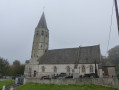
  7. 6 : mi 3.39 - alt. 512 ft - Église Saint-Adrien (Maisnil)
  8. 7 : mi 3.79 - alt. 518 ft - Water tower and wayside cross
  9. 8 : mi 4.37 - alt. 486 ft - Start of the path on the right
  10. 9 : mi 5.23 - alt. 453 ft - Path on the left: Bois d’Epainchen
  11. 10 : mi 5.59 - alt. 348 ft - Exit the woods via the path on the left
  12. 11 : mi 6.62 - alt. 482 ft - Junction
  13. 12 : mi 7.6 - alt. 479 ft - D23 road
  14. S/E : mi 8 - alt. 489 ft - Herlin-le-Sec Town Hall

Notes

Not particularly difficult, but suitable kit is required.
Don’t forget a small bottle of water and a snack.

Always be cautious and plan ahead when you're outdoors. Visorando and the author of this route cannot be held responsible for any accidents occurring on this route.

The GR® and PR® markings are the intellectual property of the Fédération Française de Randonnée Pédestre.

Reviews and comments

4.3 / 5
Based on 2 reviews

Reliability of the description
4.5 / 5
Ease of following the route
5 / 5
Route interest
3.5 / 5
Netra
Netra ★

Hello Polouche,

The term ‘plagiarism’ has a specific definition, which cannot apply to a route itself but only to its description. If you can show us that the description published on Visorando is a copy of a description written previously, then we will immediately remove the walk from the site. If the author has written a personal description in their own words, then there is nothing wrong with it.

Machine-translated

Poulouche_62
Poulouche_62

Overall rating : 4 / 5

Date of your route : Nov 25, 2022
Reliability of the description : ★★★★☆ Good
Ease of following the route : ★★★★★ Very good
Route interest : ★★★☆☆ Average
Very busy route : No

Yet another well-signposted FFR walk – no need for the route description or the app. What could be better than going for a walk without having to worry about looking at a map or following your phone? Just looking around you. To me, that’s plagiarism. I can do just as well!!!

Machine-translated

dom62
dom62

Overall rating : 4.7 / 5

Date of your route : Nov 10, 2022
Reliability of the description : ★★★★★ Very good
Ease of following the route : ★★★★★ Very good
Route interest : ★★★★☆ Good
Very busy route : No

A short walk suitable for families; not at all difficult, across flat ground and through woodland; a tarmac path; a pleasant half-day out on a sunny day.

Machine-translated

Other walks in the area

For more walks, use our search engine .

The GPS track and description are the property of this route's author. Please do not copy them without permission.