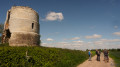
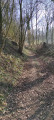
The Chemin des Morts

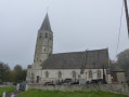
From Saint-Michel-sur-Ternoise along the Chemin des Morts towards the Épainchen estate at the source of the Ternoise, passing by the famous nightclub “Les Catherinettes” and Saint-Michel Church.
Enjoy the walk, everyone...

Details

3133602
Creation:
Last update:
Last review:
  • Walking
    Activity: Walking
  • ↔
    Distance: 5.00 mi
  • ◔
    Average duration: 2h 30 
  • ▲
    Difficulty: Easy

  • ⚐
    Back to start: Yes
  • ↗
    Ascent: + 272 ft
  • ↘
    Descent: - 269 ft

  • ▲
    Highest point: 486 ft
  • ▼
    Lowest point: 302 ft

Photos

Description of the walk

Car park at the village hall in Saint-Michel-sur-Ternoise.

(S/E) Leave the village hall behind you; before leaving the car park, take the footbridge over the Ternoise on the right, follow the road and turn right at the junction. Pass under a railway bridge and follow the road to the junction 50 metres before the D85.

(1) At the junction, take the road on the left, follow the D85 southwards and cross over the D939.

(2) About 250 m after the bridge, take the track on the right heading north and, at the first junction of tracks, turn left heading south-south-west. At the end of the dirt track, turn left heading east-south-east onto the track that climbs and rejoin the D85.

(3) Follow it to the right for about 500 m heading south. There is heavy traffic, so please take care until you reach the junction a few hundred metres before the entrance to Tachincourt.

(4) Take the Chemin des Morts on the left heading east-north-east, crossing the bridge over the D939 and the level crossing.

(5) Cross the D8 departmental road to reach the road opposite. At the junction, turn left, then left again at the second junction. After 50 m, follow the path on the right heading north-west, passing the sources of the Ternoise and the restaurant Les Catherinettes.

(6) Join the D85E3, follow it to the left heading south-west for about 400 m, then turn onto the dirt track on the right at the entrance to Saint-Michel-sur-Ternoise. Walk past the church of Saint-Michel-sur-Ternoise and join the D8.

(7) Follow it to the left towards the south-east until you reach the car park for the village hall (S/E).

Waypoints

  1. S/E : mi 0 - alt. 305 ft - Village hall car park. Head towards the - Ternoise (rivière)
  2. 1 : mi 0.42 - alt. 312 ft - Haricot
  3. 2 : mi 0.91 - alt. 427 ft - Path on the right
  4. 3 : mi 1.75 - alt. 482 ft - Junction with the D85
  5. 4 : mi 1.99 - alt. 476 ft - The Chemin des Morts
  6. 5 : mi 3.1 - alt. 322 ft - Level crossing
  7. 6 : mi 3.7 - alt. 325 ft - Les Catherinettes
  8. 7 : mi 4.52 - alt. 308 ft - Junction with the D8
  9. S/E : mi 5 - alt. 305 ft - Village hall car park

Notes

Walking shoes are recommended as the paths can be muddy
Don’t forget to bring a small bottle of water to keep yourself hydrated.

Worth a visit

Reviews and comments

4.3 / 5
Based on 2 reviews

Reliability of the description
5 / 5
Ease of following the route
5 / 5
Route interest
3 / 5
elvenly
elvenly

Overall rating : 4 / 5

Date of your route : Aug 15, 2022
Reliability of the description : ★★★★★ Very good
Ease of following the route : ★★★★★ Very good
Route interest : ★★☆☆☆ Disappointing
Very busy route : No

We must not have done the same walk as benoitrando. I’d say 70 per cent tarmac, much of it without even a pavement, with some very unpleasant stretches in terms of traffic.

The route is easy to follow, but the walk itself is of little interest to my taste, unless you love fields, fields, fields and country roads.

Machine-translated

Bouli62
Bouli62

Thank you

Machine-translated

benoitrando
benoitrando

Overall rating : 4.7 / 5

Date of your route : Oct 23, 2020
Reliability of the description : ★★★★★ Very good
Ease of following the route : ★★★★★ Very good
Route interest : ★★★★☆ Good
Very busy route : Yes

A very pleasant route, alternating between countryside and woodland with very little tarmac. Nothing to complain about – the route description is spot on; you just have to follow the directions.

Thank you, Bouli62, for this lovely route.

Machine-translated

Other walks in the area

For more walks, use our search engine .

The GPS track and description are the property of this route's author. Please do not copy them without permission.