Le Pronay and its “cathedral”

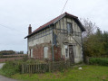
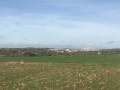
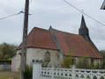
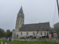
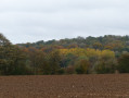
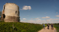
Le Pronay, a hamlet of Ramecourt with its ‘Cathedral’ (3), so named by one of our members: it is in fact a chapel. You’ll reach it by crossing the Bois de Pronay. For the return journey, follow a section of the old railway line from Saint-Pol to Frévent and, to finish, you’ll pass in front of Sains Castle.
A largely shaded walk.

Details

3421242
Creation:
Last update:
Last review:
  • Walking
    Activity: Walking
  • ↔
    Distance: 6.22 mi
  • ◔
    Average duration: 3h 00 
  • ▲
    Difficulty: Moderate

  • ⚐
    Back to start: Yes
  • ↗
    Ascent: + 171 ft
  • ↘
    Descent: - 197 ft

  • ▲
    Highest point: 495 ft
  • ▼
    Lowest point: 328 ft

Photos

Description of the walk

Park on the square in Herlin-le-Sec, near the town hall.

(S/E) Facing the town hall, turn right, heading south. At the crossroads by the water tower, turn right and walk for about 200 metres.

(1) Follow the path on the right until you reach the D 196. Please take care – this is a busy road. Take the small road on the left, cross the D 916 with care and take the path opposite. Further on, leave the path on your left.

(2) A few metres from the edge of the woodland, take the path leading into the woodland (west). Follow this path for about 700 m.

(3) At the chapel, turn right onto the road.

(4) At the last house on the left, take the small path on the left between the hedge and the fields – which is regularly cultivated – and join the old railway line path, then turn left.

(5) At the junction with the road you took earlier, carry on straight ahead and do the same at the next junction. Cross the road via a bridge near the cemetery and continue straight on until you reach the D 916.

(6) Caution: busy road. Cross with care and continue straight on along the path, which veers slightly to the right. You’ll reach a junction with a road.

(7) Turn left and follow theGRP®, passing in front of Sains Castle.

(8) Just after the château, carry on straight ahead, following theGRP®, andenter the Sains woods.

(9) At the three-way junction, take the path on the right, continuing to follow theGRP® until the next junction.

(10) Leave theGRP®, turn left and head towards a reverse-Y junction.

(11) Carry on to the right.

(1) Follow the road to the water tower, turn left and return to the starting point (S/E).

Waypoints

  1. S/E : mi 0 - alt. 492 ft - Place d’Herlin-le-Sec, near the town hall
  2. 1 : mi 0.23 - alt. 492 ft - Crossroads at the end of the circular loop
  3. 2 : mi 0.8 - alt. 436 ft - Entrance to the path in the woods
  4. 3 : mi 1.32 - alt. 331 ft - Chapel
  5. 4 : mi 1.53 - alt. 328 ft - Path on the left
  6. 5 : mi 2.15 - alt. 364 ft - Crossroads, opposite
  7. 6 : mi 3.18 - alt. 417 ft - Junction with the D916
  8. 7 : mi 3.81 - alt. 459 ft - End of railway line, turn left onto the °°GRP®°°
  9. 8 : mi 4.31 - alt. 472 ft - Sains Castle
  10. 9 : mi 4.75 - alt. 427 ft - Crossroads
  11. 10 : mi 5.23 - alt. 489 ft - End of GRP
  12. 11 : mi 5.77 - alt. 486 ft - Y-junction
  13. S/E : mi 6.22 - alt. 489 ft - Place d’Herlin-le-Sec, near the town hall

Notes

Between points (2) and (3), the path can be muddy in wet weather.
Sturdy footwear is recommended, and don’t forget to bring a bottle of water.

Worth a visit

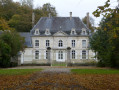
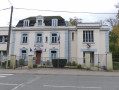
(8) Sains Castle, built in 1774 by Jean-François de Canettenont. It features a pediment bearing the coat of arms of the de Sains family.

Reviews and comments

4.2 / 5
Based on 3 reviews

Reliability of the description
4.7 / 5
Ease of following the route
4.3 / 5
Route interest
3.5 / 5
Jean-Mi 62550
Jean-Mi 62550
• Edited:

Overall rating : 3.5 / 5

Date of your route : Jun 09, 2022
Reliability of the description : ★★★★☆ Good
Ease of following the route : ★★★☆☆ Average
Route interest : Not used / Not applicable
Very busy route : No

In principle, this route is perfect, but as of today (9 June 2022), a large section of it is impassable due to fallen trees!
A local by-law prohibits access until the area has been fully cleared.
We walked part of it, taking long detours through the fields without realising, and eventually spotted this notice displayed at a crossroads!
The section affected by the fallen trees is on the old railway line!

Machine-translated

Bouli62
Bouli62

Thank you for your comments
I’ve corrected point 5
It’s true that the path mentioned in point 4 is constantly being cultivated.

Machine-translated

benoitrando
benoitrando

Overall rating : 4.7 / 5

Date of your route : Oct 25, 2020
Reliability of the description : ★★★★★ Very good
Ease of following the route : ★★★★★ Very good
Route interest : ★★★★☆ Good
Very busy route : Yes

A very pleasant route, with a few tricky bits, along the path that winds down through the Pronay woods (the weather’s been poor over the last few months). But hey, if a horse can manage it, so can a human!!!!!
Point 1: Opposite the town hall, turn right and immediately take the road branching off to the left to reach the water tower. This is only visible at the end of the route.
Point 4: The path is virtually non-existent; the field has been ploughed right up to the hedge. I went ahead anyway as there were traces of a horse having passed through.
Point 5: I think it would be a good idea to mention crossing the bridge over the road near the cemetery.

Thank you, Bouli62, for this lovely route.

Machine-translated

thiloujac
thiloujac

Overall rating : 4.3 / 5

Date of your route : Aug 23, 2020
Reliability of the description : ★★★★★ Very good
Ease of following the route : ★★★★★ Very good
Route interest : ★★★☆☆ Average
Very busy route : No

A rather monotonous route.

Machine-translated

Other walks in the area

For more walks, use our search engine .

The GPS track and description are the property of this route's author. Please do not copy them without permission.