From the Ternoise springs to the Chemin des Morts

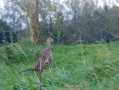
A walk through the Ternois countryside, between woodland and open countryside, taking you to the headwaters of the Ternoise and the woods of Saint-Pol and Saint-Michel, where, with a bit of luck and if you keep quiet, you might spot some roe deer.
Take care when crossing the woods during the hunting season.

Details

2786790
Creation:
Last update:
Last review:
  • Walking
    Activity: Walking
  • ↔
    Distance: 6.78 mi
  • ◔
    Average duration: 3h 30 
  • ▲
    Difficulty: Moderate

  • ⚐
    Back to start: Yes
  • ↗
    Ascent: + 394 ft
  • ↘
    Descent: - 377 ft

  • ▲
    Highest point: 486 ft
  • ▼
    Lowest point: 305 ft

Photos

Description of the walk

Park in the car park of the village hall in Saint-Michel-sur-Ternoise.

(S/E) Leave the car park, cross the D8 at the pedestrian crossing and take the road opposite heading north-east towards Ostreville.

(1) At the end of the houses, turn onto the path on the left leading into the woods.

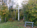
(2) At the wayside cross, take the path furthest to the right which leads into the woods. Carry on straight ahead, heading north-east, until you reach the D85E3

(3) At the junction with the water tower, cross this departmental road with care and follow the road opposite.
About 500 m from the junction, at the bend, leave the road and follow the path on the right which leads into the woods.

(4) At the end of the path, turn left towards the restaurant Les Catherinettes, pass one of the sources of the Ternoise and follow the path on the right which runs alongside the Ternoise.

(5) At the end of the path, follow the road to the left and take the first road on the right (Rue Verte). Further on, turn right and join the D8.

(6) Cross the D8 with care (there is no pedestrian crossing) and continue along Rue de Maisnil, which is almost directly opposite. Cross the railway line at the level crossing, go over the bridge spanning the D939 and continue straight on along Chemin des Morts.

(7) At the junction with the D85, follow this road to the right with care for 400 m and take the path on the left as you come out of the bend. Ignore the first path on the right and continue to the left, heading south-west, ignoring the path on the right.

(8) Turn right onto the track that leads back towards the four-lane road, then turn right to follow it until you rejoin the D85.

(9) Turn left and follow the D85 with care. Cross over the D939 and enter Saint-Michel-sur-Ternoise.

(10) After a cluster of houses, take the road on the right, then turn immediately right into Rue de Tachincourt. Pass under the railway line.

(11) Turn left into the cul-de-sac and head for the village hall (S/E).

Waypoints

  1. S/E : mi 0 - alt. 305 ft - Village hall car park
  2. 1 : mi 0.21 - alt. 315 ft - Path on the left towards the woods
  3. 2 : mi 0.69 - alt. 381 ft - Calvary
  4. 3 : mi 1.51 - alt. 443 ft - Water tower
  5. 4 : mi 2.27 - alt. 325 ft - “Les Catherinettes” restaurant – Source of the > - Ternoise (rivière)
  6. 5 : mi 2.61 - alt. 322 ft - Road junction
  7. 6 : mi 2.87 - alt. 318 ft - D8
  8. 7 : mi 4 - alt. 476 ft - Junction with the D85
  9. 8 : mi 4.7 - alt. 459 ft - Path on the right – elevation 140
  10. 9 : mi 5.86 - alt. 427 ft - D85
  11. 10 : mi 6.3 - alt. 322 ft - Entrance to Saint-Michel-sur-Ternoise
  12. 11 : mi 6.68 - alt. 308 ft - Cul-de-sac on the left
  13. S/E : mi 6.78 - alt. 305 ft - Village hall car park

Notes

Bus shelters in the village hall car park.
Hiking poles and walking boots are recommended.
Please wear a high-visibility vest.

Worth a visit

The sources of the Ternoise (4).

Reviews and comments

4.3 / 5
Based on 3 reviews

Reliability of the description
4.7 / 5
Ease of following the route
4.3 / 5
Route interest
4 / 5
JUDAS Sylvaine
JUDAS Sylvaine

Overall rating : 4.7 / 5

Date of your route : Mar 19, 2021
Reliability of the description : ★★★★★ Very good
Ease of following the route : ★★★★★ Very good
Route interest : ★★★★☆ Good
Very busy route : Yes

A lovely walk that takes us through the woods, along the River Ternoise and through small villages.
However, between the 8th and the 9th, there was far too much noise along the four-lane road.
I think it would be much more pleasant to take the windmill path.

Thank you very much for all these walks, which allow us to discover new places.

Machine-translated

Bouli62
Bouli62

Thank you

Machine-translated

benoitrando
benoitrando

Overall rating : 4.7 / 5

Date of your route : Oct 24, 2020
Reliability of the description : ★★★★★ Very good
Ease of following the route : ★★★★★ Very good
Route interest : ★★★★☆ Good
Very busy route : Yes

A very pleasant route, almost entirely on footpaths and tracks with very little tarmac. What’s more, with the route description, it’s impossible to go astray or end up walking further than the route requires. You simply need to follow and stick to the instructions – it’s accurate to the metre, so no worries.

Thanks, Bouli62, for this lovely route.

Machine-translated

Dominique Leu
Dominique Leu
• Edited:

Overall rating : 3.7 / 5

Date of your route : May 26, 2020
Reliability of the description : ★★★★☆ Good
Ease of following the route : ★★★☆☆ Average
Route interest : ★★★★☆ Good
Very busy route : No

A lovely, well-described walk. The only problem was between points 7 and 8, where we weren’t sure which path to take to get back onto the D85. I think the path has been turned into farmland… We ended up walking an extra 3 km.

Machine-translated

Other walks in the area

For more walks, use our search engine .

The GPS track and description are the property of this route's author. Please do not copy them without permission.