The paths through the woods of Saint-Pol and Saint-Michel

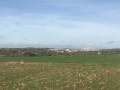
A lovely walk, mostly along forest paths that are very pleasant in sunny, warm weather. If you set off early in the morning, you’re likely to come across roe deer out for a stroll in the woods.
Please note: the path is closed during the hunting season.

Details

3194024
Creation:
Last update:
Last review:
  • Walking
    Activity: Walking
  • ↔
    Distance: 7.31 mi
  • ◔
    Average duration: 3h 45 
  • ▲
    Difficulty: Moderate

  • ⚐
    Back to start: Yes
  • ↗
    Ascent: + 420 ft
  • ↘
    Descent: - 410 ft

  • ▲
    Highest point: 459 ft
  • ▼
    Lowest point: 305 ft

Photos

Description of the walk

Park in the square by the village hall in Saint-Michel-sur-Ternoise.

(S/E) From the square, head for the D8 county road, turn right towards the south-east and follow it for about 500 metres.

(1) At the first junction, turn left onto Rue d’en Haut heading east, follow it for about 500 m and, at the crossroads, turn left heading north-east onto Chemin de Rocourt.

(2) At the junction with a path on the left, take it north-west towards the woods; at the edge of the woods, turn left, follow the path for 50 m and enter the woods at the second entrance – the first being private. Follow the path straight on, heading west-south-west, until you reach the source of the Ternoise.

(3) Turn right towards the restaurant Les Catherinettes and join the D85E3. Turn right and, after 20 metres, take the woodland track on the right heading north-east. At the end of the track, turn left onto the road and enter Grandcamp.

(4) At the junction by the water tower, cross the D85E3 and follow the road opposite, which ends in a forest track. Follow it all the way down.

(5) At the wayside shrine, turn right heading north-north-east, walk alongside the cemetery and continue along the forest track.

(6) At the crossroads of tracks near the railway line, turn right, go under the D 941 and join the D 86.

(7) On the D86, turn left, cross the railway line, pass under the D941 again and, after 1,000 metres, walk alongside the Ternois waste disposal site.

(8) At the entrance to the industrial estate, turn left at the first junction and continue to the sewage treatment works. Turn left, then left again, and walk past a concrete mixing plant.

(9) At the end of the stony track, turn right onto the path leading down towards the woods. At the pumping station, follow the path on the left and head towards the tunnel on the right.

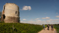
(10) Go through the tunnel; make sure you have a torch, and follow the path which climbs back up through the woods.

(6) When you reach the forest track, turn right onto the path you took on the way there.

(5) At the crossroads, take the second path on the left heading south-east.

(11) At the junction with the D 85E3, turn right and join the D 8 to return to the starting point (S/E).

Waypoints

  1. S/E : mi 0 - alt. 305 ft - Saint-Michel-sur-Ternoise village hall
  2. 1 : mi 0.35 - alt. 318 ft - Rue d’en Haut
  3. 2 : mi 1.15 - alt. 459 ft - Turn left at the crossroads
  4. 3 : mi 1.74 - alt. 322 ft - Source of the - Ternoise (rivière)
  5. 4 : mi 2.54 - alt. 443 ft - Water tower
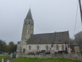
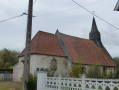
  6. 5 : mi 3.37 - alt. 384 ft - Calvary, cemetery and church
  7. 6 : mi 3.57 - alt. 397 ft - Crossroads near the railway line
  8. 7 : mi 4.5 - alt. 390 ft - D86 junction, level crossing
  9. 8 : mi 5.38 - alt. 433 ft - Industrial estate
  10. 9 : mi 6.09 - alt. 413 ft - Path on the right
  11. 10 : mi 6.31 - alt. 331 ft - Tunnel under the railway line
  12. 11 : mi 7.11 - alt. 315 ft - Junction with the D85E3
  13. S/E : mi 7.31 - alt. 305 ft - Saint-Michel-sur-Ternoise village hall

Notes

You’ll need the right kit.
Don’t forget your bottle of water.
A torch might come in handy

Worth a visit

(3) The headwaters of the Ternoise.

Reviews and comments

4.1 / 5
Based on 3 reviews

Reliability of the description
4 / 5
Ease of following the route
4.3 / 5
Route interest
4 / 5
Bouli62
Bouli62

Hello Benoitrando
I’ll have a look at point 9 – yes, that must be a recent addition – and find out more.
Thank you for your comments.

Machine-translated

benoitrando
benoitrando

Overall rating : 4.7 / 5

Date of your route : Oct 23, 2020
Reliability of the description : ★★★★★ Very good
Ease of following the route : ★★★★★ Very good
Route interest : ★★★★☆ Good
Very busy route : Yes

A pleasant route that takes you through both woodland and countryside. There are a couple of minor annoyances, though: points 7 and 8. A fairly long stretch along the road, much of which is through an industrial estate. The section through the tunnel at point 9 is muddy but not very long.
Point 9: take the path on the right just after the concrete plant. At the bottom, access to the woodland is now blocked by a plastic chain and a ‘private hunting ground’ sign. The barrier looks fairly new to me (I did manage to get through, though), so it’s worth checking. If that’s the case, a change of route would be necessary (but could this be a dirty trick by the hunters?).

Thanks to Bouli62 for this lovely route.

Machine-translated

capauri
capauri

Overall rating : 4.3 / 5

Date of your route : Jun 14, 2020
Reliability of the description : ★★★★☆ Good
Ease of following the route : ★★★★★ Very good
Route interest : ★★★★☆ Good
Very busy route : No

A lovely, very pleasant walk (apart from the industrial estate, which is a real let-down).
In the industrial estate itself, take the first left and you’ll leave the industrial estate at the sewage treatment works…
For the tunnel, make sure you have a torch; it’s short but very muddy today, and it would have been dangerous to go through in the dark.
Apart from these few points, it’s a lovely route – we loved it.

Machine-translated

Bouli62
Bouli62

Hello
Thank you for your comment, but could you be a bit more specific so that I can make the necessary improvements?
Have a nice day

Machine-translated

MIC62
MIC62

Overall rating : 3.3 / 5

Date of your route : May 24, 2020
Reliability of the description : ★★★☆☆ Average
Ease of following the route : ★★★☆☆ Average
Route interest : ★★★★☆ Good
Very busy route : No

It’s really difficult to find the entrance to the woods. Part of it is off-limits

Machine-translated

Other walks in the area

For more walks, use our search engine .

The GPS track and description are the property of this route's author. Please do not copy them without permission.