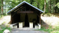
View of the Tête des Mineurs from Lamadeleine-Val-des-Anges

A superb woodland walk, near the village of Étuffont and at the foot of the Baerenkopf.
This family walk alternates between thePR® trail and the forest track. It offers a wonderful variety of geological, botanical and mycological features.

Details

n°21793320
Creation:
Last update:
–
Last review:
  • Walking
    Activity: Walking
  • ↔
    Distance: 6.58 mi
  • ◔
    Average duration: 4h 15 
  • ▲
    Difficulty: Moderate

  • ⚐
    Back to start: Yes
  • ↗
    Ascent: + 1,381 ft
  • ↘
    Descent: - 1,381 ft

  • ▲
    Highest point: 2,992 ft
  • ▼
    Lowest point: 1,686 ft

Description of the walk

Park in the small car park at a place called Le Gros Hêtre.

Marked with Yellow Rings

(S/E) Take the forest track heading north, which zigzags until it joins aPR® trail.
Turn right at the hairpin bend, staying on the forest track for 100 metres

(1) Turn left off it at the Fork in the road ahead. Follow thePR® as it climbs north-north-west until you reach a bend in a forest track.

(2) Stay on thePR® by keeping left and rejoin the forest track you left earlier. Turn left, then right 50 metres further on to stay on thePR®. At the next Fork in the road, veer left and continue to the Plain Baleroy.

(3) Turn right at the crossroads and stay on thePR® until you reach the Col des Sept Chemins shelter. Enjoy another break.

Unmarked

(4) Turn off downhill onto the first forest track on the right, heading south. On the left, leave a logging track and thePR® marked by a Blue Ring. Follow the track to reach the valley floor of the Ruisseau de la Goutte Saint-Michel.

(5) Stay on the forest track which veers to the right, leaving the descending track on your left. You’ll reach another Fork in the road.

(6) Turn left onto the forest track that descends and ignore another track heading to the right. Continue downhill until you rejoin thePR® route you took on the way there. Carry on until you reach the hairpin bend.

(1) Leave thePR® and take the forest track on the left, then follow this same track downhill to the car park (S/E).

Waypoints

  1. S/E : mi 0 - alt. 1,686 ft - Small car park at a place called Le Gros Hêtre
  2. 1 : mi 1.14 - alt. 2,303 ft - Crossroads at the circular bend
  3. 2 : mi 1.89 - alt. 2,674 ft - Bend in the forest track
  4. 3 : mi 2.31 - alt. 2,828 ft - The Baleroy Plain
  5. 4 : mi 3.15 - alt. 2,428 ft - The Col des Sept Chemins shelter
  6. 5 : mi 4.15 - alt. 2,500 ft - La Goutte Saint-Michel stream
  7. 6 : mi 4.39 - alt. 2,513 ft - Junction
  8. S/E : mi 6.58 - alt. 1,686 ft - Small car park at a place called Le Gros Hêtre - Madeleine (rivière) - Affluent de la Bourbeuse

Worth a visit

Rock description:

Car park: alluvial deposits, pebbles, gravel and sand (Riss or Würm)
Point (1) and (4): Rhyo-dacitic tuffs and ignimbrites (Upper Viséan)
Point (2): Arkosic grauwacke
Point (3): Pelites
Point (5): Grauwackes – sandy limestones
Point (6): Grauwackes – lutites

Always be cautious and plan ahead when you're outdoors. Visorando and the author of this route cannot be held responsible for any accidents occurring on this route.

The GR® and PR® markings are the intellectual property of the Fédération Française de Randonnée Pédestre.

Reviews and comments

3.7 / 5
Based on 3 reviews

Reliability of the description
4 / 5
Ease of following the route
4.3 / 5
Route interest
2.7 / 5
Meldan
Meldan

Overall rating : 4.3 / 5

Date of your route : Jul 08, 2024
Reliability of the description : ★★★★☆ Good
Ease of following the route : ★★★★★ Very good
Route interest : ★★★★☆ Good
Very busy route : Yes

A lovely walk with a few climbs – beginners take care

Machine-translated

bouledjouidja rabah
bouledjouidja rabah

Hello
I’m glad you enjoyed this song.
I hope you continue to enjoy your walks.

Machine-translated

magory
magory

Overall rating : 3.7 / 5

Date of your route : Aug 20, 2023
Reliability of the description : ★★★★☆ Good
Ease of following the route : ★★★★☆ Good
Route interest : ★★★☆☆ Average
Very busy route : No

A pleasant, very shady walk

Machine-translated

bouledjouidja rabah
bouledjouidja rabah
• Edited:

The appeal of this environment lies in nature itself; it is accessible to a wide range of people, and another attraction is the diversity of the landscapes and the wide variety of rock formations from the bottom to the top. Also, during these heatwaves, the shade provided by the majestic trees is a significant bonus.
If you enjoy open, airy spots, I’d invite you to explore the plateaus of the Jura region or the Vosges ridges.
Enjoy the rest of your walks.

Machine-translated

Randonneur25210
Randonneur25210

Overall rating : 3 / 5

Date of your route : Jul 23, 2023
Reliability of the description : ★★★★☆ Good
Ease of following the route : ★★★★☆ Good
Route interest : ★☆☆☆☆ Very disappointing
Very busy route : No

Hello,
I travelled 160 km there and back to follow this route, having read the description of the walk. Whilst the route, signposting and quality of the paths were all as expected, and the GPX track was very reliable, I only found two spots, each 30 metres long, with a clear enough view to catch a glimpse of the Belfort gap and Switzerland. The rest of the 10.5 km is through the forest with a view of just 50 metres!!! In summer, the leaves on the trees block the view of the distant landscape!!!
I’m now asking myself a fundamental question: Visorando, you feature many routes of this type in your weekly newsletter. Are you reliable??? JCD.

Machine-translated

Other walks in the area

For more walks, use our search engine .

The GPS track and description are the property of this route's author. Please do not copy them without permission.