


Refine your search for walks in Rivière de Cabrils
Rivière de Cabrils walks


 Around Sansa
 Visorando Member
 9.11 mi
 +1,644 ft
 -1,644 ft
 5h 35
5h 35
 Moderate
 Departure from Sansa (Pyrénées-Orientales)
This route, starting from Sansa, will take you on a tour of the surroundings of the northernmost village in the Garrotxes. A fairly long and challenging hike.
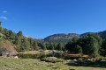
The Refuge des Estagnols from Sansa
 7.06 mi
+1,532 ft
-1,549 ft
4h 35
Moderate
Departure from Sansa (Pyrénées-Orientales)
7.06 mi
+1,532 ft
-1,549 ft
4h 35
Moderate
Departure from Sansa (Pyrénées-Orientales)
A lovely walk taking in some of the Catalan heritage sites of the Garrotxes.Route marked in yellow, with directional and information signs that are either recent or in very good condition.No signposting between (7) and (9), but it is impossible to go wrong. The yellow markings indicated, and present in November 2022, are not guaranteed to remain in place over time (disappearance, destruction).Paths are in perfect condition. This walk can be shortened as desired.The most challenging part is returning to Sansa via the small D4/D4e road: allow half an hour’s drive from Olette.
Ayguatébia-Talau and the Vallée du Feu
4.38 mi
+1,214 ft
-1,224 ft
3h 05
Moderate
Departure from Ayguatébia-Talau (Pyrénées-Orientales)
A beautiful, unspoilt hike through the Garrotxes Valley, starting from Ayguatébia.
Circular route around Railleu
 6.87 mi
+1,775 ft
-1,749 ft
4h 40
Moderate
Departure from Railleu (Pyrénées-Orientales)
6.87 mi
+1,775 ft
-1,749 ft
4h 40
Moderate
Departure from Railleu (Pyrénées-Orientales)
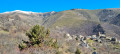
A lovely getaway to a remote and little-known corner of the Catalan Pyrenees Regional Nature Park, namely the Garrotxes and, more specifically, the village of Railleu. You can also explore the neighbouring village of Sansa on this route.
Les Teixoneres
 9.78 mi
+3,399 ft
-3,379 ft
7h 30
9.78 mi
+3,399 ft
-3,379 ft
7h 30
 Difficult
Departure from Olette (Pyrénées-Orientales)
Difficult
Departure from Olette (Pyrénées-Orientales)
A hike with a challenging start. The climb through the forest is magnificent.
The route along the hills and the return leg offer views of a varied landscape.
Huts, an old castle and a listed village are all part of this walk.
This walk is accessible by public transport. See practical information.
This walk can be considered very difficult due to its length and steep sections.
From Railleu to Sansa
3.51 mi
+945 ft
-942 ft
2h 25
 Easy
Departure from Railleu (Pyrénées-Orientales)
Easy
Departure from Railleu (Pyrénées-Orientales)
A short, accessible hike connecting two of the five villages located in the wild and little-known Garrotxes valley. Several old mills with information panels can be found along the route.
From Sansa to the Estanyols Lakes
5.54 mi
+1,562 ft
-1,552 ft
3h 55
Moderate
Departure from Sansa (Pyrénées-Orientales)
A family hike accessible to all in the wild Garrotxes valley. From the village of Sansa, on a forest trail on the way there, the route leads to the Estagnols Lakes, where there is also a refuge.