Country:
 City:
City:


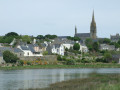
The route starts from the central square, the Place de la République (large car park).
(S/E) Leave the square at the top and follow Boulevard du Général de Gaulle for about ten metres. Turn left into Rue Laénnec. Walk past the rear of the former minor seminary, pass close to the Tourist Office and arrive at Place de l’Église Notre-Dame de Roscudon. Take a moment to admire the south porch, built around 1400, one of the most original examples of Gothic architecture in Brittany (a visit to the collegiate church is well worth it).
(1) With your back to the porch, take the pedestrian passageway leading to Rue des Courtils, which you follow to the left to reach Petite Rue Chère.
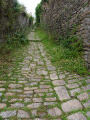
(2) Head down this cobbled, stepped alleyway to the right (the name ‘Chère’ comes from the Old French ‘choir’, meaning ‘to fall’) and you’ll come out onto Rue du Goyen.
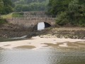
(3) Turning left, continue across the Pont de Kéridreuff, which replaced the former ford. A tide mill, one of the oldest in Brittany, stands on this bridge. At the end, turn right onto a small road (Rue de Stangalon) and follow it for about 400 m (view of Pont-Croix).
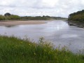
(4) At the signpost, turn right to head towards the left bank of the river. Follow the path, which is flat at first before alternating between a few short ascents and descents through the woodland. Cross a footbridge and arrive at a fork in the path, marked by a tree trunk carved into the shape of a mushroom. This fork does not appear on the IGN map.
(5) Turn left before a footbridge and head uphill through the woods to reach a fountain and a large wash house. Further down, this path rejoins the coastal path you left earlier and continues along the edge of fields in a south-westerly direction.
(6) At a sign indicating active oyster beds, leave the track on the left and climb four steps to continue through the woods. Walk past a few old boats that are spending their twilight years at the far end of the cove. Turn left to head up into the woods, where a rope stretched between the trees on your right-hand side marks the path, leading to the entrance to Locquéran Castle.
(7) Turn right and walk down the road using the safe crossings, first to the left then to the right. Cross the bridge (view of Audierne harbour on the left). At the end of the bridge, follow the path between the river and the buildings. Walk round the “Aqua Show” aquarium and continue along the path below the D765.
(8) At Anse de Suguensou, veer right to cross a small bridge and continue along the old Pont-Croix–Audierne railway line. Pass the Lespoul lagoon on your left, where two information boards describe the various birds that live there. Over a distance of 3 km, this section of the path is marked by milestones every 100 m. A graduated chart allows you to assess your running performance according to your age.
(9) At a car park, you’ll reach a short tarmac section. After about 200 metres, turn right off it (signpost) to continue along the edge of a field. Pass another car park and continue following the river upstream, with beautiful restored houses lining the left-hand side. Pass another car park (information sign about the bridge and the tide mill) and turn left to cross Rue du Goyen.
(3) Turn right, then immediately left to head up the Grande Rue Chère, a lane identical to the Petite Rue Chère but, as its name suggests, wider. A steep climb lies ahead to reach the car park (S/E).


 Visorando Member
 Easy
Easy