Country:
 City:
City:




Park in the car park at Confort-Meilars Town Hall.
(S/E) Head back towards the main road (D765) and follow it to the right.
GR® 34g signposting: White and Red
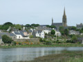
(1) Walk past the church and pass by the foot of the imposing wayside cross. Then turn left, heading due south.
(2) Cross Rue du Presbytère on the left-hand side and walk past the school. Pass a small wayside cross and follow the road downhill.
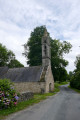
(3) Ignore a road on the left and you’ll soon reach the small village of Meilars with its church surrounded by its cemetery.
No signposting
(4) Leave the church on your left and continue along the road which crosses the Goyen via a bridge.
(5) Shortly afterwards, leave the road and take a path on the right, following it to the Mahalon cemetery. Turn right onto the street leading to Saint-Magloire Church.
(6) Carry on for 50 metres to discover the Saint-Maudez Fountain set into a wall. Retrace your steps.
(6) Keep the church on your left.
PR® marked in yellow
Shortly afterwards, turn right onto the main street, keeping to the right-hand pavement, and walk past the town hall.
(7) Turn right into a public garden with a children’s play area. Exit on the other side, level with the Saint-Pierre Chapel.
(8) Follow the road to the right, heading due south. You’ll come to a roundabout.
(9) Turn right onto the small road, then turn left at the Fork in the road.
PR® marked in yellow (in the opposite direction)
Continue for about fifty metres. Turn left onto a path that crosses a woodland and leads to a small side road.
Unmarked
(10) Turn left and follow the road to the Kerrest co-operative bakery. Turn left to head back towards Mahalon, returning to the roundabout you passed earlier.
PR® marked in yellow (in the opposite direction)
(9) Turn right and follow the road down for about 200 m.
(11) Turn left into the Stang Irvin valley. Note the fountain and a 15th-century wayside cross on your right. Follow this path due north to a small cross-road. Then turn right and continue for about fifty metres.
Unmarked
(12) Look out for a short path on the right and follow it to quickly reach the Coatmorvan cadastral mound. Retrace your steps.
PR® marked in yellow (in the opposite direction)
(12) Continue to the right along the small road towards Keréval. Turn left to descend gradually towards the River Goyen.
(13) Cross the bridge and head back up, turning left towards the Moulin de Lesvoyen.
Unmarked
(14) Turn right as you head back up the road, then turn left onto the path between the fields to join a cross-country track.
PR® marked in yellow (in the opposite direction)
(15) Follow this small country road to the left as it climbs steadily, passing close to a quarry.
Unmarked
(16) Shortly afterwards, veer left and follow the small road which passes near two hamlets and joins the road you took on the way there.
(3) Follow it to the right as far as the school.
(2) Turn right at the corner by the school.
(17) After about a hundred metres, turn left to cross a wooded park with picnic tables, passing by the church.
(1) Cross the D765 at the pedestrian crossing, follow it to the right and turn left immediately to reach the town hall car park (S/E).
 Visorando Member
 Easy
Easy