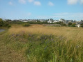
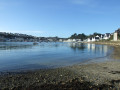
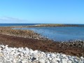
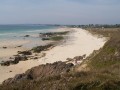
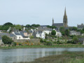
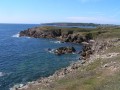
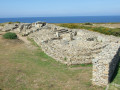
From Audierne, take a walk towards Sainte Evette, passing through coastal and countryside scenery

Brittany is a land of legends, born of its rainy and windy climate. For centuries, these legends have taken shape in the form of religious monuments and churches. On this walk, you’ll have the chance to discover the distinctive heritage of this region at the south-western tip of Brittany, whilst enjoying the charms of the pretty little town of Audierne and the surrounding countryside, not to mention the sea.

Details

37916634
Creation:
Last update:
Last review:
  • Walking
    Activity: Walking
  • ↔
    Distance: 3.88 mi
  • ◔
    Average duration: 1h 55 
  • ▲
    Difficulty: Easy

  • ⚐
    Back to start: Yes
  • ↗
    Ascent: + 180 ft
  • ↘
    Descent: - 184 ft

  • ▲
    Highest point: 151 ft
  • ▼
    Lowest point: -3 ft
  • ⚐ Country: France
  • ⚐ City: Audierne (29770)
  • ⚑
    Start/End: N 48.022751° / W 4.539494°
  • ❏
    IGN map(s): Ref. 0419ET
  • Hour-by-hour weather

Photos

Description of the walk

Meet at the Centre d’Audierne, Place de la République, opposite the marina.

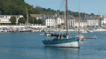
(S/E) Head towards the marina quay and follow the promenade along the water, heading south-east, towards the sea. The footpath leads to the Capucins footbridge.

(1) Continue along the footbridge and turn left, heading towards a small harbour and then on to the sea. Go round the building after the small harbour (restaurant) and climb the steps. You’ll come to a coastal path.

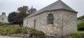
(2) Carry on along this path for just over a kilometre, alongside the beach, until you reach the Chapel of Sainte-Evette (or Sainte-Edwette) and the beach of the same name.

(3) Take the first alleyway on the right after the chapel, Venelle de Landrevette, and follow it until you reach a small path leading uphill to the right: Rue de la Fontaine. Don’t miss the Fontaine de Sainte-Edwett, 50 metres further on, as well as the typically Breton calvary, where the path joins a small road. Turn left and continue uphill to a T-junction, where the road turns into a track. You can only go left. A sign points to ‘Parc Ar Paeron’.

(4) Follow this main track until you reach the park, where it turns right, passing between cultivated gardens. Once past these gardens, the path goes through a wooded area. Take the first track on the right, which leads to a road.

(5) Cross the road (Rue de la France Libre), veering slightly to the left, and take the small road, at the entrance to which there is another wayside cross. It leads towards the village of Kerboul. At the right-angled bend, near a farm, do not continue towards Kerboul but take the path to the left.

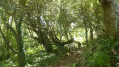
(6) Continue through the lovely woodland and join a small road at the hamlet of Kerandraon.

(7) Take this road (Rue de Kerhuon) to the right. After a circular bend to the left, take the second path on the left, which leads through the woods to Rue Racine, in the upper part of Audierne.

(8) Walk down this street until it crosses Rue de Verdun, then continue in the same direction along Rue Waldeck Rousseau. Cross the junction with Rue Émile Combes and Rue Danton and carry on along Rue Camille Desmoulins. At the end of the street, you’ll find yourself facing the old, traditional Église Saint-Raymond. Be sure to walk round it (see details below).

(9) Head towards Rue Émile Zola, which runs above and behind the church. This leads to a flight of steps descending to the right, joining Rue Ernest Renan; then turn right onto Rue Laënnec, which leads to Place de la République (S/E).

Waypoints

  1. S/E : mi 0 - alt. 16 ft - Place de la République
  2. 1 : mi 0.45 - alt. 26 ft - Capucins Footbridge
  3. 2 : mi 1.1 - alt. 39 ft - Coastal path - Goyen (fleuve)
  4. 3 : mi 1.82 - alt. 26 ft - Sainte-Edwette Chapel and beach
  5. 4 : mi 2.09 - alt. 112 ft - Head towards Parc Ar Paeron
  6. 5 : mi 2.74 - alt. 151 ft - Rue de la France Libre
  7. 6 : mi 2.91 - alt. 128 ft - T-junction before the hamlet of Kerboul
  8. 7 : mi 3.06 - alt. 115 ft - Rue de Kerhuon
  9. 8 : mi 3.41 - alt. 144 ft - Rue Racine above Audierne
  10. 9 : mi 3.76 - alt. 56 ft - Saint-Raymond Church
  11. S/E : mi 3.88 - alt. 16 ft - Place de la République

Notes

There aren’t really any places to eat along the way, except by the sea. It’s best to bring something to drink if it’s hot.
In Audierne, there are shops and restaurants.

NB: parking is difficult in summer; there are other car parks along the route by the beach

Worth a visit

(1) Passerelle des Capucins: this is a 122-metre-long footbridge, situated along the small Capucins beach. It was completed in 1894 as part of the works to improve the port of Audierne. The footbridge is made of metal, whilst the section reserved for pedestrians is made of wood.

(3) According to legend, Saint Edwette, patron saint of fishermen, is said to have arrived by boat in Plozévet with her brother Saint Demet in the 4th century. She is said to have lived alone at the site where the chapel dedicated to her now stands. She died there in 383. The present chapel is a reconstruction.
It is surely no coincidence that this legend has taken root in this remote corner of Brittany. Not far from the western tip, notably the Raz de Sein, a dangerous passage for sailors, the Bay of Sainte-Edwette provides a safe haven in the event of bad weather. Storms are a common occurrence in this region, and in the past, fishermen risked their lives in fragile sailing boats.
In this bay, a breakwater was built to protect against the waves, and it still serves as a harbour today for a few fishermen and pleasure boaters. A water sports centre is also situated directly opposite the chapel dedicated to Saint Edwette.
St Edwette’s Fountain: very old, it was restored in 1723. Usually, Breton fountains were situated lower down than the chapel associated with them. This is an exception. The niche, protected by a wire mesh, houses a pretty polychrome statuette dating from the second half of the 19th century.
St Edwette’s Calvary: built between 1633 and 1669 and restored in 1997. Note the small statues situated above it. A notice provides some interesting information on this subject.

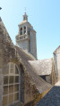
(8) Saint Raymond’s Church, or Saint Rumon’s (originally). This saint, of English origin, is venerated in Cornwall. The granite church was built within the moat of the former Audierne castle, itself a remnant of an ancient Roman camp. It was not until the mid-17th century that the clergy replaced the worship of Saint Rumon with that of Saint Raymond Nonnat, a Catalan cardinal.
Most of the church dates from 1607, but the bell tower, built in 1631, was rebuilt in the 18th century in the Baroque style. Three boats are carved on the south façade and the west porch of the church: a top-hulled vessel, a lobster boat and a fishing boat, illustrating the activities and wealth of Audierne’s merchants at that time.

Reviews and comments

4.4 / 5
Based on 3 reviews

Reliability of the description
4.3 / 5
Ease of following the route
4.3 / 5
Route interest
4.7 / 5
phpicard
phpicard

Overall rating : 5 / 5

Date of your route : Aug 10, 2025
Reliability of the description : ★★★★★ Very good
Ease of following the route : ★★★★★ Very good
Route interest : ★★★★★ Very good
Very busy route : No

We did this tour in reverse, which allowed us to finish with a lovely swim at Ste Éventé beach.

Machine-translated

JCB85320
JCB85320

Overall rating : 4.3 / 5

Date of your route : Apr 18, 2025
Reliability of the description : ★★★★☆ Good
Ease of following the route : ★★★★★ Very good
Route interest : ★★★★☆ Good
Very busy route : No

A lovely route starting from Audierne. It’s a shame we did it in the rain. We had to put our clothes in the tumble dryer when we got home.

Machine-translated

Marc et Gisèle
Marc et Gisèle

Overall rating : 4 / 5

Date of your route : Jul 10, 2024
Reliability of the description : ★★★★☆ Good
Ease of following the route : ★★★☆☆ Average
Route interest : ★★★★★ Very good
Very busy route : No

You’ll need the smartphone app. The printed guide says, in step 4, …passing between cultivated gardens. Once past these gardens… However, you need to turn right before you reach them.
This walk is lovely and very interesting, and gives us a better insight into Audierne.

Machine-translated

Other walks in the area

For more walks, use our search engine .

The GPS track and description are the property of this route's author. Please do not copy them without permission.