Country:
 City:
City:


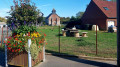
Park in the square outside Bajus Town Hall.
(S/E) Leave the square and follow the road to the right; continue on, take the first road on the right and follow it uphill to a bend.
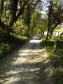
(1) At the bend, turn left onto the path – an old railway line – and follow it for about 1,500 metres, skirting the Bois de Houdain.
(2) At the crossroads, leave the old railway line and take the path on the left heading due south; follow it to the road and continue along it to the right.
(3) At the first junction, turn right onto the road which climbs northwards for about 700 m.
(4) Join the old railway line on the right, heading east.
(2) At the next junction, turn left towards the north and follow the track up to the road. Follow the road to the left towards the water tower and head down into the village of Diéval.
(5) At the bottom of the hill, turn right onto the road and follow it for about 800 m.
(6) At the crossroads, turn left onto the path heading north-east.
(7) At the bottom of the track, turn slightly to the right and follow the Chemin de Lille, which skirts the Bois Mont for about 1,700 metres until you reach the road with a wayside shrine.
(8) At the junction with the road, cross it carefully and follow the path opposite heading east, which passes under a power line.
(9) On the plateau at the crossroads, turn right and head south-east.
(10) At the first T-junction, turn right towards the Beugin model aircraft club, follow the path that runs alongside the Bois d’Épenin and leads to a road.
(11) Turn left onto the road and follow it to the first houses in La Comté.
(12) Cross the road, take the path – a former railway line – and follow it for about 2,200 metres.
(1) At the bend, follow the road to the left and return to the starting point (S/E).

 Association / Club / Walk leader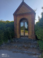

 Visorando Member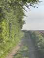
 Difficult
  Easy
Easy