Mont de la Comté

One of the most interesting walks in the area, criss-crossing the hills and valleys around Mont de La Comté. It’s worth noting that paragliders occasionally take off from this hill, as it’s an official launch site.

Details

n°15211906
Creation:
Last update:
Last review:
  • Walking
    Activity: Walking
  • ↔
    Distance: 4.35 mi
  • ◔
    Average duration: 2h 20 
  • ▲
    Difficulty: Easy

  • ⚐
    Back to start: Yes
  • ↗
    Ascent: + 338 ft
  • ↘
    Descent: - 338 ft

  • ▲
    Highest point: 617 ft
  • ▼
    Lowest point: 266 ft
  • ⚐ Country: France
  • ⚐ City: La Comté (62150)
  • ⚑
    Start/End: N 50.423588° / E 2.50259°
  • ❏
    IGN map(s): Ref. 2305E, 2405O
  • Hour-by-hour weather

Description of the walk

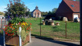
Park in Rue du 14 Juillet, not far from the junction with Rue du Château, which leads to the Town Hall, a large building in the traditional white stone of the Artois hills.

(S/E) Cross at the pedestrian crossing, then walk up Rue du 14 Juillet, heading north.

(1) Turn right onto Rue de la Rochelle and, at the bend, carry on straight ahead towards the transmission mast and the Bois d’Harmonval.

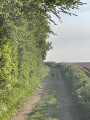
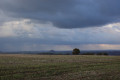
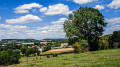
(2) Turning right, you’ll reach one of the most beautiful views of the walk – and perhaps even of the whole region. Carry on straight ahead, with the Mont de la Comté on your left. You’ll come to a four-way junction in the Plaine du Ransart.

(3) Take the small country road on the right.

(4) Turn slightly right towards Mont de la Comté and, if you’re lucky, you’ll be able to watch some paragliders in flight.

(5) Turn back.

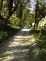
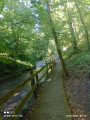
(4) Turn right and head into the woodland: this stretch is quite a change of scenery and feels a bit like entering a green tunnel.

(6) If you turn round, you can admire the famous Mont de La Comté and its paragliding launch site. Take a moment to admire the rolling countryside all around you.
Carry on straight ahead and you’ll come out onto Rue du 8 Mai. Turn right to reach the car park (S/E).

Waypoints

  1. S/E : mi 0 - alt. 279 ft - Parking on Rue du 14 Juillet, near the - Lawe (rivière)
  2. 1 : mi 0.26 - alt. 276 ft - Rue de la Rochelle
  3. 2 : mi 1.05 - alt. 486 ft - Crossroads, turn right
  4. 3 : mi 2.36 - alt. 594 ft - T-junction, turn right
  5. 4 : mi 2.83 - alt. 597 ft - Mont de la Comté junction
  6. 5 : mi 3.09 - alt. 617 ft - Mont de la Comté
  7. 6 : mi 3.59 - alt. 427 ft - T-junction, go straight on
  8. S/E : mi 4.35 - alt. 279 ft - Parking on Rue du 14 Juillet

Notes

- Good walking shoes, of course.
- Binoculars – you can sometimes spot storks and herons in the pastures.

Worth a visit

- A pizzeria along the route.
- Olhain Park (all-season tobogganing, an open-air swimming pool in the woods, an excellent café, etc.).
- The Art Deco swimming pool in Bruay-la-Buissière (the only one of its kind in France) and the Lodge du Stade Parc.
- The Cité des Électriciens with its little restaurant. This is where the film ‘Bienvenue chez les Ch’tis’ was filmed.
- Béthune and its restaurants, notably Le Vezuvio and Le Sojun (Thai/Vietnamese cuisine with a modern twist).
- The Saint-Pol-sur-Thernoise motor racing route.

Reviews and comments

4 / 5
Based on 2 reviews

Reliability of the description
4.5 / 5
Ease of following the route
4.5 / 5
Route interest
3 / 5
Jls62
Jls62

Overall rating : 4.3 / 5

Date of your route : Jun 13, 2024
Reliability of the description : ★★★★★ Very good
Ease of following the route : ★★★★★ Very good
Route interest : ★★★☆☆ Average
Very busy route : No

A lovely walk – not too long for a half-day outing, well signposted and easy to follow. There are some fine views once you reach the higher ground. Whilst the initial ascent is easy along wide, open paths, the descent at the end of the route is trickier: it’s a narrow, very steep path with rutted tracks through the undergrowth, which I imagine would be difficult to navigate in the rain or after a storm. It’s also tricky to park at the start, as you have to park on the main road: there’s no car park. It’s manageable for a single car but problematic if there’s a group of several cars;

Machine-translated

minouchon62
minouchon62

Overall rating : 3.7 / 5

Date of your route : Jan 19, 2024
Reliability of the description : ★★★★☆ Good
Ease of following the route : ★★★★☆ Good
Route interest : ★★★☆☆ Average
Very busy route : No

Part of the route across the fields is more difficult in bad weather, but otherwise offers a lovely view over the surrounding countryside

Machine-translated

Other walks in the area

For more walks, use our search engine .

The GPS track and description are the property of this route's author. Please do not copy them without permission.