Country:
 City:


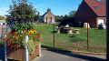
Starting point: Rue de l’Église in Diéval.
(S/E) Head towards the church and enter the cemetery. Cross it to find, on the other side, a flight of steps leading to Rue du Baudet.
Follow it to the right. At the T-junction, turn right again (Rue de Brunémont). After the bend to the left, turn right onto the path leading to the houses and look out for the entrance to a footpath immediately on your right.
(1) Take this path, which crosses a ravine before climbing up to Rue Monseigneur Éloi. Follow it to the left until you reach a T-junction.
(2) Turn left (GRP® Ternois Nord); at the next Fork in the road, ignore the road on the right and, about 300 m further on, you’ll reach another Fork in the road.
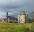
(3) Turn right onto the wide path (GRP®). Ignore a path branching off to the left, then another to the right, and you’ll arrive in front of Antigneul Castle. Just past the castle, the path turns left (the lovely avenue opposite is unfortunately off-limits!) to run alongside the small wood. Reach the edge of the wood.
(4) Head right along the edge of the woodland (GRP®) until you reach the railway line. Cross it and continue along the path opposite. The path turns left at a chapel and reaches a T-junction.
(5) Turn right towards Bours. At the junction, carry on straight ahead and stay on the lovely track, which passes through the hamlet of Monneville before reaching the D 89.
(6) Follow it straight on for a few metres before turning left into Rue de Chametz. After about 200 m, turn left onto a grassy track. Follow it for about fifty metres, then turn right onto a lovely footpath. You’ll reach a Fork in the road.
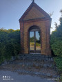
(7) Turn right and you’ll reach Rue de l’Église (with a wayside shrine on the right-hand corner).
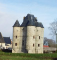
Here, you can take a short detour to the left to visit the Donjon.
Turn right. Cross the pretty stream, continue straight on and pass under the railway bridge.
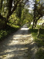
(8) Turn left immediately onto theGR® 127. The path is magnificent and offers lovely views of Bours and the valley. However, although well-maintained, it is very steep and often slippery (it’s best to use the steps).
If you take your time and watch out for the wooden steps and the limestone ground, the climb is no real problem.
At the top, cross a woodland before reaching a small road. Follow it straight ahead until you reach a main track on the right (GR®). There is an information board here, a post with hiking arrows and, hidden behind it, the remains of a wayside shrine. Take this track to reach Diéval.
Pass the first houses and you’ll find Rue Marie Caron on your right.
(9) Leave theGR® and follow this street. After about a hundred metres, turn left onto a path and reach Rue de Marest (where you’ll rejoin theGR®). Follow it to the right until you reach a T-junction.
(10) Turn right to return to the junction you passed on the way there.
(2) Then turn left onto Rue Monseigneur Éloi and follow it to reach Rue de l’Église (S/E).


 Visorando Member

 Easy
 Association / Club / Walk leader