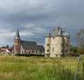
From Diéval to Ourton via the footpaths

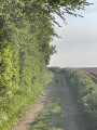
You’ll discover these two villages linked by beautiful paths, some stony, some earthen. You should spot plenty of flora and fauna along the way. It’s advisable to do this route in dry weather as some sections can be muddy.

Details

2782421
Creation:
Last update:
Last review:
  • Walking
    Activity: Walking
  • ↔
    Distance: 7.02 mi
  • ◔
    Average duration: 3h 45 
  • ▲
    Difficulty: Moderate

  • ⚐
    Back to start: Yes
  • ↗
    Ascent: + 584 ft
  • ↘
    Descent: - 574 ft

  • ▲
    Highest point: 548 ft
  • ▼
    Lowest point: 256 ft
  • ⚐ Country: France
  • ⚐ City: Diéval (62460)
  • ⚑
    Start/End: N 50.435936° / E 2.450405°
  • ❏
    IGN map(s): Ref. 2305E
  • Hour-by-hour weather

Description of the walk

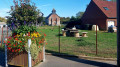
Park in Diéval square opposite the village hall.

(S/E) Opposite the village hall, follow the road to the right heading north-east.
100 m past the wayside cross, take the path on the left heading north-west and, at the second junction, turn right, then right again at the second junction.

(1) At the wayside cross, follow the road to the right towards the north-north-east. At the first junction (elevation 168), carry on straight ahead and do the same at the next junction. You’ll come within sight of the high-voltage power line.

(2) 100 metres from the line, at the junction, follow the path to the right heading south-east and pass under the high-voltage power line. At the pumping station, leave the path on your right and continue until you reach the D 86E2.

(3) Once on the road, turn right for about 25 metres and take the road on the left which passes in front of Ourton Cemetery. Cross the road, follow the path opposite to the end and turn right onto Rue de Verdin.

(4) After 300 metres, don’t miss the small track on the right heading south-south-west. This will take you onto Rue de l’Église.

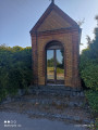
(5) After the church, take the first road on the left, then, after 250 m, the one on the right. At the D 941, head up to the right towards the south, cross at the traffic lights and keep following the road to the right until you reach the wayside shrines.

(6) At the wayside shrine, carry on straight ahead along the one-way road heading south, then, at the next junction (with a statue of the Virgin Mary in the wall of the house), follow the D 86E2 to the left towards the south-east.

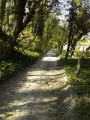
(7) At the crossroads with the statue of the Virgin, turn right towards the west onto a track that ends in a path and follow the edge of the woodland. Ignore the paths to the left or right and continue for approximately 1,800 metres.

(8) At the Y-junction, follow the path on the left heading south-west, which climbs uphill. At the top of the path, at the junction, turn right and enter Diéval.

(9) At the small cross on a stele, turn right onto the narrow lane that descends to the D 941; cross it at the pedestrian crossing and follow it to the left. Turn onto the first road on the right; at the next junction, follow Rue Brunemont straight on towards the west.

(10) About 300 m from the junction, after a left-hand bend, take the small lane next to the house heading north. When you reach the D 89 opposite the Sainte-Thérèse hall, turn right and follow the road back to the starting point (S/E).

Waypoints

  1. S/E : mi 0 - alt. 436 ft - Place de Diéval, opposite the village hall
  2. 1 : mi 0.58 - alt. 522 ft - Calvaire
  3. 2 : mi 1.96 - alt. 505 ft - T-junction
  4. 3 : mi 2.73 - alt. 367 ft - D86E2 and a blank space in the wall of the house
  5. 4 : mi 3.03 - alt. 266 ft - Path on the right
  6. 5 : mi 3.21 - alt. 328 ft - Church
  7. 6 : mi 3.49 - alt. 279 ft - Calvary and Oratory – Towards the bridge at the - Biette (rivière) à finaliser
  8. 7 : mi 4.21 - alt. 358 ft - Vierge
  9. 8 : mi 5.3 - alt. 364 ft - Y-junction
  10. 9 : mi 6.17 - alt. 476 ft - Small concrete cross on a stele
  11. 10 : mi 6.62 - alt. 443 ft - Path on the right
  12. S/E : mi 7.02 - alt. 436 ft - Place de Diéval, opposite the village hall

Notes

This route requires you to wear walking boots and use walking poles.
Don’t forget your water bottle

Reviews and comments

4.6 / 5
Based on 3 reviews

Reliability of the description
4.7 / 5
Ease of following the route
4.3 / 5
Route interest
4.7 / 5
dsenechal
dsenechal

Overall rating : 4 / 5

Date of your route : May 31, 2024
Reliability of the description : ★★★★☆ Good
Ease of following the route : ★★★☆☆ Average
Route interest : ★★★★★ Very good
Very busy route : No

A lovely route, but be careful: there are deep ruts filled with water or mud near point 8. The viewing point at point 10 is not maintained and is somewhat obstructed by vegetation.

Machine-translated

JUDAS Sylvaine
JUDAS Sylvaine

Overall rating : 5 / 5

Date of your route : Apr 17, 2021
Reliability of the description : ★★★★★ Very good
Ease of following the route : ★★★★★ Very good
Route interest : ★★★★★ Very good
Very busy route : No

We went out in fine weather, which allowed us to enjoy some lovely views and see the contrast between the mining country and the green valleys.
Thank you for these discoveries

We spotted some more hiking signposts on this latest walk. We’re going to tackle those as well

Machine-translated

axel703
axel703

Overall rating : 4.7 / 5

Date of your route : Oct 19, 2020
Reliability of the description : ★★★★★ Very good
Ease of following the route : ★★★★★ Very good
Route interest : ★★★★☆ Good
Very busy route : No

between points 7 and 8: muddy and slippery ground (chalk)

Machine-translated

Other walks in the area

For more walks, use our search engine .

The GPS track and description are the property of this route's author. Please do not copy them without permission.