Country:
 City:
City:


Parking is available along the D119 near Labroye Church.
(S/E) Set off along Rue de Tollent, which runs alongside the church and climbs to the right until you reach a fork.
(1) Head up Rue des Cavées on the left to reach the plateau and the Plaine de la Forêt at a crossroads.
(2) Follow the path on the left, heading due north, until you reach a Fork in the road.
(3) Leave this path, head down to the right towards the hamlet of Coquichart, where you walk up the street on the left and join the D134E3.
(4) Follow it to the left with caution and head towards Regnauville.
(5) Cross the busy D928 – a major north-south road (Saint-Omer – Abbeville) – with extreme caution and continue straight on.
(6) Cross the last street in the village (Rue Picard) and carry on along the small road, ignoring any side paths. When you reach a copse, head straight down the grassy path and join the small Route du Fond de Val.
(7) Follow it to the right and pass through the hamlet of the same name.
(8) At the last house in the hamlet, leave the road and continue along the path straight ahead leading into the woods. The path follows the edge of the Labroye Forest until it joins theGRP® Canche-Authie trail, which overlooks the valley.
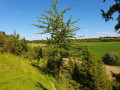
(9) Turn left and follow it to the end. Take in the view! Various information boards recount the history of the two villages in the valley, which once made their living from wicker. You’ll reach the D928.
(10) Cross the two lanes with care, then turn right onto the street leading to this departmental road. Follow it to the left and you’ll find the car park on your left, near Labroye Church (S/E).


 Visorando Member
 Easy
Easy 
 Difficult