Les Moulins de la Belle from Verrines

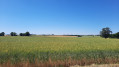
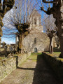
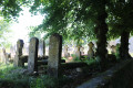
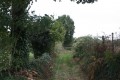
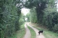
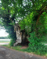
A pleasant walk around the River Belle, exploring unspoilt countryside and significant built heritage (the church and cemetery at Verrines, family cemeteries, old houses, etc.). The fairly undulating route offers beautiful scenery with varied colours depending on the crops and small woodlands.

Details

3175910
Creation:
Last update:
Last review:
  • Walking
    Activity: Walking
  • ↔
    Distance: 5.91 mi
  • ◔
    Average duration: 2h 50 
  • ▲
    Difficulty: Easy

  • ⚐
    Back to start: Yes
  • ↗
    Ascent: + 164 ft
  • ↘
    Descent: - 171 ft

  • ▲
    Highest point: 361 ft
  • ▼
    Lowest point: 240 ft

Photos

Description of the walk

Car park at Verrines Church (space next to Rue de la Cure, above the church and the cemetery).

(S/E) Take Rue de la Cure downhill. You’ll come out onto Route de Montigné (D 103) and follow it to the right. Cross the River Belle and head straight on towards the Montifaut district. On the uphill stretch, at a junction, turn right onto a path that runs alongside the River Belle on the hillside.

(1) At the Fork in the road, take the road on the right, pass through the hamlet of Follet and cross the River Belle. At the next junction, take a track on the left and climb up onto the plateau. Then follow the edge of the plateau, heading north.

(2) Above the hamlet of Parsay, take the grassy track on the left, which is almost flat. Continue along a dirt track. At the next Fork in the road, take the track on the right and return to the edge of the plateau.

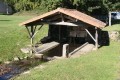
(3) Turn sharply left onto the Chemin du Moulin de la Vée (road) and head downhill. Cross the Belle stream and head straight back up into La Mouline. At the T-junction, turn left into Rue du Bourg, then turn left onto Rue de la Cueille, which leads downhill. At the bottom, first turn right then left to follow a narrow alleyway between two houses. You’ll come to a well-preserved washhouse and fountain (uncovered).

(4) Pass the washhouse, join Chemin de la Boucharde and follow it to the right. At the end, turn right. Take thefirst left, Rue de la Cerisaie. At the end, turn left onto the D 103.

(5) After just under a hundred metres, turn right towards Le Grand Puits de Bonneuil. Walk past the Grand Puits farm (on your right). Immediately turn left onto Rue du Lavoir. Take thefirst path on the right, just before a hedge. Note an old washhouse (now dry) and its pump on your right. At the end of the path, turn right onto Route des Trois Vallées.

(6) Cross the Route de Viré with care and continue straight ahead into Rue des Chaumes. Carry on straight ahead and, at the end, turn left onto the track known as Chemin de la Cormière. Pass a Protestant family cemetery on your right. At the end, turn right and then immediately left onto a track. Head south-west across the fields and ignore a turning on the right.

(7) You’ll emerge onto a small road; turn left onto a track. Go round a small copse on the left and reach a crossroads. Cross the road carefully and first turn left then right to follow the road heading eastwards with care.

(8) At the junction, turn right onto a track. At the end, turn sharply left onto a small road. Pass the hamlet of La Garenne and reach the hamlet of La Dreurie.

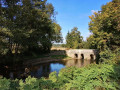
(9) Then turn right onto a downhill street. Cross a branch of the River Belle via a small bridge, walk through a very shaded area along the riverbank, then cross the second branch of the river via an old stone bridge. Follow the cul-de-sac which joins the Route de Montigné (D 103).

(10) Cross the road with care (poor visibility), continue straight ahead and immediately turn right onto Rue du Prieuré. Walk past the cemetery on your left and pass by the foot of the church. At the rear of the church, take the steps and return to the car park (S/E).

Waypoints

  1. S/E : mi 0 - alt. 282 ft - Église Saint-Maixent (Verrines-sous-Celles)
  2. 1 : mi 0.62 - alt. 272 ft - Follet - Belle (rivière) - Affluent de la Boutonne
  3. 2 : mi 1.14 - alt. 322 ft - Fork in the road
  4. 3 : mi 1.86 - alt. 325 ft - Junction
  5. 4 : mi 2.34 - alt. 285 ft - La Mouline wash house and fountain
  6. 5 : mi 2.57 - alt. 348 ft - Starting from La Mouline
  7. 6 : mi 3.21 - alt. 328 ft - Bonneuil
  8. 7 : mi 4.04 - alt. 338 ft - Road–path junctions
  9. 8 : mi 5.04 - alt. 308 ft - Crossroads
  10. 9 : mi 5.63 - alt. 276 ft - La Dreurie
  11. 10 : mi 5.8 - alt. 253 ft - Crossroads - Cimetière de Verrines sous Celles (Celles sur Belle)
  12. S/E : mi 5.91 - alt. 282 ft - Église Saint-Maixent (Verrines-sous-Celles)

Notes

The car park is located at Verrines Church (the square next to Rue de la Cure, above the church and the cemetery)

This walk, which covers varied terrain, requires sturdy footwear.

This route is signposted as it follows the ‘Les Moulins de la Belle’ route published by the Deux-Sèvres Departmental Hiking Committee. It is marked in yellow. Nevertheless, it is advisable to follow the directions in this description and on the map, whilst also paying attention to the surrounding landscape. Distance markers from the starting point, or even the GPS coordinates of waypoints (including the start), can also help walkers find their way.

Hike completed by the author on 8 June 2020

Worth a visit

Verrines sous Celles
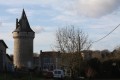
The Church of Saint Maixent / Benedictine Priory of Saint-Maixent
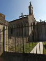
A deed dating from 1078 mentions that a church and some land were donated to the monks of Saint-Maixent Abbey. The origins of the building are unknown. A fire in 1569 is said to have devastated the transept, the apse and the north apsidal chamber; a report from the same year notes that the church was fully vaulted but poorly roofed. In 1666, an inventory of the premises shows that the roof structure and roofing had been rebuilt. In 1728, urgent restoration work was noted in an inspection report. A contract was drawn up in 1734 between Pierre Bellat, architect, and the master roofer Elie Miot, along with the master carpenters Raboteau and Antoine Gaillard. In 1768 and 1785, two inspection reports were drawn up concerning the priory house and its outbuildings. Having become a commendatory church, it was sold as national property during the Revolution. In 1797, it was acquired by Jean Beauchamp. It was listed as a historic monument in 1840. The 1842 plan by the Niort-based architect Segretain shows that the nave had been demolished, except for the bay near the transept. The church was purchased by Charles Pontonnier de la Girardière, who, in 1846, donated it to the parish council of the church at Verrines. In 1998, the Diocesan Association of Poitiers sold the church to the municipality of Verrines. All that remains of the priory quarters is an entrance passageway, which appears to date from the 16th century, and some 19th-century buildings.
Description
Apart from the roughcast rubble-stone façade, all other elevations are built of medium-sized ashlar. The church features a semi-circular chevet, a transept flanked by two apsidioles, a square bell tower above the transept crossing, flanked to the south by a circular stair turret, and a single bay of the original nave. The apse has a cul-de-four vault; the central bay of the chancel and the transept arms are vaulted with broken barrel vaults; the crossing is covered by a dome with squinches. Apart from the bell tower, which has a slate roof, the other roofs are made of flat stone. The interior decoration is found on the capitals: seventeen capitals feature plant motifs, five depict quadrupeds, birds or mythical creatures, two bear religious symbols and four feature historical scenes. To the south of the church lies the entrance to the former dwelling, covered by a high slate roof.
Source: The canton of Celles-sur-Belle: 1,620 heritage features studied

The cemetery
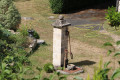
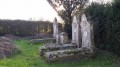
The cemetery is situated in the centre of the village, to the north of the church. It is enclosed by a rubble stone wall. It is accessed from the west via a small path lined with yew trees. It slopes gently from east to west. The tomb of Pierre Daniau, custodian of the church at Verrines during the Revolution, is obelisk-shaped and of exceptional design. The tomb of the parish priest François-Casimir Queuille serves as the cemetery cross. The majority of the tombs date from the second half of the 19th century and the first half of the 20th century. The last burials took place around 1960. The tombs are arranged in rows, more or less in order. A few are broken or have collapsed. There are all types of gabled tombs (flattened, semi-circular, flat) and gravestones of a wide variety of shapes. Many gravestones feature engraved or carved decorations (a heart, a cross, a fleur-de-lis, the hands of a married couple, a bouquet). There are numerous tombs arranged in pairs (couples) or in groups of three or more (families).
Source: The canton of Celles-sur-Belle: the 1,620 heritage features studied

The Marais Fountain
The washhouse is situated on the edge of the country lane separating Le Chatry from the village of Croué, on a spring that feeds the River Belle. A few steps lead down to the basin, the edges of which are made of limestone slabs; the metal drain plug, used to empty the basin, is still in place. The washhouse has been restored.
Source: ‘The Washhouses of Deux-Sèvres’, published by the Deux-Sèvres General Council

Reviews and comments

4.7 / 5
Based on 2 reviews

Reliability of the description
4.5 / 5
Ease of following the route
5 / 5
Route interest
4.5 / 5
randonneurs.DS
randonneurs.DS

Overall rating : 4.3 / 5

Date of your route : May 29, 2022
Reliability of the description : ★★★★☆ Good
Ease of following the route : ★★★★★ Very good
Route interest : ★★★★☆ Good
Very busy route : No

A rather pleasant walk.
A mix of small roads and various paths, passing through small hamlets and localities.
Some shaded sections and some sunny ones (which were already getting quite hot , even though it was the end of May and not particularly warm).
Machine-translated

Sneg
Sneg

Overall rating : 5 / 5

Date of your route : Mar 14, 2021
Reliability of the description : ★★★★★ Very good
Ease of following the route : ★★★★★ Very good
Route interest : ★★★★★ Very good
Very busy route : No

Thank you for this lovely walk around La Belle.

Machine-translated

Other walks in the area

For more walks, use our search engine .

The GPS track and description are the property of this route's author. Please do not copy them without permission.