Country:
 City:
City:



(S/E) Stand facing the farm track (towards the east) and take the road on the right which heads south-east. The high-voltage power line is on your right at the start of the route.
Further on, pass a widened farm track on your left which leads to the Périgné wind farm.
At the junction with the D 101, cross over and continue straight ahead (the junction is widened on the south-western side due to a nearby wind turbine).
(1) Turn right onto the first narrow, very quiet road. Pass under the high-voltage power line and emerge onto the Route de Mairé (which is slightly busier). Cross straight ahead and take the Chemin des Frênes. At the end of the Chemin des Frênes, turn right onto Rue de Riplet.
(2) Pass Chemin des Fermendiers on your left, which leads to the Château de la Grézolle (1810). A little further on, you’ll see a plaque on the wall on the right commemorating the Resistance fighter Jean Pineau.
Carry on along Rue de Riplet, which winds its way and eventually joins the busy D740.
(3) Cross the D740 (there is a pedestrian crossing) and carry on, almost directly opposite, along the Chemin de Théré. At the next junction, turn right onto the Chemin des Minaies. Then ignore the streets on both the right and the left. At the Y-junction, take the farm track on the right, which continues from the tarmac road you have been following and eventually leads to a junction of three tarmac roads at right angles: take Chemin de la Prairie straight ahead.
After 70 metres, take Allée de la Source on the right. At the end, turn left into Rue du Chamoureau, then right into Allée de la Cure. Turn left onto a gravel path heading towards the tennis court, which is surrounded by high fences. Just before the tennis court, you’ll need to go down a few stone steps.
Walk along the right-hand side of the tennis court and continue straight on under the shaded avenue until you reach Saint-Martin’s Church.
(4) When you reach the foot of the church, turn left to walk round it, passing in front of its forecourt.
Join the Route de Secondigné and head back up towards the D740, turning slightly right uphill.
At the junction with the D740, turn left towards Niort (use the pavement as this road is very busy, including with many heavy goods vehicles). Continue for about 100 metres.
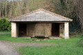
(5) Opposite the Fontaine wash house, turn left onto Chemin des Roquettes between two houses and carry on straight ahead.
Ignore a farm track on the left that branches off at a right angle. Pass the farm track on the right – near a small pond – which leads to the sewage treatment works. The farm track continues in a straight line and, a little further on, joins the River Belle, which it follows from there.
This is the locality known as “La Prairie”: it was here, on the night of 16–17 November 1943, that a Lysander, arriving from London, landed to evacuate two Resistance fighters. The waterlogged ground prevented it from taking off (see the ‘During the Walk’ section: ‘A “pick-up” in Périgné’).
When the path veers away from the Belle, it straightens out again and reaches a ‘T’-junction of forest tracks. Turn right.
The farm track turns right and runs alongside the Belle again, heading north, before reaching a ford fairly quickly.
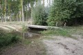
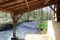
(6) Cross the Belle at the ford known as the Confolens ford. The ford is fitted with concrete telephone poles, making it easy to cross in all seasons.
Continue along the farm track, which takes a right-angled bend and then continues to the D119.
Just before the D119 (which is quite busy), there is a path on the left through the undergrowth, created by a farmer, which avoids having to walk along the narrow, winding road, even though this path is in poor condition.
At the end of this short track, cross the D119 and enter the Étang Prérault area. Go round the first building on the left, keeping the pond on your left.
(7) Turn right onto the farm track which leads away from the Étang Prérault, then bends first to the left and then to the right. At the junction, continue to the right until you reach a gentle bend to the left where four paths form a double ‘Y’: continue to the left, passing the two paths on the right in turn.
As you approach the first houses in Prérault, pass a farm track on your left (running almost parallel to the D740, with a ‘no entry’ sign at the start, except for agricultural use). The track then becomes the Chemin des Bergères, a tarmac road.
(8) Cross the D740. Continue straight ahead and immediately take the farm track known as Chemin de la Prêle, which branches off to the left and overlooks La Belle.
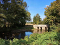
(9) Where the farm track joins the Route de Bessac, turn right towards the hamlet. On reaching Bessac, turn left straight away onto the Route de la Taupinière, which, shortly afterwards, crosses the Belle via the Vau bridge. Continue along this road.
(10) Turn right onto the Route des Roches and, at the next junction, turn left onto the Chemin du Bois à Martin.
The Chemin du Bois à Martin (tarmac) leads to the D103 road, which you cross straight ahead before turning left onto a narrow, tarmac but grass-covered track (for those who have chosen to set off from Périgné, you must turn right just before joining the farm track).
A few hundred metres further on, a road coming from the Périgné water tower joins on the right. Cross it. Continue to the triangular junction (S/E).

 Visorando Member
 Easy
Easy