


Refine your search for walks in Lac de la Moutière
Lac de la Moutière walks


 Lake La Moutière
 Visorando Member
 4.94 mi
 +1,365 ft
 -1,352 ft
 3h 30
3h 30
 Moderate
 Departure from Saint-Martin-de-Belleville (Savoie)
Walk up to the Moutière restaurant from the Moutière chairlift station. View of the Moutière reservoir.
The Lakes of Val Thorens
 9.32 mi
+2,503 ft
-2,500 ft
6h 30
9.32 mi
+2,503 ft
-2,500 ft
6h 30
 Difficult
Departure from Saint-Martin-de-Belleville (Savoie)
Difficult
Departure from Saint-Martin-de-Belleville (Savoie)
Discover the main lakes of Val Thorens in detail. On this route, you’ll pass by Lac du Thorens and Lac de la Moutière, whilst also walking alongside Lac de la Portette, before finishing at the unmissable Lac Blanc. The route offers stunning views of Val Thorens throughout.
Walks near Lac de la Moutière
 From Les Menuires to the Roc 1 cable car
5.51 mi
+1,673 ft
-272 ft
3 hrs
Moderate
Departure from Saint-Martin-de-Belleville (Savoie)
This route takes the Sentier des Girauds and then the Sentier des Teppes, before retracing its steps and ending with the Sentier des Girauds, which leads to the Roc 1 cable car arrival point. As the ski touring trail is not marked before the Christmas holidays and is impossible to find, it is still possible to take the footpath, which offers a beautiful, easily accessible hike, perfect for an introduction to ski touring.
Along the ridges between Les Menuires and Le Molard
 3.64 mi
+279 ft
-531 ft
2h 00
3.64 mi
+279 ft
-531 ft
2h 00
 Easy
Departure from Saint-Martin-de-Belleville (Savoie)
Easy
Departure from Saint-Martin-de-Belleville (Savoie)
The walk climbs gently before descending towards Le Molard and the Saint-Martin 1 cable car. Throughout the route, you’ll be treated to sweeping views of the mountains and the Belleville valley. The alpine pastures offer magnificent scenery. Best done in summer whilst the ski lifts are operating.
Peclet-Polset Refuge - Merlets Lakes Refuge
 9.26 mi
+3,114 ft
-3,314 ft
7h 00
Difficult
Departure from Pralognan-la-Vanoise (Savoie)
9.26 mi
+3,114 ft
-3,314 ft
7h 00
Difficult
Departure from Pralognan-la-Vanoise (Savoie)
This second stage links the Peclet Polset Refuge to the Lacs Merlets Refuge via the Col du Soufre. You walk alongside the great Gebroulaz Glacier before reaching the Refuge du Saut. Next comes the ascent of the Col de Chanrouge and the arrival at the Lacs Merlets.
This stage takes you off the usual route through the Vanoise National Park. The landscapes are very wild. You’ll find plenty of edelweiss here.
From the Refuge du Saut to the Chalet du Clou
 10.51 mi
+3,517 ft
-3,458 ft
7h 55
Difficult
Departure from Les Allues (Savoie)
10.51 mi
+3,517 ft
-3,458 ft
7h 55
Difficult
Departure from Les Allues (Savoie)
Third day of a 4-day route in the Vanoise Massif.
A beautiful ascent along the Gébroulaz Glacier and a lunar landscape via the Col du Soufre
From the Refuge du Saut to the Refuge de l'Orgère via the Col du Soufre
 10.24 mi
+3,576 ft
-4,196 ft
7h 50
Difficult
Departure from Les Allues (Savoie)
10.24 mi
+3,576 ft
-4,196 ft
7h 50
Difficult
Departure from Les Allues (Savoie)
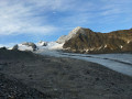
From the Refuge du Saut to the Refuge Porte de l'Orgère, the route passes close to the Gébroulaz Glacier via the Col du Soufre (2,817 m) before descending towards Lac Blanc and, via theGR®55, the Col de Chavière (2,796 m) and the Tête Noire rocks.
From Tougnète to Les Ménuires via the ski lifts
 3.18 mi
+299 ft
-614 ft
1h 45
Easy
Departure from Saint-Martin-de-Belleville (Savoie)
3.18 mi
+299 ft
-614 ft
1h 45
Easy
Departure from Saint-Martin-de-Belleville (Savoie)
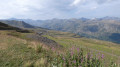
Spectacular panoramic views from the summit of Tougnète, at an altitude of 2,437 m. Magnificent panoramic views from vantage points along the entire route. Arrival at the top of the Roc 1 cable car, at 2,260 m.
This hike should be undertaken during the summer when the ski lifts are operating for hikers.
Descent from Tougnète to Le Molard in summer using the ski lifts
 3.03 mi
+0 ft
-1,985 ft
1h 25
Easy
Departure from Saint-Martin-de-Belleville (Savoie)
3.03 mi
+0 ft
-1,985 ft
1h 25
Easy
Departure from Saint-Martin-de-Belleville (Savoie)
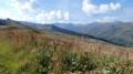
Tougnète is an easy peak to reach in summer via the ski lifts and allows you to admire magnificent panoramic views with ease. The superb meadows come into view on the descent. There are no difficulties; just take the time to admire the scenery.
Lac de Bissorte - Refuge du Mont Thabor
 7.77 mi
+3,819 ft
-1,014 ft
6h 55
Difficult
Departure from Orelle (Savoie)
7.77 mi
+3,819 ft
-1,014 ft
6h 55
Difficult
Departure from Orelle (Savoie)
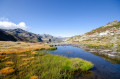
First beautiful stage of a challenging three-day tour of Mont Thabor. A beautiful stage with an elevation gain of almost 1,200 metres. Climb to the Bissorte dam, cross the Vallon des Marches, with a possible break at the refuge. Then climb to the beautiful Lac des Bataillères and the pass of the same name, with a superb view of the Lacs Sainte Marguerite and the Vallon de la Grande Montagne. Breathtaking view of the Cheval Blanc.
Porte de l’Ogère Mountain Hut – Plan d’Amont
 6.27 mi
+3,412 ft
-2,913 ft
5h 50
Difficult
Departure from Villarodin-Bourget (Savoie)
6.27 mi
+3,412 ft
-2,913 ft
5h 50
Difficult
Departure from Villarodin-Bourget (Savoie)
Walk in the Maurienne region from the Porte de l’Ogère mountain hut to Plan d’Amont via the Col de la Masse
From the Orgère Mountain Hut to the Granges in the Vallée Étroite
 16.10 mi
+4,564 ft
-5,131 ft
11h 25
Difficult
Departure from Villarodin-Bourget (Savoie)
16.10 mi
+4,564 ft
-5,131 ft
11h 25
Difficult
Departure from Villarodin-Bourget (Savoie)
This eleventh stage crosses the Mont Cenis massif and, in part, the Cerces massif. From the Refuge de l’Orgère, the GR®5 descends to Loutraz, crossing the River Arc via the bridge to the east of Modane. The route goes round the town hall, passes the church, follows the railway line eastwards, then westwards, and climbs the slope beneath the Fréjus Tunnel to pass under the motorway. It continues its ascent towards Notre-Dame du Charmaix. After the Valfréjus resort, it enters the Ruisseau du Charmaix valley and reaches the hamlet of Les Herbiers. Below the old Small Pass, it crosses the stream and, following the road, reaches the Lavoir Reservoir before tackling the steep climb towards La Losa, then, via the Combe de la Grande Montagne, reaches the Col de la Vallée Étroite. After a detour to the east, the descent heads due south, towards the Plaine Tavernette, then the valley of the same name. Finally, the GR®5 follows the Ruisseau de la Vallée Étroite to the Granges de la Vallée Étroite.