The Peïrefique Lakes

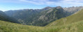
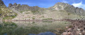
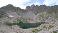
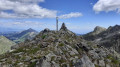
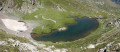
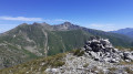
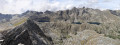
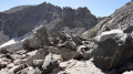
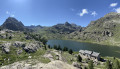
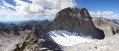
Nestled in a rugged cirque at the foot of the Roche de l’Abysse and the Pointe de Peïrefique, these two small lakes will enchant you.
Moderator update as at 24/09/2020: Please note! The access road to the starting point is now closed to all vehicles except 4x4s.

Details

3505202
Creation:
Last update:
Last review:
  • Walking
    Activity: Walking
  • ↔
    Distance: 5.37 mi
  • ◔
    Average duration: 3h 55 
  • ▲
    Difficulty: Moderate

  • ⚐
    Back to start: Yes
  • ↗
    Ascent: + 1,624 ft
  • ↘
    Descent: - 1,601 ft

  • ▲
    Highest point: 7,766 ft
  • ▼
    Lowest point: 6,683 ft

Photos

Description of the walk

From Saint-Dalmas de Tende, take the D91 towards Castérino. In the village, carry on to the upper car park, then follow the track to the Baisse de Peïrefique (low-clearance vehicles not recommended).

(S/E) A few metres from the car park, head back to marker 371, the starting point of the route. Follow the small path climbing to the left of the track (signposted ‘Lac de Peïrefique / Roche de l’Abysse’). Continue to a small pass at marker 372.

(1) Turn right heading north-east and head for marker 377, which is already visible (signpost: Roche de l’Abysse).

(2) From marker 377, turn left onto a path through the woodland which, after a few hairpin bends, leads to marker 378.

(3) Continue to the right, descending to marker 379, the junction between the Lacs de Peïrefique and the Roche de l’Abysse.

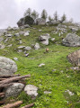
(4) Leave the Roche de l’Abysse path on your right, head westwards, and enter a small valley that is rocky at the start and covered in rhododendrons. Begin a bend northwards and continue the ascent through a mass of scree to reach the first lake.

(5) Make your way through large scree to find the outlet of the upper lake (there isn’t really a path). Follow the upper lake as far as possible.

(6) Enjoy a peaceful break by the lake. Return to the lower lake along its right-hand bank.

(5) Return via the same route taken on the way out to (S/E).

Waypoints

  1. S/E : mi 0 - alt. 6,690 ft - Baisse de Peïrefique – Marker 371
  2. 1 : mi 0.55 - alt. 6,798 ft - Marker 372
  3. 2 : mi 0.62 - alt. 6,762 ft - Marker 377
  4. 3 : mi 1.31 - alt. 7,280 ft - Marker 378
  5. 4 : mi 1.76 - alt. 6,988 ft - Marker 379
  6. 5 : mi 2.29 - alt. 7,648 ft - Lower Lake Peïrefique
  7. 6 : mi 2.68 - alt. 7,740 ft - Upper Lake Peïrefique
  8. S/E : mi 5.37 - alt. 6,686 ft - Baisse de Peïrefique – Marker 371

Notes

- Mountain kit, particularly good footwear.
- No water available along the entire route.

This route passes through a protected area, which may be subject to special regulations:

Worth a visit

- Castérino.
- Descent from Peïrefique.
- Peïrefique Lakes.
- Col du Sabion.
- Roche de l’Abysse.
- Tende Pass and its many forts.
- Giaure Fort.

Reviews and comments

5 / 5
Based on 2 reviews

Reliability of the description
5 / 5
Ease of following the route
5 / 5
Route interest
5 / 5
jl1309m
jl1309m

Overall rating : 5 / 5

Date of your route : Jul 26, 2023
Reliability of the description : ★★★★★ Very good
Ease of following the route : ★★★★★ Very good
Route interest : ★★★★★ Very good
Very busy route : No

A superb route along good paths, except for the final stretch leading to the lakes (boulders). You absolutely must head to the upper lake, going round to the right to climb up to a high point (marked by a large, clearly visible cairn) from which you can see both lakes. Then descend via the scree slope down to the lake. From the upper lake, you can easily make your way down via the spillway to reach the lower lake.
From marker 370 at the PEYREFIQUE pass, I recommend heading up towards the bunker to the summit of the GRATIN (Edelweiss) and walking straight on to marker 372 – it’s just grassy terrain with lovely views. Please note for those wishing to start the hike from the Baisse de PEYREFIQUE: the track is reserved for 4x4s.

Machine-translated

grandin
grandin ★

cloc83, thanks for the info

Machine-translated

cloc83
cloc83

Please note that the access road to the starting point is now closed to all vehicles except 4x4s (B0 sign in place on 6 September 2020)

Machine-translated

daval sandy
daval sandy

Overall rating : 5 / 5

Date of your route : Jul 25, 2020
Reliability of the description : ★★★★★ Very good
Ease of following the route : ★★★★★ Very good
Route interest : ★★★★★ Very good
Very busy route : Yes

🏞

Machine-translated

Other walks in the area

For more walks, use our search engine .

The GPS track and description are the property of this route's author. Please do not copy them without permission.