


 Country:

 City:
City:


To reach the start of the walk, take the D6204 and, at Saint-Dalmas-de-Tende, follow signs for Lac des Mesches and Casterino via the D91. Drive through the hamlet of Casterino and take the narrow road for about 25 minutes to reach the small car park at marker 371; take care if you’re driving a vehicle with a low chassis.
Yellow markings along the entire trail.
(S/E) The trail starts on the left at the wayside shrine dedicated to Saint Rita. Walk for about 15 minutes through a small wood to reach marker 372. This is the only shaded section of the route.
(1) This marker indicates a fork in the path: to the right, the path leads towards the Peyrefique Lakes. Straight ahead, our path continues towards the Col du Sabion. The path runs along the mountainside on a gentle, steady slope until it reaches a small stream that crosses the path.
(2) At this point, the path is narrow and slippery; take care, but it’s not particularly difficult. Continue along this path, which climbs and descends gently, to reach marker 373 (approximately 1 hour 15 minutes between the two markers).
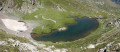
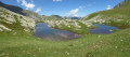
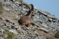
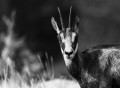
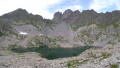
(3) This area is a wetland with several small lakes, the water in which gradually disappears as the season progresses. The path from the marker is lined with stones as far as a large blockhouse which serves as a refuge for chamois and ibex.
(4) You pass the blockhouse and climb towards the pass, reaching it in 30 minutes from marker 373.
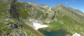
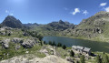
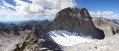
(5) From the pass, which marks the border with Italy, you can see Lac de la Vache, which can be reached in 5 minutes via a fairly steep path; the return climb will take a little longer.
The return journey follows the same route.
(4) At the large blockhouse, you can leave the path to visit the small lakes. You then continue on to the car park at marker 371 (S/E).

 Visorando Member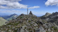

 Difficult
 Very difficult
