Mont Sainte-Marie

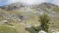
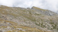
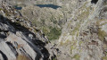
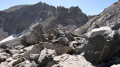
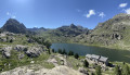
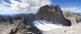
Mont Sainte-Marie overlooks the three large lakes of the Valmasque valley: Lac du Basto, Lac Noir and Lac Vert.
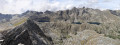
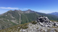
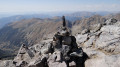
From the summit, to the north, the view stretches from the Grand Capelet to the peak of Chanineye. To the west, the view is just as spectacular: from Mont Bégo to the Grand Capelet, including the Baisses de Fontanalbe and Valmasque.

Details

1465640
Creation:
Last update:
Last review:
  • Walking
    Activity: Walking
  • ↔
    Distance: 11.32 mi
  • ◔
    Average duration: 8h 15 
  • ▲
    Difficulty: Difficult

  • ⚐
    Back to start: Yes
  • ↗
    Ascent: + 3,504 ft
  • ↘
    Descent: - 3,474 ft

  • ▲
    Highest point: 8,940 ft
  • ▼
    Lowest point: 5,568 ft

Photos

Description of the walk

From Saint-Dalmas de Tende (06), take the D91 road towards Castérino. In the village, carry on to the upper car park.

(S/E) From the car park, head for marker 395 and enter the Mercantour National Park. Begin a gentle climb along the yellow-marked path to reach the first junction near a wayside shrine.

(1) Continue to the right on thePR®® trail, passing marker 392 which points to the right towards Lac des Grenouilles.

(2) Carry on straight ahead along the track to a junction near marker 390.

(3) Just before marker 390, take the path towards the Refuge de Fontanalba. Continue along the track to the refuge.

(4) Immediately after the refuge, turn right onto the path that cuts across a bend in the track. Return to the track until you reach marker 387.

(5) Cross the small bridge on the right and you’ll reach marker 388 very quickly. From this point, you enter the restricted area containing the rock carvings of Les Merveilles and Fontanalba.
From marker 388, continue towards the Lacs Jumeaux, leaving the Lac Vert path on your left. Pass in front of the Gias des Pasteurs (a small sheepfold) and reach the start of the Voie Sacrée.

(6) Climb the steps of the ‘Voie Sacrée’. As you go, admire the rock carvings. Pass the path leading down to the Lacs Jumeaux and follow the start of a track that climbs north-west.
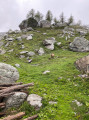
On the grassy slope, reach a small flat area, then take a narrow gully on the right (the bed of the stream flowing down to the Lacs Jumeaux).
Climb up the gully through scree, grass and rocks, which leads to the ridge (with occasional traces of a path). Continue until you reach the foot of the ridge.
Caution: Do not climb right up to the very edge of the ridge.

(7) Veer left just before the ridge. Follow a path below the ridge at times, through the rocks, until you reach a point where the summit is finally clearly visible.

(8) Climb the grassy slope towards the summit of Mont Sainte-Marie.

(9) Follow the ridge along the rocks of Sainte-Marie to a large fault.

(10) Descend below the ridge to join a good path a little further down. Pass at the foot of the Cime de Bicknell. Continue to marker 397, which is the Baisse de Fontanalbe marker.

(11) Head down the path on the right. This is the Baisse de Valmasque path leading to the Valmasque Refuge as far as marker 96.

(12) Carry on to the right towards the Valmasque Refuge, skirting the Lacs du Basto and Lac Noir.

(13) Then pass Lac Vert to reach marker 97.

(14) Turn right (leaving the path leading to the refuge on your left). Descend to reach marker 98.
Descend the entire valley to marker 374, the standard route to Castérino.

(15) Continue along the track to reach marker 393. Follow the right bank of the Ruisseau de Valmasque. Leave the stream when it joins the track and keep parallel to it to reach marker 394 at the gate marking the park entrance. A few more metres to reach the car park (S/E).

Waypoints

  1. S/E : mi 0 - alt. 5,607 ft - Upper Castérino car park
  2. 1 : mi 0.89 - alt. 6,043 ft - Oratory
  3. 2 : mi 1.58 - alt. 6,417 ft - Lac des Grenouilles signpost
  4. 3 : mi 2.25 - alt. 6,348 ft - Head towards the Fontanalbe Refuge (near marker 390)
  5. 4 : mi 2.61 - alt. 6,598 ft - Take the path on the right which cuts across a bend - Refuge de Fontanalba
  6. 5 : mi 3.06 - alt. 6,959 ft - Marker 387 (small bridge). Pass the - Lav Vert de Fontanalbe
  7. 6 : mi 3.71 - alt. 7,283 ft - Start of the Voie Sacrée
  8. 7 : mi 4.31 - alt. 8,301 ft - Rocky ridge near Mont Sainte-Marie
  9. 8 : mi 4.46 - alt. 8,573 ft - Rocks near Mont Sainte-Marie
  10. 9 : mi 4.73 - alt. 8,940 ft - Summit of the - Mont Sainte-Marie (2739m)
  11. 10 : mi 5.3 - alt. 8,675 ft - Descend below the ridge
  12. 11 : mi 5.9 - alt. 8,432 ft - Marker 397 (Baisse de Fontanalbe)
  13. 12 : mi 6.25 - alt. 7,776 ft - Marker 96 - Le lac du Basto
  14. 13 : mi 7.41 - alt. 7,503 ft - Lac Noir (Mercantour)
  15. 14 : mi 7.96 - alt. 7,461 ft - Marker 97 - Lac+Vert (Mercantour)
  16. 15 : mi 9.18 - alt. 6,424 ft - Marker 374
  17. S/E : mi 11.32 - alt. 5,610 ft - Upper Castérino car park

Notes

Please note:
Between (6) and (7), the path is quite exposed.
Between (3) and (10), there is a restricted area containing rock carvings. Please comply with the regulations. When walking towards Mont Sainte-Marie, please comply with Article 6 of the Order of 3 June 2013, point 7. See the Order. The use of walking sticks with metal tips is prohibited in this area.
During the summer months, a park warden will remind you of this.
There are no water sources along the route.
.

This route passes through a protected area, which may be subject to special regulations:

Worth a visit

  • Rock carvings at Fontanalbe near the Lacs Jumeaux and the Voie Sacrée.*

Always be cautious and plan ahead when you're outdoors. Visorando and the author of this route cannot be held responsible for any accidents occurring on this route.

The GR® and PR® markings are the intellectual property of the Fédération Française de Randonnée Pédestre.

Reviews and comments

4.3 / 5
Based on 1 review

Reliability of the description
4 / 5
Ease of following the route
4 / 5
Route interest
5 / 5
jl1309m
jl1309m

Overall rating : 4.3 / 5

Date of your route : Jul 28, 2023
Reliability of the description : ★★★★☆ Good
Ease of following the route : ★★★★☆ Good
Route interest : ★★★★★ Very good
Very busy route : No

We climbed directly from the Twin Lakes to the 2530-metre point.
There are very few cairns, but the section along the couloir is good, though very steep. After that, it’s grassy. The view from the summit is remarkable. However, the descent down this couloir is difficult. From the summit, we followed the ridge to the FONTANALBE pass – superb views and a pleasant, well-marked path. Please note that the descent from the 2,657-metre point on the ridge towards the Twin Lakes is prohibited by the site wardens due to the rock carvings found on the Sacred Path.
The return journey from the FONTANALBE pass to the FONTANALBE refuge is splendid but takes longer.

Machine-translated

Other walks in the area

For more walks, use our search engine .

The GPS track and description are the property of this route's author. Please do not copy them without permission.