Les Hauts-Forts from Morzine

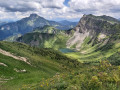
This route is the longest but the least exposed way to reach the highest point of the French Chablais (2,466 m).

Please note that the sections along the ridges and the pass at the Col de l’Encarnette may not be suitable for those prone to vertigo.

Details

3631989
Creation:
Last update:
Last review:
  • Walking
    Activity: Walking
  • ↔
    Distance: 5.86 mi
  • ◔
    Duration according to the author: 5 hrs 
  • ▲
    Difficulty: Very difficult

  • ⚐
    Back to start: Yes
  • ↗
    Ascent: + 4,541 ft
  • ↘
    Descent: - 4,521 ft

  • ▲
    Highest point: 8,028 ft
  • ▼
    Lowest point: 3,619 ft
  • ⚐ Country: France
  • ⚐
    Areas: Alps, Chablais
  • ⚐ City: Morzine (74110)
  • ⚑
    Start/End: N 46.159614° / E 6.728805°
  • ❏
    IGN map(s): Ref. 3528ET, 3528ETR, 3530ET, 3530ETR
  • Hour-by-hour weather

Photos

Description of the walk

In Morzine, take the Route de la Manche (following the Dranse). At a place called ‘Le Crêt’, take the small road on the left that goes uphill and follow it for 250 m. Park after the bridge, in the small car park on the right.

(S/E) Head north-east towards Les Hauts Forts and you’ll soon reach the forest. Follow a series of long, steep switchbacks through the forest. The path is fairly well-marked and even; follow the yellow dots and arrows. Pass close to a small waterfall and continue along the main path. This will take you to the Bramaturtaz chalet.

(1) Continue climbing. Cross a stream: be careful – the stones are arranged like steps but they are slippery and shift slightly.

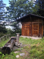
(2) Leave the forest and you’ll reach a chalet with a fountain (note that this may have run dry by late summer). Continue climbing up through the mountain pasture along a less steep path. You’ll then reach the Chalets du Plan de Zore.

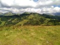
(3) Carry on straight ahead towards Les Hauts-Forts, leaving the chalets on your right. The path is easy at first. The slope becomes steeper and the first hairpin bends appear. Climb up to the Col du Pic à Talon.

(4) Turn right and follow the ridge along a gentle path. You’ll reach the Col des Chalettes (snowfields possible depending on the season).

(5) Continue eastwards along the ridge to reach the Col de l’Encarnette.

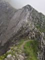
(6) Look out for a hump: once you’re on top of it, spot a small path on your left that leads downwards. Take this path: very soon, a cable appears to secure your descent for about ten metres. Cross a gap: the path across it is clear and well-defined; the danger lies in the drop-offs to the right and left. Once on the other side, another cable helps you climb up; continue along the ridge, which gradually widens. You will then reach the summit of the Hauts de Forts and its cross.

(7) The descent follows the same route as the ascent back to the car park (S/E).
Waypoints

  1. S/E : mi 0 - alt. 3,619 ft - Le Crêt. Near the - Dranse de Morzine (rivère)
  2. 1 : mi 0.61 - alt. 4,980 ft - Chalet de Bramaturtaz
  3. 2 : mi 0.79 - alt. 5,285 ft - Exit from the forest
  4. 3 : mi 1.11 - alt. 5,843 ft - Chalets du Plan de Zore
  5. 4 : mi 1.69 - alt. 6,696 ft - Col du Pic à Talon
  6. 5 : mi 2.21 - alt. 7,264 ft - Col des Chalettes (2215m)
  7. 6 : mi 2.53 - alt. 7,667 ft - Col de l'Encarnette (2359m)
  8. 7 : mi 2.93 - alt. 8,018 ft - Les Hauts Forts
  9. S/E : mi 5.86 - alt. 3,619 ft - Le Crêt

Notes

Water point at the chalet with a fountain (2).
Hiking poles are highly recommended for the descent.
No special equipment is required to cross the pass.

Worth a visit

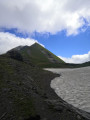
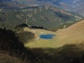
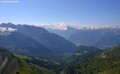
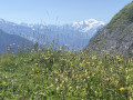
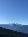
The resort of Morzine; the Dents Blanches route is not far away. From the summit, there are views of the resort of Avoriaz, the northern slope of the Haut-Giffre, Mont Blanc, the Pointe d’Angolon and a large part of the Chablais massifs, as well as the Lac des Mines d’Or, etc.

Reviews and comments

4.8 / 5
Based on 2 reviews

Reliability of the description
5 / 5
Ease of following the route
5 / 5
Route interest
4.5 / 5
anne ubrig
anne ubrig

Overall rating : 5 / 5

Date of your route : Jun 25, 2025
Reliability of the description : ★★★★★ Very good
Ease of following the route : ★★★★★ Very good
Route interest : ★★★★★ Very good
Very busy route : Yes

I did this hike starting from Morzine-le-Puthey, taking the forest path that leads to the Chalet de l’Acquit, then on to Morzinette, and from there up to the Col du Pic de Talon. I carried on to Les Hauts Forts. And on the way back, I descended from the pass on the other side.
A superb view – that’s the appeal of hikes that lead to summits. Here’s what Philippe Claudel writes:
“...you look out over the world with that feeling that G. Bachelard ... described as a monarchical contemplation of the world. When you’re up high, with the valleys at your feet, it’s always quite poignant and difficult to make the descent.”

Machine-translated

Daniel740
Daniel740

Overall rating : 4.7 / 5

Date of your route : Aug 20, 2020
Reliability of the description : ★★★★★ Very good
Ease of following the route : ★★★★★ Very good
Route interest : ★★★★☆ Good
Very busy route : No

A challenging hike that offers no respite. No need to worry about signposting – it’s impossible to go the wrong way. Crossing the pass isn’t particularly difficult, even if the approach is quite daunting.

Machine-translated

Other walks in the area

For more walks, use our search engine .

The GPS track and description are the property of this route's author. Please do not copy them without permission.