Country:

 City:
City:



Start at the car park, Rue de l’Égalité.
(S/E) From the car park, walk up the street and enter the public garden on the right. Cross it and walk past the town hall, then take Rue Louise Carré opposite.
(1) Turn right, then right again onto Rue Daquin, and take the steps on the left. Cross the square, then continue left onto Rue Émile Combes for 20 metres, then left onto Rue Jules Guesde, until you reach Rue Jean Baptiste Dubois.
(2) Follow it to the left and carry on straight ahead until you reach Chemin d’Houchain.
(3) Follow it straight ahead, then turn left at the crossroads until you reach the next junction.
(4) Turn left, heading south-west, and continue straight on until you reach the departmental road (D188).
(5) Turn right, then take the first track on the left until you reach a four-way junction.
(6) Turn right and, at the end, turn left; at the roundabout, turn left and, at the bean-shaped central island, keep left again to return to the junction you passed on the way there.
(6) Turn right until you reach a junction with the D188.
(7) Turn right onto Rue Victor Hugo, then left onto Rue Voltaire. At the end, go round the back of the building and take the path on the left to return to another junction which you also passed on the way out.
(3) Turn right-hand round and follow the original route in the opposite direction until you reach the initial fork.
(1) Go straight ahead onto Rue Florent Évrard; at the end, turn right, then left onto Rue Lavoisier. At the roundabout, go straight ahead onto Rue Juliot Curie and continue straight on until the third junction (Rue de Madrid).
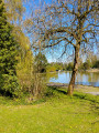
(8) Follow it to the left to reach Rue Émile Zola, then turn right towards Parc Germinal.
(9) Cross the street, enter the park and walk straight through it. At the end, continue along Rue des Meuniers. Turn right at the end of the street, then immediately right onto Rue Émile Tirtaine, until you reach another junction.
(10) Keep to the right onto Rue du 8 Mai, then cross the park at the far end on the left. Turn left along the motorway, ignore one street and follow Boulevard de la Fosse No. 10 to the left until it ends. Turn right for 30 metres, then left.
(11) Follow the path as it slopes gently downwards, then go to the end and turn left. Take the second street on the left (Rue des Rossignols). At the junction, continue straight ahead, then keep left (Rue Arthur Lamendin) until you reach a crossroads.
(12) Cross over, head up to the right onto the slag heap and carry on straight ahead until you reach Rue transversale d’Émile Basly.
(13) Head straight ahead along the dirt track and, further on, turn left (at the end of the track) to return to the starting point, going straight on and then turning right at the junctions. (S/E)
 Association / Club / Walk leader

 Visorando Member
 Easy
Easy