Country:

 City:




Set off from the “La Case Nature” lodge on the small road leading from the D81 to La Bessède.
(S/E) Follow the small road towards Labessède for about 200 m. At the first right-hand bend in the road, at the start of the descent, take the path branching off to the left (yellow marker – ‘from Labessède to St Michel de Léon’ walking sign).
Continue along this path, following the yellow markings (PR®) for 2.4 km. You’ll rejoin the tarmac road at elevation 774, at the junction of the small road between La Quintaine and Lacarrarié and the road leading to Le Grezalet.
(1) Turn left towards La Monténarié. Walk past the buildings at La Monténarié.
(2) At a bend to the left in the road, leave the signposted route and follow the stony path on the right, which climbs steeply for a few tens of metres. This path takes you to the D89 just before the junction with the path leading to the Souillas farm (elevation 750). Walk alongside the D89 on the right-hand side (towards Masnau) for about 600 metres.
(3) Turn left onto the Route de Belle Combe. Follow this road for about 40 metres before taking a path on your right that leads across the fields (public footpath). Follow this path, which first crosses the Route du Gouty et Garrigaute and then joins the Route de Pourenquiès at Bel Air.
(4) Head back towards the D89 (on the right) and, at the crossroads, take the small road that leads down towards La Durantié.
(5) Walk through the hamlet (with the old buildings and farm buildings on your left); near a modern house (on your right), the tarmac path turns back into a grassy track and leads to the village of Masnau after passing by a small lake.
(6) Continue straight on through the village of Masnau (heading due north), staying on the D82 (towards Massuguiès, Montfranc, Pourencas...). On leaving the village, near some imposing farm buildings, turn right towards the village hall: continue along this wide track (again marked in yellow –PR® of the Upper Dadou Valley 2, from Masnau to Saint-Salvy de Carcavès via St Michel de Léon), straight on towards the east for about 750 m. The track then turns left (north) and reaches a junction of tracks.
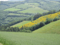
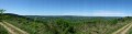
(7) At the crossroads, follow the track on the left (north-west) which winds across the plateau (offering fine views) and rejoins the D82 at elevation 745, near an electricity substation.
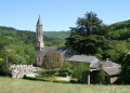
(8) Cross the D82 and continue along the path opposite (yellow markers) which heads towards Goutiorp and the Masnau stadium. The route continues for a good part of the way along the ridge before descending gently towards St-Michel-de-Léon. Cross the Boudène stream via a small bridge, then turn right towards the village centre (church, cemetery).
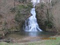
(9) At the corner of a house opposite the cemetery, the signpost indicates that you should head down to the right along a path (2 steps) which leads directly to the “Saut de la Truite” waterfall a little further on (you will then need to retrace your steps).
It is also possible to reach the waterfall from the other side of the valley: walk past the cemetery (heading almost due north), and after 300 metres you’ll reach the small road through the Dadou Valley; then turn right and, just after the junction with the Route du Fieu, turn right again onto the path running alongside the meadows, which leads to the waterfall 130 metres further on. Then retrace your steps. N.B. Horse riders can water their horses at the waterfall; picnic tables are provided by the side of the Route du Dadou, about 100 metres past the junction with the Route du Fieu, heading towards Soulié.
From St-Michel-de-Léon, take the path that passes in front of the church and heads south-west. Just past a cross, barely 200 m after the church, the signposts indicate a left turn. Follow this signposted route. After about 500 m, leave the path to descend into a meadow and cross the Garrigaute stream.
(10) From there, the path climbs steeply, zigzagging through woodland before reaching the pastures and then the Magnès farm.
(11) Walk round the buildings, keeping an eye out for the yellow signposts. Cross the pastures before reaching La Quintaine on the D81 (elevation 733). Continue along the D81 for about a hundred metres (heading south-east). Walk past the houses and, at the junction of the D81 and the D89, take the small road to La Monténarié – Le Grezalet – Lacarrarié. Follow this road to rejoin the route you took on the way there.
(2) Follow this route in the opposite direction to the outward journey, heading south, to reach La Case Nature (S/E).


 Visorando Member

 Difficult
 Tourist office