Country:

 City:
City:


To reach the start, drive through the town of Charmey, heading east towards Jaun. About 2 km after Charmey, take the small road on the right towards Gros Mont. You’re in for a 6 km climb up a narrow mountain road that gets narrower and narrower, with very tight hairpin bends as you ascend. The road ends in a track as you reach level ground, leading to the car park.
(S/E) From the car park, head back down the track and take the concrete path that climbs to the right, following the white-red-white markings towards Hochmatt for about 300 metres.
(1) At the corner of the mountain farm, take a path leading uphill to the left through pastureland, still following the signs for Hochmatt.
(2) At the top of the pasture, before the woodland, ignore the path branching off to the right and continue climbing straight ahead to cross a wooded area and reach more pastureland.
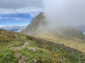
(3) When you reach a pass, ignore the track leading down and take a narrow path climbing to the left towards the summit. After 300 metres, a hairpin bend directs the path westwards until you reach a ridge. Continue climbing along the ridge heading north-east until you reach the summit of the Hochmatt.
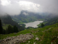
(4) From the summit, enjoy the view over the Jogne Valley. A metal cross stands a little further down. Descend eastwards to follow the path towards the summit of Cheval Blanc, heading towards Petit Mont.
(5) From the summit of Cheval Blanc, a long descent begins, still marked in red and white, towards the Petit Mont valley. Follow the ridge initially, before veering south at one hairpin bend and then east at the next.
(6) When you reach the alpine farm, take the path that descends to the right towards the south, crossing a small wood and then a pasture. A hairpin bend will take you back eastwards to rejoin the Petit Mont road next to a building. You will come to a crossroads.
(7) Head uphill to the right along the concrete Petit Mont road, which, 600 metres further on, turns into a track at an alpine farm; continue along this track for a further 600 metres.
(8) Ignore the track leading down to the left and continue up the Petit Mont track. Pass three hairpin bends before reaching a small plateau.
(9) Ignore the path leading up to the right towards Hochmatt. This path may be a shortcut. Continue up the track straight ahead to another alpine farm.
(10) At the farm, just past a drinking trough, take the path on the left towards Gros Mont. The path, still marked in white and red, climbs gently towards the Fréjima Dèvan farm. It climbs onto a plateau, passes a high point (Le Pralet, 1,844 m) before descending towards another farm.
(11) Cross the track and continue down through the pasture. The signposted path zigzags through the meadows.
(12) At the junction, continue down to the right, heading north, crossing a wooded area until you reach another building.
(13) Go round the building on the right and head down into the meadow to follow the signposted path which leads back to the first farm at the start and the tarmac track.
(1) Return to the starting car park on the left by following the route in reverse to the one taken on the way out (S/E).
 Visorando Member
 Difficult
 Moderate