


françois coffineau

 Association / Club / Walk leader
 Premium user
 Sign up:
Published route(s)
 From Grange Bernard to the Refuge de Terre Rouge
 5.14 mi
 +1,896 ft
 -33 ft
 4h 00
4h 00
 Moderate
 Departure from Valmeinier (Savoie)
First stage of the Petit tour du Mont Thabor hike
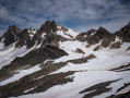
The ridges from Perron to Bréquin
 13.91 mi
+5,827 ft
-5,814 ft
7 hrs
13.91 mi
+5,827 ft
-5,814 ft
7 hrs
 Very difficult
Departure from Saint-Martin-de-la-Porte (Savoie)
Very difficult
Departure from Saint-Martin-de-la-Porte (Savoie)
A ridge walk, partly off-trail, culminating at Mont Bréquin with a magnificent view over the Maurienne Valley and the surrounding Alps.
From the Terre Rouge Refuge to the Mont Thabor Refuge
8.39 mi
+3,740 ft
-2,651 ft
7h 05
 Difficult
Departure from Valmeinier (Savoie)
Difficult
Departure from Valmeinier (Savoie)
Second stage of the short Mont Thabor circuit hike
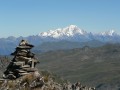
A short walk around Mont Thabor
24.52 mi
+8,251 ft
-8,238 ft
3 days
Difficult
Departure from Valmeinier (Savoie)
A hike packed with kilometres – both in distance and in elevation gain!A 360° viewpoint on Mont Thabor between the Vanoise and Écrins.Find all the reviews for this hike on the first stage’s pagehttps://www.visorando.com/randonnee-peti...