The eastern balconies of Chantelouve

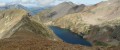
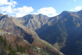
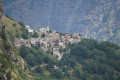
Breathtaking views of the village of Chantelouve and the Col d’Ornon valley as you pass by the Cabane des Charmettes.
A path appears to have disappeared at ::5:; see reviews

Details

n°20769048
Creation:
Last update:
Last review:
  • Walking
    Activity: Walking
  • ↔
    Distance: 4.62 mi
  • ◔
    Average duration: 3h 35 
  • ▲
    Difficulty: Moderate

  • ⚐
    Back to start: Yes
  • ↗
    Ascent: + 1,693 ft
  • ↘
    Descent: - 1,703 ft

  • ▲
    Highest point: 5,341 ft
  • ▼
    Lowest point: 3,638 ft

Description of the walk

Park in the car park by the church in Chantelouve.

(S/E) Follow the path from the church, cross the bridge over the Malsanne and take the forest track on the left. Follow the winding track until you reach a car park used for timber hauling, then continue past it for a good hundred metres.

(1) Continue along the track as it winds through the woodland until you cross the Malsanne at a place called Pont Moulin.

(2) Immediately after crossing the river, turn right onto the steeply sloping path towards Lac du Vallon. Continue until you reach a forest track; follow it to the left until you come to the junction with the Lac du Vallon path.

(3) Turn left. Walk past the Fontaine des Fayards, the highest point of the walk. Continue downhill until you reach the junction with another path coming from your left.

(4) Continue along the path to the right: you’ll pass a superb viewpoint overlooking the Col d’Ornon valley, 15 metres from the path. Not for the faint-hearted! Continue your descent, ignoring a path on the right. As you emerge from the woods, head right across the meadow towards the buildings you can see and join the access path leading to them, following it towards the Ruisseau de la Pras.

(5) Do not cross it, but take the path through the undergrowth on your left – it’s a bit hard to spot at first! Join the Chemin des Rochats.

(6) Turn left towards the houses, walk past them and continue to the banks of the Malsanne. Do not cross the river; turn right and join the Grand Armet departmental road. Follow it carefully downhill to the first junction.

(7) Take the road on the left called Chemin de Bourg d’Oisans and return to your starting point at the church (S/E).

Waypoints

  1. S/E : mi 0 - alt. 3,648 ft - Church car park. Cross the - Malsanne (rivière)
  2. 1 : mi 1.52 - alt. 4,551 ft - Junction
  3. 2 : mi 1.72 - alt. 4,656 ft - Junction towards Lac du Vallon
  4. 3 : mi 2.12 - alt. 5,108 ft - Forest track
  5. 4 : mi 2.77 - alt. 5,098 ft - Junction, end of alternative route
  6. 5 : mi 3.51 - alt. 4,242 ft - Ruisseau de la Pras
  7. 6 : mi 4.1 - alt. 3,819 ft - Chemin des Rochats
  8. 7 : mi 4.44 - alt. 3,720 ft - Junction on the Chemin de Bourg d’Oisans
  9. S/E : mi 4.62 - alt. 3,652 ft - Church car park

Notes

(2) Alternative route: after crossing the Malsanne, take the path on the left instead of the one on the right. This leads back to (4).

Worth a visit

(S/E) As the church is closed for safety reasons, you will not be able to visit the interior!

You’ll see three wash houses along the route where women used to come to wash their laundry; the first is on your right before crossing the bridge over the Malsanne.

After the first bend in the forest track, admire a pretty waterfall and the schist rocks.

At the third bend, take a moment to admire the view of the village of Chantelouve.

At the car park used for timber hauling, before the (1), you’ll hear a fountain running and you’ll see a cross nearby erected in memory of a forest ranger who died in the line of duty.
After the (1), take in the undergrowth of firs and beech trees.

Before reaching Pont Moulin (2), observe the water seeping through the limestone tufa (travertine), a sedimentary rock formed by the decomposition of limestone layers.

At point (2), look to your right and admire the rocks covered with dozens of mini-waterfalls. In winter, these become impressive ice falls!

Look up towards the torrent and admire its majesty – and even more so if you’re lucky enough to pass by at sunrise!

About 100 metres past the (3), you’ll pass a sunken shelter that used to serve as a shepherd’s hut! You can take shelter there in bad weather and appreciate the simple comforts of days gone by.

At the highest point of the walk, you’ll find a water source known as the ‘Fontaine des Fayards’: you can quench your thirst here – the water is very cool!

On the descent, you can admire the handiwork of our friend the woodpecker on the trunks of the decaying fir trees.

After the waymark (4), you’ll enter a magnificent area, but do take care as you admire the view over the Col d’Ornon valley: there’s a viewpoint near the path (not recommended for those with a fear of heights!) and the schist stone remains underfoot throughout.

Between waypoints (5) and (6), observe the effects of flooding on the bed of the Ruisseau des Pras.
The second wash house on the route, on your left, as you pass through the hamlet of Les Rochas.
The third wash house, on your left, at Les Faures, as you head down the Chemin de Bourg d’Oisans.

Reviews and comments

4.2 / 5
Based on 2 reviews

Reliability of the description
4 / 5
Ease of following the route
4 / 5
Route interest
4.5 / 5
RandoYvIsa
RandoYvIsa

Hello
Thank you for your comments
On the last part of the route, it’s true that the path isn’t very obvious because of the grass, but it is there. It’s nicer than heading back down via the tarmac road, but the road does give you the chance to visit the village!
Enjoy your future walks

Machine-translated

Merlantin
Merlantin

Overall rating : 4.3 / 5

Date of your route : Aug 31, 2024
Reliability of the description : ★★★★☆ Good
Ease of following the route : ★★★★☆ Good
Route interest : ★★★★★ Very good
Very busy route : No

At the end of the walk, you need to cross the Pras stream to reach the road.
Then turn left onto the tarmac road which passes through the hamlets of Les Siauds, Villelongue and Les Faures to return to the starting point.

Machine-translated

RandoYvIsa
RandoYvIsa

Hello,
It’s true that we’re right at the start of the season and some of the ‘hunters’ paths’ are very overgrown with grass – this one is a case in point. But you can carry on along this one without fear of getting lost, as it’s wedged between the stream on the right – which is impassable at this point – and the mountain on the left. The path runs parallel to the one you took, but through the woods!
Enjoy your walk along the other routes in Chantelouve, and thank you for your feedback

Machine-translated

Colette Talvard
Colette Talvard

Overall rating : 4 / 5

Date of your route : Jun 19, 2023
Reliability of the description : ★★★★☆ Good
Ease of following the route : ★★★★☆ Good
Route interest : ★★★★☆ Good
Very busy route : No

Please note that from point 5 onwards, the red path shown on the map disappears after 10 minutes; we returned to point 5 and crossed the stream, arriving at the Route du Grand Armet. Take the first small road on the right, the Chemin du Bourg d’Oisans, which leads you down to the church, the starting point.
We had spotted a wooden sign for Chantelouve between points 4 and 5, if my memory serves me correctly.
A lovely walk with beautiful views over the Col d’Ornon valley and, on the other side, the Grand Armet massif.

Best wishes to you all.

Machine-translated

Other walks in the area

For more walks, use our search engine .

The GPS track and description are the property of this route's author. Please do not copy them without permission.