Country:

 City:


In the centre of Foucherans, take Rue de Bonnevaux. On leaving the village, take the first right, then turn left at the nearby junction. Park at the edge of the Bois de Sente, on theGR® 595, in the car park before the barrier. Markings: yellow-blue, white-red; the second half of the route is unmarked.
(S/E) Set off along the forest track. Soon, in a clearing, signposts direct you to turn left, passing in front of the ‘President’s beech’. Stay on this straight path, which soon begins a steep descent that may be slippery in wet weather. Take the path branching off to the right. Pass a forest track on your right to join a lovely gravel track which has replaced the old ‘Tacot’ track (signpost).
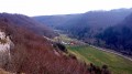
(1) Turn right (towards Ornans). You’ll pass through a 180-metre-long tunnel, which is normally lit automatically, then walk past the old small station, joining the D280, which you follow to the right for about a hundred metres until you reach a ‘Stop’ sign.
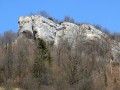
(2) Twenty metres past the Stop sign, head up the hillside to the right along the path, where the markings disappear. After a steep climb, leave a path on your left. Pass by the foot of some beautiful rocks, which you’ll go round to discover a lovely, moss-covered sunken path that looks like something out of a haunted forest. You’ll come across a forestry track at right angles to you, rutted with muddy tracks, which you’ll avoid by skirting the edge of a fir forest on your right. At a sign reading ‘Hunting Reserve’ and a ‘No. 22’ painted on a tree, head up to the right towards the ledges.
(3) At the ledges, the path turns left, skirting the ledges at a distance.
(4) When it bends slightly to the left and you can see a red-and-white pylon through the trees, take the track on the right which passes beneath the power lines, offering a fresh view of the valley. The track enters the woods and soon crosses a wider path. Cross it, continuing the descent along the narrow path opposite. You’ll soon reach a fork in the track. Take the left-hand path.  Be careful: the path on the right soon leads off towards the sheer cliffs. You’ll continue to walk along the ledges, passing some beautiful rock crevices.
(5) At a forked tree (the trunk splits in two), partly hollowed out, you’ll reach a junction with a wider path. Head down the path on the right. You’ll cross some sharp limestone pavements. Fifteen steps on, the path forks. Head down to the right. Further down, you’ll join another path at a right angle. You’re now above the tunnel. Head left to reach, with care, an unsecured viewpoint.
(6) Retrace your steps for about fifteen paces and continue along the path that climbs to the right. Opposite a striking rock, it turns left as it climbs. If you find yourself at the top of the scree slope, facing the rock, you have gone too far. Go back about ten steps and continue the climb. Soon, ignore a small path on your left and carry on climbing to the right, keeping straight on this well-defined path which begins to descend. It becomes a wider track overlooking the Tacot railway line.
(7) At a loose stone marker (on the right), sign No. 37, head up at right angles to the left along the straight ridge path and stay on it until you rejoin the marked path from the start. Head off to the left, passing the hundred-year-old beech tree once more, then turn right to return to the car park (S/E).

 Visorando Member


 Moderate