Country:

 City:
City:





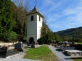
Car park in front of Foucherans Church. White-red and yellow-blue markings. Some sections are unmarked.
(S/E) Join the D122E departmental road via the small path at the far end of the car park, by a wooden barrier. Cross the road at the pedestrian crossing to leave Foucherans and turn left, following the pavement. When the departmental road bends to the right at the village exit, cross it carefully and head down the gravelled path opposite. You’ll rejoin the D122E and follow it to the Fontaine-lavoir Saint-Maximin crossroads.
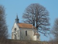
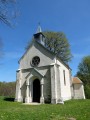
(1) Cross the D102 and head straight up to the chapel via the pasture to the left of the wash house (there’s a zigzag opening in the fence). At the edge of the woodland, climb a small wooden ladder to discover a pretty sunken path that leads you to the chapel.
(2) Walk past the Saint-Maximin Chapel until you reach the fork in the path, then turn right, passing the beautifully restored caborde. At the next bend, turn left to walk round the arboretum, passing the picnic table. Back on the small tarmac road, continue down the slope to the left for about 150 metres until you reach the hiking trail branching off to the left, which you should ignore.
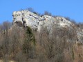
(3) Turn right onto the path opposite, despite the White Cross and Red Cross. A lovely path takes you under some beautiful rocks and, on your right, past a small sinkhole, leading to a junction marked by signposts. Climb up to the left until you reach the first pseudo-dolmen.
(4) Continue along the path until you reach the small road, which you cross. Carry on along the path opposite until you reach the corner of the fence. Then take the path on the right, soon reaching some sharp limestone pavements. Go round them on the left. The path isn’t very well marked, but carry on straight ahead, parallel to the edge of the woodland some fifty metres away, to reach the foot of the Trépot Dolmen, turning left at the signpost marked ‘De lapiaz en dolmens’.
(5) Walk back about twenty paces to the signpost and continue to the left along the lovely path dotted with sharp limestone pavements – which are much better marked – to reach the D102 county road, which you follow to the left for about a hundred metres.
(6) Take the stony path that climbs towards the pastures, veers left and enters the woodland. Stay on this path of large stones until you reach the nearby fork.
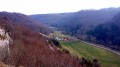
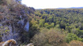
(7) Head up to the left and stay on this well-defined, ascending track, which passes through a lovely fir forest and joins a hiking trail at a right angle. Turn right. You’ll soon come to a signpost and a fork in the path; carry on straight ahead towards the Belvédère du Gratteris. When you reach some beautiful fir trees, look out for a narrow path on the left which leads to the promontory about fifty metres away. Far to the left, Mont Poupet comes into view.
(8) Leave the viewpoint via the path on the left. Soon leave this path for the narrow track that runs along the ledges to the left and joins the hiking trail a little further on. Continue to the left, crossing a superb, sun-drenched fir forest and passing the wooden pontoons of a cyclo-cross course. You’ll soon spot the signpost and a path leading down to the right. On your left, about 200 metres further down, you’ll see a fir tree with a yellow-and-blue marker on either side and a large orange rectangle in the middle.
(9) Take the small track on the right for about ten steps, revealing a lovely parallel path which you’ll follow down to the left. You’ll come to a pretty, amphitheatre-shaped sinkhole. Carry on straight ahead, coming up against some sharp limestone pavements which you’ll climb carefully. You’ll pass some beautiful crevices. When I was there, the path had been well cleared of undergrowth. You’ll reach a stony track. Turn right. The path quickly loses its gravel surface. You’ll pass a beautiful sinkhole and, shortly afterwards, come across a small track leading off at right angles to the right into a fir forest, which takes you to a karst sinkhole about fifty metres away. The sinkhole is unprotected ( keep an eye on children and keep your dogs on a lead).
(10) Turn back and continue along the forest track, keeping an eye on your right-hand side to spot more beautiful sinkholes. The track narrows to a path before widening again into a wider forest track, passing a final sinkhole and rejoining the junction of the circular Bois du Mont loop that you passed earlier.
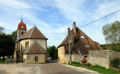
(7) Head down to the main road and turn left onto the D102 towards Trépot, passing a new washhouse and drinking trough – the perfect spot for a refreshing break. In the village, head down to the right towards the Church of Saint-Ferréol and Saint-Ferjeux and its beautiful churchyard.
(11) Walk down another 50 metres or so and turn left onto the Chemin de Jardy, which takes you back to Foucherans and the car park. (S/E).
 Visorando Member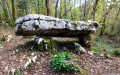

 Moderate