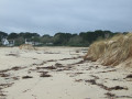
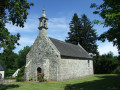
The chapels of Le Perguet and Saint-Sébastien and the Mer Blanche cove

A countryside route that passes near the Mer Blanche Nature Reserve. Along the route, there are two chapels: the Perguet complex and the modest Saint-Sébastien Chapel, as well as an Iron Age stele.

Details

n°6420246
Creation:
Last update:
–
Last review:
  • Walking
    Activity: Walking
  • ↔
    Distance: 5.13 mi
  • ◔
    Average duration: 2h 25 
  • ▲
    Difficulty: Easy

  • ⚐
    Back to start: Yes
  • ↗
    Ascent: + 85 ft
  • ↘
    Descent: - 85 ft

  • ▲
    Highest point: 95 ft
  • ▼
    Lowest point: 10 ft
  • ⚐ Country: France
  • ⚐ City: Fouesnant (29170)
  • ⚑
    Start/End: N 47.877092° / W 4.047379°
  • ❏
    IGN map(s): Ref. 0519ET
  • Hour-by-hour weather

Photos

Description of the walk

Perguet Chapel is situated alongside the D44, which links Fouesnant to Bénodet. Parking is available next to the chapel.

Whether you’re starting or finishing the walk, take the time to explore this complex, which includes the chapel with its adjoining ossuary, its calvary and its triumphal arch.

(S/E) With your back to the chapel, head south along the small tree-lined road with a 50 km/h speed limit (Hent Menez Perguet). Walk past an old orchard on your left and, after about 700 m, you’ll reach a junction with a signpost.

Light blue signposting in the opposite direction (“Around Mousterlin”)

(1) Continue to the “Give Way” sign, cross the D134 with care and take the safety lane on the right. At the house just before the road sign for Kerler Beach, note a pretty well on your left. Ignore the road to the beach – you’ll take that on the way back – and continue along the D134 (no more safety lane) until, after about a hundred metres, you reach the sign for Saint-Sébastien Chapel.

(2) Turn onto this small road leading to the chapel. Near a house (marked ‘Keramanson’ on the map), you’ll notice an old bread oven and meadows where horses from the nearby riding centre regularly graze. Ignore a turn-off on the left and you’ll soon reach the modest Saint-Sébastien Chapel (a 12th-century chapel which was extended in the 15th and 17th centuries and restored twice, in the mid-20th century and in 2013).

(3) Continue to the nearby roundabout, noting, on your left, a rustic garden created from fallen trees. Turn left at the roundabout, despite the Blue Cross, and follow this stretch of road (Hent Leurbrat), which continues as a dirt track leading to the end of a cove in the Mer Blanche Nature Reserve.

Light blue signposting in the opposite direction (“Autour de Mousterlin”) +GR® ®34 marked in white and red

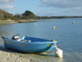
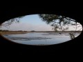
(4) Turn right and follow the edge of the cove, on your right, to gradually discover the Mer Blanche Nature Reserve behind the Mousterlin State Dune. Continue along a boardwalk until you reach a car park.

(5) Turn left and follow the small road straight ahead, lined with oak trees; after about 500 m, ignore the dual signposting that branches off to the right.

No signposts

Carry on along this small road, which bends to the right, running alongside a meadow where the neighbouring farm’s impressive herd of Charolais cows usually grazes, until you reach the road leading to Kerler Beach.

(6) Turn left onto this road (Hent Kerler) and join the D134. At the stop sign, turn right, following the pedestrian crossing for about a hundred metres. Opposite a bus shelter, cross this departmental road with care, take the road opposite (Hent Menez Perguet) and you’ll reach some directional signs.

Light blue signposting (“Autour de Mousterlin”)

(1) Turn right onto the small road (Hent Prajoumarc) which runs between a somewhat overgrown wooded area on the left and a residential neighbourhood on the right. Ignore a road on the right and continue in the same direction along the road, which is now called Hent Pen Ilis. It is bordered on the left by wetlands. Near an abandoned farm, look out for an Iron Age stone marker on the left, then arrive at a T-junction where the light blue-marked route branches off to the right.

Unmarked

(7) Turn left, then turn left again at the first road (signposted ‘Hent Kergonoën’), cross a small stream and continue along the same road, which climbs slightly, until you reach the first road on the left (signposted ‘Hent Mespiolet’).

(8) Take this small road, follow it to the end, ignoring all private turnings on both the right and left, until you reach the road leading to the chapel. Turn right to join this road (S/E).


Waypoints

  1. S/E : mi 0 - alt. 95 ft - Chapelle Sainte-Brigitte (Perguet)
  2. 1 : mi 0.44 - alt. 62 ft - Crossroads at the end of the circular loop
  3. 2 : mi 0.69 - alt. 66 ft - Sign for Saint-Sébastien Chapel
  4. 3 : mi 1.11 - alt. 33 ft - Chapelle Saint-Sébastien (Kerangorrec)
  5. 4 : mi 1.48 - alt. 13 ft - Edge of the cove
  6. 5 : mi 2.18 - alt. 10 ft - Car park
  7. 6 : mi 3.02 - alt. 49 ft - Hent Kerler
  8. 7 : mi 4.12 - alt. 59 ft - T-junction
  9. 8 : mi 4.51 - alt. 89 ft - Hent Mespiolet signpost
  10. S/E : mi 5.13 - alt. 95 ft - Chapelle Sainte-Brigitte (Perguet)

Notes

Please note that the route involves a great deal of walking along narrow country lanes.
Low-cut walking shoes are sufficient for this route, at least in dry weather.

Worth a visit

Sainte-Brigitte Chapel in Le Perguet.
The church is open to visitors during school holidays on Saturdays, Sundays and Mondays, from 10.00 am to 1.00 pm and from 2.00 pm to 6.00 pm (beautiful modern stained-glass windows).

Saint-Sébastien Chapel.

Pen-Ilis stone: an Iron Age stone.

A route abounding in flowers in spring.

Always be cautious and plan ahead when you're outdoors. Visorando and the author of this route cannot be held responsible for any accidents occurring on this route.

The GR® and PR® markings are the intellectual property of the Fédération Française de Randonnée Pédestre.

Reviews and comments

3.8 / 5
Based on 2 reviews

Reliability of the description
5 / 5
Ease of following the route
4.5 / 5
Route interest
2 / 5
mcplomeur
mcplomeur

Overall rating : 4.3 / 5

Date of your route : Jun 28, 2021
Reliability of the description : ★★★★★ Very good
Ease of following the route : ★★★★★ Very good
Route interest : ★★★☆☆ Average
Very busy route : No

The highlight of this route: the two chapels. A lovely photography exhibition in St Sébastien. But there’s a lot of road walking; only the start of the route, near the ‘white sea’, is a footpath.

Machine-translated

FLOCH
FLOCH ★

Thank you for this review
I did mention that the route involves a lot of driving on country roads, but they aren’t all busy – far from it.
I’m sorry about the chapels, but outside the summer season, you’ll rarely find them open. The reason is simple: the risk of theft and the trafficking of sacred artefacts.
Whenever I can, I specify the opening times, as was the case for the Perguet chapel.
All the best on Visorando.

Machine-translated

Marie Claude DONIO
Marie Claude DONIO

Overall rating : 3.3 / 5

Date of your route : Jun 08, 2021
Reliability of the description : ★★★★★ Very good
Ease of following the route : ★★★★☆ Good
Route interest : ★☆☆☆☆ Very disappointing
Very busy route : No

Hello,

This route isn’t worth doing, as it involves too much driving (around 80–100) on roads that are also very busy and narrow.

Unfortunately, the Perguet Chapel isn’t open.

Kind regards

Machine-translated

Other walks in the area

For more walks, use our search engine .

The GPS track and description are the property of this route's author. Please do not copy them without permission.