


 Country:
 City:
City:



Car park at the community hall, near the church.
Blue and purple signposting
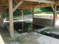
(S/E) From the car park, head across to the pedestrian crossing opposite, which goes round the church to the right, then turn right onto the road leading down to the hamlet of Le Stivell. Note, in the middle of the junction, a 16th-century wayside cross, featuring a cross adorned with fleurons. Turn left and walk past the old communal washhouse, which has been fitted with a roof and landscaped. Continue to a signpost indicating the Prajou and Moulin du Pont routes.
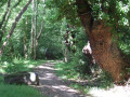
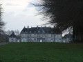
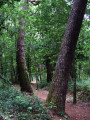
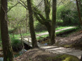
(1) Turn right into the driveway of a large estate (Ty Névez Maner an Traon), walk past it and continue along a sunken track that leads into the woodland. Cross a small stream via a footbridge and continue to the junction with a road.
Purple markings (sparse and very faint)
(2) Turn left onto a path running along the edge of a meadow on your left, which soon ends and leads down onto the road. Continue carefully along the side of the road. In a 30 zone, look out for a pretty pond on the property on your right. Follow this road straight on; it begins a steady climb until you reach the junction with the Route de Saint-Tudy (a half-broken sign pointing to the chapel).
No signposting
(3) Turn right, passing an old transformer flanked by a more modern one. Follow this road downhill, passing the hamlet of Ker Avalou on the right, then the locality of Kerguilavant on the left. Shortly afterwards, look out for a sign pointing to Kerjacob on the right.
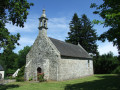
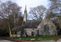
(4) Turn right onto the access road to this restored farmhouse and continue along the grassy path by the gable end of the house. After entering a field, carry on straight ahead through the tall grass (an unmaintained section) and emerge at the hamlet of Saint-Tudy. Turn right to reach the chapel situated on a small grassy hillock (you can view the interior via a timed access gate).
(5) After taking the time to explore the chapel, head back along the small road, turn left at the junction, pass the hamlet of Rozaligou and begin a lovely climb.
Carry on straight ahead and pass the Kerguilavant organic poultry farm.
(4) Carry on straight ahead until you reach the fork in the road from the outward journey (sign for the chapel).
Purple markings (sparse and very faint)
(3) Turn right and join the D45.
No markings
(6) Turn left and walk along the verge of this relatively busy road until you reach the sign for the Bellevue Industrial Estate.
(7) At a bus shelter, take this road to the left. Note a small cross on the left and a large orchard on the right.
Follow this road with care until you reach the entrance to the industrial estate (Fouesnant Ambulance Station on the right).
(8) Cross the road carefully to head up into the Bellevue Industrial Estate, walk alongside a football pitch and arrive at a junction (sign saying ‘give way’). Continue along the road opposite, going against the flow of traffic, which leads back down towards the main road. Pass the first footpath on your right (sign for the hamlet of Bellevue No. 23) and, immediately afterwards, take the next one, which leads up towards a new street; follow this to reach the hamlet of Kerguily.
At the end of the street, first turn left then right to carry on straight ahead. Ignore the steps leading down to the restored washhouse and leave the residential area to rejoin the main road.
Head up to the right towards the church and, at the corner of its surrounding wall, climb the steps to reach the large grassy esplanade where boules courts have been laid out (Espace Yvon Le Maout).
Walk round Saint-Mathurin Church, pass the war memorial and turn left to reach the car park of the community hall (S/E).



 Visorando Member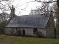

 Moderate
