


 Country:
 City:
City:


Parking at Place de la Mairie.
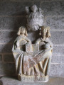
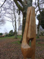
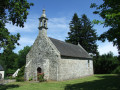
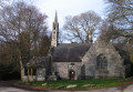
(S/E) From the Town Hall Square, head left towards the fountain known as the ‘Fontaine de Kerper’ and its wash house with two basins, then join Rue de l’Église and follow it to the left. Climb up into the fenced area of land of the 16th-century Church of Sainte-Hilaire to discover, in the porch, a stone sculpture of the Holy Trinity. Leave the fenced area of land, noting on the left a stone cross and a venerable English oak said to have been planted around 1870, and head towards the roundabout.
(1) Go round this roundabout on the left, cross over and take the footpath on the left between the houses and the road.
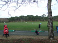
Follow this path under the trees to the end, where you’ll reach a gate. Turn right onto Route du Golf, follow this road using the wide, safe lane designated for pedestrians and cyclists, and walk alongside the golf course’s practice area.
(2) Turn right at the entrance to the Golf de l’Odet, walk along the driving range on your right-hand side, then continue round the car park. View of the western part of the golf course.
(3) At the ‘Résidence du Golf de l’Odet’ sign, at the exit of the car park, take the path leading to the entrance of the Résidence du Golf (recycling bins). Continue along the circular path that goes round the tennis courts and rejoin the golf course.
(2) Turn right, staying on the safety lane, and continue until you reach the Fork in the road marked ‘Carn Pont’.
(4) Turn left and follow this quiet little road, lined with meadows and wetlands, to the end to reach the D174.
(5) Make a first turn right then left to cross over and take the Route de Guerveur (exercise extreme caution: no pedestrian crossings, busy road and poor visibility). Pass an imposing electricity substation from which high-voltage power lines run, then, at the bend in the road, turn left onto Allée Ar Gall (signposted), which continues to a track where you’ll join a section of the “Route de Cheffontaines” marked in red.
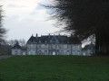
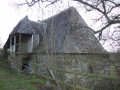
(6) Take a sharp left-hand bend, walk alongside a woodland, pass under a power line and arrive at a metal gate marking the boundary of the Château de Cheffontaines estate. Pass, on your right, by a vast pond with black water, then, on your left, by the old Kergoat Mill, which is almost in ruins. Continue to the end of this long, straight avenue, flanked by the château’s wall and a fine row of oak and beech trees. It ends at another metal gate. Turn right for a short round trip offering a view of the 18th-century Château de Cheffontaines, built in the ‘Malouinière’ style.
(7) Retrace your steps and continue along this road towards Clohars-Fouesnant. Take extreme care: the road is narrow and winding; if travelling in a group, keep in single file.
(8) At the entrance to the sports ground, take the safe path that runs alongside the nursery and primary schools and leads to the Town Hall square (S/E).

 A pleasant, peaceful route with few other walkers.
 Visorando Member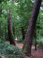

 Moderate
