Country:

 City:


In Eygliers, leave the RN94 and take the Route de Réotier; pass the car park for the ‘petrifying fountain’ on your left and follow the road towards Réotier Town Hall, then take the Route de l’Alp/Tête de Vautisse (D638T). Park at the junction of the Route de l’Alp and the Route de Truchet.
(S/E) From the car park, set off along the Route de Truchet to the north-east, which turns left and heads north. Pass the Chemin de Pra Mangeant on your right, then the Chemin de la Chapelle Saint-Roch on your left; follow the sign for the ‘orientation table’ until you reach a junction.
(1) Leave the D638T, which descends to the right, and turn left uphill towards the Clot de Pra Bouchard at the junction with the path leading to the orientation table.
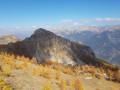
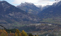
(2) Leave the track and take the path on the right. Walk uphill for about a hundred metres; ignore a path on the right; at the junction, make a round trip to the orientation table.It offers a 180° view stretching from Les Agneaux on the left to the Parpaillon massif on the opposite side.
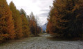
(3) Then retrace your steps to the previous junction and turn right, crossing the clearing also known as ‘Camp de la Marine’ as it once hosted summer camps or youth holidays organised by the Navy.
Rejoin the path about thirty metres from the point (2) and head right (north-west) towards the few remaining barracks. Continue along this nature trail to the remains of the Clot Aqueduct.
(4) Cross the stream and continue to follow the canal. About 250 metres further on, let the canal branch off to the left; carry on straight ahead and you’ll reach the Villard torrent (Saint-Thomas on IGN maps).
(5) Turn left onto the path that climbs towards the Fontaine des Rois mills; these date from the construction of the Fort de Mont Dauphin and were used to grind the grain grown locally.
Heading roughly south, then cross the meadows (the path is not always clearly marked). After passing Basse Rua and “Devant le Clot”, you’ll reach a T-junction.
(6) Turn right and rejoin the Bas Villard path, which, on the left, leads to Mikeou at a junction (signposts on the right-hand side) at a place called Les Fontaines.
(7) Turn right onto the road towards Tête de Vautisse/les Alpages. About forty metres past the fountain, you’ll reach the start of a footpath.
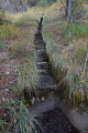
(8) Leave the road and take the path on the left, marked by a sign reading: “Canal Manouel Pinfol”, and follow the canal. At the 1431 mark, look out for the paved channel and follow it to the road leading to Pinfol, near the climbing site. After walking a few dozen metres along the road, a path branches off to the right (signposted).
(9) Climb up this steep path towards the hamlet of Rabastelle-le-Bas (abandoned since the late18th century), of which only a few low walls remain. The path joins a track suitable for vehicles; continue straight on until you reach a hairpin bend at the hamlet of Pinfol.
(10) As you come out of the bend, take a steeply ascending track to the left (signposted ‘Mikeou’, GR®50). Follow it to the ruins of Rabastelle-le-Haut. Like the previous ruins, these sites have been inhabited since medieval times.
(11) The path joins a lovely forest track leading to the hamlet of Mikéou.
(12) Turn right until you reach a junction you passed earlier.
(8) Carry on straight ahead, crossing through the hamlet of Mikéou once more until you reach the junction you passed on the way there.
(7) Turn right, heading south. After about 300 m, ignore a path that veers uphill to the right; about a hundred metres further on, don’t miss a path that descends to the left.
(13) Turn left, heading south-east, to quickly reach the path leading to the hamlet of Les Guieux. First turn left then right to head south-east again. When you reach a hairpin bend in the road, continue downhill along it until you reach the car park (S/E).
 Visorando Member

 Easy
 Difficult