Pinfol Circular Loop

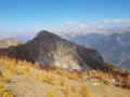
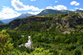
A lovely short walk on the slopes of Réotier, alternating between walks through the woods, mountain pastures and views over the valley.

Details

8391218
Creation:
Last update:
Last review:
  • Walking
    Activity: Walking
  • ↔
    Distance: 3.99 mi
  • ◔
    Average duration: 2h 40 
  • ▲
    Difficulty: Moderate

  • ⚐
    Back to start: Yes
  • ↗
    Ascent: + 968 ft
  • ↘
    Descent: - 965 ft

  • ▲
    Highest point: 5,141 ft
  • ▼
    Lowest point: 4,206 ft

Description of the walk

Park in the car park at the junction of the D638t road and the track leading to the Pinfol lodge.

(S/E) Take the track to the lodge and negotiate the hairpin bend.

(1) Follow a small, steep path on the left markedGR®50(red and white markings). Join a forest track.

(2) Turn right onto this track, continuing to follow theGR®50towards the Mikéou chalets. Once you reach the small tarmac road, turn right to head towards them.

(3) Continue along the road towards Réotier.

(4) Take the path on the left, which cuts across a hairpin bend and rejoins the road further down; follow this road downhill to the Truchet viewpoint.

(5) Then follow the D638t road back to the car park where you started (S/E).

Waypoints

  1. S/E : mi 0 - alt. 4,206 ft - Car park at the Pinfol lodge car park
  2. 1 : mi 0.9 - alt. 4,587 ft - Pinfol lodge
  3. 2 : mi 1.78 - alt. 5,135 ft - Forest track
  4. 3 : mi 2.7 - alt. 4,925 ft - Mikéou chalets
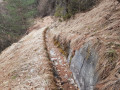
  5. 4 : mi 2.97 - alt. 4,813 ft - Small path on the left (old canal)
  6. 5 : mi 3.2 - alt. 4,633 ft - Belvédère de Truchet
  7. S/E : mi 3.99 - alt. 4,209 ft - Car park for the Pinfol lodge trail

Notes

You can get water at the Pinfol lodge and the Mikéou chalets.

Always be cautious and plan ahead when you're outdoors. Visorando and the author of this route cannot be held responsible for any accidents occurring on this route.

The GR® and PR® markings are the intellectual property of the Fédération Française de Randonnée Pédestre.

Reviews and comments

4.6 / 5
Based on 3 reviews

Reliability of the description
5 / 5
Ease of following the route
5 / 5
Route interest
3.7 / 5
fidu
fidu
• Edited:

You’re being rather disingenuous! It’s true that on the way back, part of the route is along the road – that’s a shame – but it’s certainly not two-thirds of it. As for the view, in many other places you can see the river, but is it really a problem to see it…

Machine-translated

PierrickBZH
PierrickBZH

Overall rating : 3.7 / 5

Date of your route : Jul 30, 2026
Reliability of the description : ★★★★★ Very good
Ease of following the route : ★★★★★ Very good
Route interest : ★☆☆☆☆ Very disappointing
Very busy route : No

A rather uninteresting walk; you can already see the view of the river from the road. The path is very steep, and two-thirds of the circular route is on tarmac.

Machine-translated

fidu
fidu

Overall rating : 5 / 5

Date of your route : Aug 24, 2026
Reliability of the description : ★★★★★ Very good
Ease of following the route : ★★★★★ Very good
Route interest : ★★★★★ Very good
Very busy route : No

A lovely little walk.
A lovely viewpoint and a pleasant walk through the woodland.

Machine-translated

rpastant
rpastant

Overall rating : 5 / 5

Date of your route : Sep 26, 2023
Reliability of the description : ★★★★★ Very good
Ease of following the route : ★★★★★ Very good
Route interest : ★★★★★ Very good
Very busy route : No

Hello,

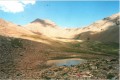
From Gap to Réotier, a 1 hour 10 minute drive covering 61 km! It was definitely worth taking this lovely family walk, ‘La Boucle de Pinfol’, suggested by our friend. No other walkers today, despite this lovely warm and sunny day. And what a beautiful view! In the distance, towards the Val d’Escreins, lies the Font Sancté; further to the right, towards Risoul, is the Razzis at 2,575 metres. An easy walk, taking about 2 hours 45 minutes as indicated, starting from the Lodge de Pinfol with a fairly steep climb. About 700 metres from the lodge, there’s a lovely climbing spot which was very busy this morning, particularly with Dutch soldiers on a training exercise.
There is space to park several vehicles in the ‘grassy’ car park at the start. We followed the route without any difficulty; it was well marked (GR50) and also had signposts. We missed the small path on the left (an old canal) – at an altitude of 1,471 m – which would have allowed us to take a shortcut down via the Chemin de Jalards, but it didn’t matter… The Chalets de Mikéou area is magnificent, and what a view from the Truchet viewpoint.

Machine-translated

Other walks in the area

For more walks, use our search engine .

The GPS track and description are the property of this route's author. Please do not copy them without permission.