Roche Charnière

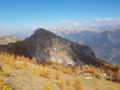
Roche Charnière is a peak visible from all over the Durance valley between Eyglier and La Roche-de-Rame. It’s very tempting to climb up and have a look. Once at the top, a breathtaking panorama awaits you. The Écrins, the Queyras, the Guillestrois, the Durance Valley, the Tête de Gaulent, the Tête de Vautisse, the Viso… I’ll stop there, but it’s up to you to continue and feast your eyes.

Details

65419436
Creation:
Last update:
Last review:
  • Walking
    Activity: Walking
  • ↔
    Distance: 2.13 mi
  • ◔
    Average duration: 1h 55 
  • ▲
    Difficulty: Moderate

  • ⚐
    Back to start: Yes
  • ↗
    Ascent: + 1,040 ft
  • ↘
    Descent: - 1,040 ft

  • ▲
    Highest point: 8,015 ft
  • ▼
    Lowest point: 6,972 ft

Photos

Description of the walk

At Réotier, leave the D38 and take theD638T, following signs for “All directions” then “Tête de Vautisse”. At Mikéou, the tarmac road gives way to a forest track. Continue along this track, following signs for “Tête de Vautisse”, to reach the Cabane de la Selle. To respect the shepherd’s privacy, carry on a little further and, after the hairpin bend, continue to park in the wide bend where there is space for several vehicles.

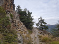
(S/E) From the car park, look out for the start of the path marked by a sign for “Roche Charnière” and cairns. Despite the numerous tracks left by sheep, follow the cairns and the main path carefully. Climb initially through the larch trees, then the path opens out into a clearing. Continue on level ground, cross some streams and arrive at a crossroads.

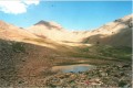
(1) Ignore the path that comes in from the right of the Cabane de la Selle and heads left towards the Cabane de l’Alp. Continue straight on along the mountainside, carefully following the cairns, until you reach a rocky area where you may need to use your hands, and carry on until you emerge onto a vast grassy plateau.

(2) On the plateau, follow the cairns to make a wide circular loop around the edge of the plateau to make the most of the sweeping views, then head back up to the forest and locate the path.

(3) The path follows the ridge, initially beneath the larch trees with a large ravine to the right. Continue crossing whilst ascending. Pass through a rocky area, keeping a close eye on the cairns until you emerge onto a slope.

(4) Climb the slope leading to the summit, following the cairns as closely as possible to reach the top.

(5) Take in the sweeping panorama, then descend back to the car park via the same route in the opposite direction.Take care to remain alert, keep an eye out for the cairns, watch out for loose stones underfoot, and take care not to slip (S/E).

Waypoints

  1. S/E : mi 0 - alt. 6,975 ft - Car park above the Cabane de la Selle
  2. 1 : mi 0.18 - alt. 7,051 ft - Crossroads
  3. 2 : mi 0.52 - alt. 7,349 ft - Small pass at the start of the grassy plateau
  4. 3 : mi 0.8 - alt. 7,572 ft - Start of the ridge in the forest
  5. 4 : mi 0.91 - alt. 7,707 ft - Start of the summit slope
  6. 5 : mi 1.05 - alt. 7,976 ft - Summit of - Roche Charniere (2420m)
  7. S/E : mi 2.13 - alt. 6,975 ft - Car park above the Cabane de la Selle

Notes

  • If there are no herders present (late in autumn or early in spring), you can park just before the La Selle hut, then continue on foot along the track. After rounding the bend, carry on a little further and look out for the path on the right which climbs towards “Roche Charnière” and leads to the crossroads (1). From there, take the path on the right and follow the guidebook.
  • In late autumn, the municipality of Réotier closes the track just before the La Selle hut. If this is the case, it’s no problem; simply continue on foot to reach the start of the hike.
  • Do not rely on the estimated time displayed by the Visorando algorithm. In fact, allow a good 2 to 3 hours for a careful round trip.
  • There’s no water along the route.
  • Given the panoramic views along the way, do remember to take a pair of binoculars.
  • As this walk takes place in a pastoral area, take the necessary precautions. It’s best to do this walk outside the grazing season to avoid any potential problems. For example, in autumn, so you can enjoy the golden larch trees and the light that illuminates the mountain pasture.

Reviews and comments

5 / 5
Based on 2 reviews

Reliability of the description
5 / 5
Ease of following the route
5 / 5
Route interest
5 / 5
jp11
jp11

Overall rating : 5 / 5

Date of your route : Jun 25, 2025
Reliability of the description : ★★★★★ Very good
Ease of following the route : ★★★★★ Very good
Route interest : ★★★★★ Very good
Very busy route : No

A beautiful, varied hike. Unfortunately, poor visibility, which has become chronic in the Southern Alps due to high temperatures (34°C at 1,400 metres), means that even with binoculars, the hike is less interesting. As indicated in the guidebook, the climb is easy, but the descent is tricky, especially between 5 and 4, due to the nature of the terrain: unstable with lots of slippery rocks. Remember that this route is not marked and that you must not lose sight of the cairns.

Machine-translated

eterlou05
eterlou05
• Edited:

Overall rating : 5 / 5

Date of your route : May 25, 2025
Reliability of the description : ★★★★★ Very good
Ease of following the route : ★★★★★ Very good
Route interest : ★★★★★ Very good
Very busy route : No

Beautiful view
Lots of flowers
One or two steep sections where you’ll need to use your hands if necessary
Rocks across the track 800 metres before the hut; no herds yet.

Machine-translated

Other walks in the area

For more walks, use our search engine .

The GPS track and description are the property of this route's author. Please do not copy them without permission.