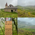
The cadoles of Perréon

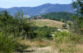
A lovely walk through the hills above the village.
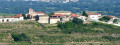
You’ll see eight cadoles and the Madonna, with some remarkable views.

Details

n°34791594
Creation:
Last update:
Last review:
  • Walking
    Activity: Walking
  • ↔
    Distance: 2.42 mi
  • ◔
    Average duration: 1h 25 
  • ▲
    Difficulty: Easy

  • ⚐
    Back to start: Yes
  • ↗
    Ascent: + 390 ft
  • ↘
    Descent: - 400 ft

  • ▲
    Highest point: 1,716 ft
  • ▼
    Lowest point: 1,381 ft

Photos

Description of the walk

Head to the hamlet of La Sablière. Park near the Cadole aux Lards. Take the opportunity to visit it.

(S/E) Then walk down the road for 100 metres until you reach a crossroads.

(1) Turn right and, a few hundred metres further on, you’ll reach a crossroads. Turn right here to reach cadole no. 1. Return to the crossroads, turn right and walk alongside a vineyard, skirting it on the right, then head downhill until you reach cadole no. 2.
Carry on alongside the vineyard; at the bottom, take the path on your right.
Carry on along this winding path for 500 m, straight ahead. It then descends quite steeply until you reach cadole no. 3.

(2) Take the path on the left and follow it through the vineyards until you reach a tarmac road, the Chemin de Chenevert. Turn right onto it for 50 m, then turn left onto the ‘Sentier Bleu’ path.
Pass Cadole No. 4, then, 800 metres further on, Cadole No. 5.

(3) Take the path leading uphill to the left and continue on to reach the Madone crossroads.

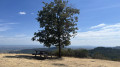
(4) Turn right to reach the Madone orientation table. Return to the crossroads, turn right to reach Crêt des Chaux, where cadole no. 7 is located.
Carry on along the edge of the vineyards to return to the original crossroads you passed on the way out.

(1) Follow the route you took on the way there in the opposite direction to return to the Cadole aux Lards car park (S/E).

Waypoints

  1. S/E : mi 0 - alt. 1,644 ft - Cadole aux Lards car park
  2. 1 : mi 0.09 - alt. 1,591 ft - Crossroads at the end of the circular loop
  3. 2 : mi 0.78 - alt. 1,450 ft - Cadole No. 3
  4. 3 : mi 1.46 - alt. 1,427 ft - Cadole No. 5
  5. 4 : mi 1.72 - alt. 1,529 ft - Madone crossroads
  6. S/E : mi 2.42 - alt. 1,634 ft - Cadole aux Lards car park

Reviews and comments

4.7 / 5
Based on 1 review

Reliability of the description
5 / 5
Ease of following the route
4 / 5
Route interest
5 / 5
siouxfalls
siouxfalls

Overall rating : 4.7 / 5

Date of your route : Mar 25, 2024
Reliability of the description : ★★★★★ Very good
Ease of following the route : ★★★★☆ Good
Route interest : ★★★★★ Very good
Very busy route : No

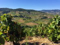
THIS ROUTE IS ENJOYABLE TO DO ON A SUNNY DAY AS IT OFFERS VIEWS OF THE BEAUTIFUL HILLS, THE SAONE VALLEY AND, IF YOU’RE LUCKY, THE ALPS

HOWEVER, THIS ROUTE IS NOT SUITABLE FOR PEOPLE WHO HAVE DIFFICULTY WITH STEEP DESCENTS BEFORE POINT 2
NOT SUITABLE FOR HEALTH-FOCUSED HIKES

P.S. The elevation gain recorded on Garmin devices is greater than that stated – 20 to 30 metres more

Machine-translated

Other walks in the area

For more walks, use our search engine .

The GPS track and description are the property of this route's author. Please do not copy them without permission.