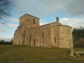
The Loges Trail in Le Perréon

An easy walk designed for families. With very little change in elevation, it can be completed in under an hour. The first part of this walk takes you through the heart of the village, showcasing our heritage and history: the old station, the ‘Tacot’, the Château des Loges, the co-operative winery and a statue of the Madonna. The second section winds through the vineyards, amongst our famous grape varieties (Gamay, Chardonnay and Viognier), and even offers a glimpse of an olive grove.

Details

n°30153083
Creation:
Last update:
–
Last review:
  • Walking
    Activity: Walking
  • ↔
    Distance: 1.73 mi
  • ◔
    Average duration: 0h 55 
  • ▲
    Difficulty: Easy

  • ⚐
    Back to start: Yes
  • ↗
    Ascent: + 98 ft
  • ↘
    Descent: - 98 ft

  • ▲
    Highest point: 1,024 ft
  • ▼
    Lowest point: 922 ft

Photos

Description of the walk

Park at Place de la Mairie, which is in the heart of the village of Le Perréon on the D88.

(S/E) Leave the square via the steps opposite the church. Follow Rue du Commerce to the right for 100 metres, then turn left. Head towards the leisure area and follow the path. You will reach the Maison des Associations, which stands on the site of the former Tacot railway station.

(1) Continue past the community hall to reach Rue des Sports. Follow it to the left until you reach the junction with the D88 (Rue de Louveigné).

(2) Cross the D88 and take Impasse des Loges opposite. After 20 m, turn right and follow the local path for about 400 m until you reach the edge of the properties.

(3) Turn left and then, amongst the vineyard plots, follow the stone markers lining the path to guide you through all the changes of direction. The return leg of this circular loop takes you past the Madone and then alongside the buildings of the Château des Loges Co-operative Winery. Join the D88.

(2) Follow this road to the right until you reach the Place de l’Église, directly opposite the Place de la Mairie (S/E).

Waypoints

  1. S/E : mi 0 - alt. 965 ft - Place de la Mairie
  2. 1 : mi 0.13 - alt. 928 ft - Ancienne gare du tacot
  3. 2 : mi 0.27 - alt. 928 ft - Crossroads of the circular loop
  4. 3 : mi 0.58 - alt. 922 ft - Crossroads
  5. S/E : mi 1.73 - alt. 965 ft - Place de la Mairie

Worth a visit

During this walk, you’ll discover:
- the Town Hall and the founding of the commune of Le Pérréon in 1990 (the youngest commune in the Rhône department, excluding amalgamated communes).
- the former Tacot railway station (now the Maison des Associations).
- the Château des Loges.
- the Madonna of the Château des Loges.
- the Château des Loges Co-operative Winery.
- The three grape varieties grown in our vineyards: Gamay, Chardonnay and Viognier
- and even an olive grove.
(1) The former Tacot railway station was served by the Beaujolais railway line

Reviews and comments

4.7 / 5
Based on 1 review

Reliability of the description
5 / 5
Ease of following the route
5 / 5
Route interest
4 / 5
L'Alpin joyeux
L'Alpin joyeux

Overall rating : 4.7 / 5

Date of your route : Feb 26, 2023
Reliability of the description : ★★★★★ Very good
Ease of following the route : ★★★★★ Very good
Route interest : ★★★★☆ Good
Very busy route : No

A family walk with children aged 4 to 5 to get some fresh air. Very pleasant in the sunshine.

Machine-translated

Other walks in the area

For more walks, use our search engine .

The GPS track and description are the property of this route's author. Please do not copy them without permission.