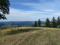
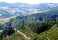
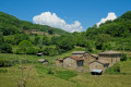
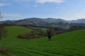
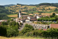
La Pyramide as seen from the Col de la Croix Montmain

A short, easy walk through the forest, suitable for all, with an unobstructed summit.

Details

n°3683089
Creation:
Last update:
Last review:
  • Walking
    Activity: Walking
  • ↔
    Distance: 1.93 mi
  • ◔
    Average duration: 1h 20 
  • ▲
    Difficulty: Easy

  • ⚐
    Back to start: Yes
  • ↗
    Ascent: + 486 ft
  • ↘
    Descent: - 486 ft

  • ▲
    Highest point: 2,904 ft
  • ▼
    Lowest point: 2,418 ft

Photos

Description of the walk

Start from the Col de la Croix Montmain, accessible via the D44 from Lamure-sur-Azergues.

(S/E) Take the wide dirt track heading south. At thefirst fork, continue to the left.

(1) At the 808-metre mark, take a stony dirt track that climbs to the right.
Follow it to the meadow.

(2) At the end of the meadow, a path branches off to the left and leads to the summit of the Pyramide.

(3) The return journey follows the same route back to the Col de la Croix Montmain (S/E).

Waypoints

  1. S/E : mi 0 - alt. 2,418 ft - Col de la Croix Montmain
  2. 1 : mi 0.59 - alt. 2,654 ft - Junction
  3. 2 : mi 0.85 - alt. 2,831 ft - Meadow
  4. 3 : mi 0.97 - alt. 2,904 ft - La Pyramide
  5. S/E : mi 1.93 - alt. 2,418 ft - Col de la Croix Montmain

Reviews and comments

4.2 / 5
Based on 2 reviews

Reliability of the description
4.5 / 5
Ease of following the route
4.5 / 5
Route interest
3.5 / 5
jfvin100
jfvin100

Overall rating : 4.7 / 5

Date of your route : Aug 20, 2026
Reliability of the description : ★★★★★ Very good
Ease of following the route : ★★★★★ Very good
Route interest : ★★★★☆ Good
Very busy route : No

Contrary to the 2021 review, the forest track is not rutted and has no particular ruts. However, a pushchair will not be able to get through
Watch out for flocks of sheep. There are warnings in place regarding sheepdogs. I would therefore advise against taking a dog on this walk
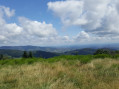
The finish is lovely and well worth the walk: a large tree, some shade, and a table with a bench for a picnic, with a brilliant view
Thank you for sharing

Machine-translated

cricri76
cricri76

Overall rating : 3.7 / 5

Date of your route : Mar 21, 2021
Reliability of the description : ★★★★☆ Good
Ease of following the route : ★★★★☆ Good
Route interest : ★★★☆☆ Average
Very busy route : Yes

A disappointing route, as the path is completely rutted by the foresters’ machinery. The viewpoint at the top offers a very wide view. However, the approach is unpleasant and even dangerous given the ruts.

Machine-translated

Other walks in the area

For more walks, use our search engine .

The GPS track and description are the property of this route's author. Please do not copy them without permission.