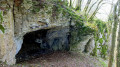
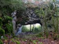
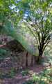
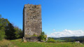
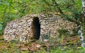
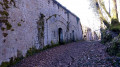
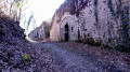
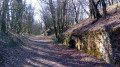
See Practical Information. You will climb towards the ‘cabordes’, these dry-stone winegrowers’ huts. Stop off at the viewing points of Fort de Planoise to take in the views of the Besançon hills, then southwards over the Doubs valley and the Jura mountains. Despite its military past, the fort offers a charming walk with its many paths winding through the ruins. You’ll return by following the cliffs through a wild, moss-covered wood that feels like a haunted and sinister forest.


 Country:
 City:
City:


Car park at Avanne Town Hall. No signposting. Signposts at certain junctions.
(S/E) Head down towards Rue de l’Église. Take a look at the old wine press on the town hall forecourt. Cross the road and head back up to the left. Turn right onto Rue du Pressoir after the war memorial. This continues as a footpath (Trail 8). Ignore the paths to the right and left
(1) At a new Trail 8 sign, the path forks. Continue along the uphill path on the right. A steep, straight climb lies ahead, leading to another fork marked by Trail markers 7, 8 and 9 (not very visible, on a tree on the left). Continue along the gentler path on the left.
You’ll come to a wider, ascending track which you’ll follow down to the left. At wooden post No. 155, at the foot of a path leading down to the left, continue straight down towards Rosemont.
(2) At the bottom (post 163), stay on this path, which begins to curve to the right, leaving the tracks on your left behind, whilst continuing in the same direction (Rosemont). Lovely view of Rosemont. You’ll reach another fork marked by a signpost; head back up towards Les Equegney – Avanne.
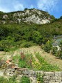
After another steep climb, you’ll reach an ascending path marked by signpost 144 B. Continue uphill in the same direction to reach the first caborde. Head down to the left (towards Avanne) for about a hundred steps to discover a superb caborde with a moss-covered slate roof.
(3) Climb the wooded hillside via the small flight of steps on the right and wind your way through the ruins along the path which, after the third caborde, veers slightly to the right. You’ll come across another path at right angles to this, which you follow uphill to the left, then another, even wider one, still keeping to the left. After a metal gate, you’ll come to a small tarmac road. Walk ten steps to the right and then climb up to the left along the narrow path. At the top, you’ll reach a small hillock; continue along the path to the right. You’ll rejoin the small tarmac road at the entrance to Planoise Fort. Pass between the walls and head right towards the esplanade and the splendid viewpoint over the Besançon hills (picnic tables).
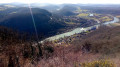
(4) A viewpoint overlooking all the hills of Besançon (binoculars are a must): Rosemont, Chaudanne, Mont Saint-Étienne and the Citadel, Mont Bregille and its fort, and in the distance, Montfaucon and the ruins of its feudal castle.
Head off to the right (with your back to the viewpoint) along the narrow path that leads to the entrance to the fort. Walk round it, starting on the left and carefully skirting the moats. Go through the gap on the other side of the embankment towards the picnic table, then head left again on the other side of the embankment.
(5) At signpost 152, go through the gate towards the viewpoint overlooking Avanne. You’ll pass by some fortifications. At the last one, turn left, following the central batteries, which you can visit with care. Then turn right at the last battery, following a low wall on your left, then a few stone steps to reach an unsecured viewpoint overlooking the southern part of the Doubs valley.
(6) Leave the viewpoint via the gravel path that passes in front of further fortifications. Continue for about fifty metres past the last one and turn left onto the path leading back towards the building. Climb up to the right along the narrow track, descending on the other side of the hillock and joining a wider path at a right angle, which you’ll follow to the left. You’ll reach the top of a large ditch lined with wild, tangled trees. The path veers slightly to the right, entering the moss-covered boxwood thickets, which resemble an eerie forest in winter. Head down this well-defined path, keeping the smaller tracks on your right.
(7) You’ll reach an open area, offering another view of the valley, and a fork in the path. Continue straight ahead carefully along the ridge, which runs quite close to the edge of the cliff. You’ll soon rejoin the path you started on; take this to the left to return to Avanne and the car park (S/E).

 Visorando Member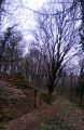

 Easy
Easy