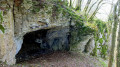
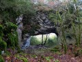
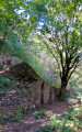
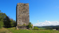
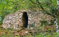
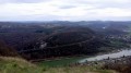
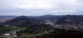
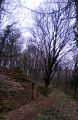
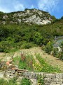
See information from Avanne Town Hall. From there, you’ll climb towards the ‘cabordes’, the dry-stone huts used by winegrowers. Then, at Fort de Planoise – the first rampart of the city of Besançon – you’ll march past the gun emplacements in military formation. You’ll stop at superb vantage points overlooking Besançon and its hills, the southern Doubs Valley and the Jura Mountains. After squeezing through a small tunnel inside a small fort, you’ll enter a wild, moss-covered wood that feels like a haunted forest.


 Country:
 City:
City:


Car park at Avanne Town Hall. No signposting. Signposts at certain junctions.
(S/E) Walk past the town hall and turn right onto Rue du Pressoir after the war memorial. This continues as a footpath
(1) Soon, ignore a path leading uphill to the right and carry on straight ahead. At the next junction, which is nearby, continue straight ahead, staying on this very straight path until you reach the first houses in Avanne.
(2) Immediately turn right up the tarmac dead-end road, passing through a metal gate. Halfway up the slope, look out for the signpost on the left and the path leading down towards Fort de Planoise. At the fork, by the two benches and the sign for “Les collines de Besançon”, carry on straight ahead towards Rosemont. A little further on, ignore the path leading down to Planoise.
(3) At the next signpost, this time ignore the path climbing to the right and carry on straight ahead in the same direction (Rosemont). The path soon forks into an X-shape; carry on straight ahead in the same direction. Lovely view of Rosemont. At the rocks, you’ll come to another fork marked by a signpost; carry on straight ahead towards Les Equegney – Avanne. At the junction marked by signpost 144B, continue uphill towards Fort de Planoise. 100 m further on (signpost 144), keep going straight up, passing under some rocks.
(4) At the corner of a new fork, you’ll come to the first ‘caborde’. Head down to the left to explore the other ‘cabordes’ of the Franche-Comté winegrowers. Climb the wooded hillside via the small staircase on the right, before the second ‘caborde’, and wind your way through the ruins. You’ll come across another path at right angles to this one; follow it uphill to the left, then take another, even wider path, keeping to the left. After a metal gate, you’ll reach a small tarmac road. Walk ten paces to the right, then climb up to the left along the narrow track. At the top, you’ll reach a small hillock; continue along the track to the right. You’ll reach the small tarmac road at a pair of walls. Pass between the walls and head right towards the esplanade and the splendid viewpoint overlooking the Besançon mountains.
(5) Turn right again onto the narrow path that leads to the fort’s entrance. Walk round the fort, starting on the left, following the ditches and passing through the gap in the metal barrier. At the wooden barrier, turn right towards the far end of the car park, heading for the wooden bin, and go through the zigzagging passage between the barriers. Take the path that winds through the undergrowth and continue along the track that runs alongside the ramparts.
(6) You’ll pass the central batteries, which you can visit with due care. Retrace your steps and continue along the same path to the jump area, an unsecured viewpoint overlooking the southern part of the Doubs valley and the Jura mountains. Turn left again towards the metal gate, where a lovely stony path begins – but ignore it for now. Take the small path that climbs to the left – which can be slippery in wet weather – where walkers have, over time, carved out earthen steps. Don’t hesitate to enter the small tunnel on the right, which leads you out on the other side of the fortifications. Head slightly to the left, going down the steps to walk alongside the small fort until you reach its end.
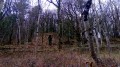
(7) Go round it via the narrow path that climbs to the left, descending on the other side of the hillock and joining, at a right angle, a wider path which you’ll take to the left. You’ll arrive at the top of a ditch lined with wild, tangled trees. The path veers slightly to the right, entering the moss-covered boxwood thickets, which take on the air of a haunted forest in winter. Head down this well-defined path. You’ll reach an open area, offering another view of the valley. Continue down to the right to rejoin the original path at the first junction.
(1) Turn left to return to Avanne and the car park (S/E).

 Visorando Member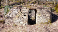

 Easy
Easy