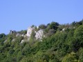
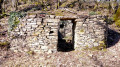
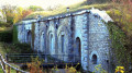
Info: Fort Moncey, better known to the people of Besançon as Fort de Planoise, was built between 1877 and 1892. Surrounded by shelters, four large batteries and barracks, it is open to the public but should be visited with caution. Walkers less interested in military history will appreciate this leafy setting and can stop off at the superb viewing points – one overlooking Besançon and its hills, the other to the south, looking out over the Doubs valley and the Jura mountains – before returning via the bucolic vineyard paths of Les Équegney.


 Country:
 City:
City:


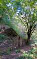
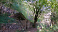
Car park at the rear of the Franche-Comté Polyclinic. By bus, take line 7. Sparse yellow markings and marker posts at junctions. Some sections are unmarked.
(S/E) Start along the concrete path at the far end of the car park. Soon, on the left by an electricity pole, the first marker (no. 158b) directs you to climb the log steps on the left towards Rosemont – Fort de Planoise. After two flights of steps, you’ll reach a signposted path. Head left, then take the path that climbs to the right (post 156) after the second bench. Stay on this well-marked path until you reach another signposted path, which you’ll follow up to the right (post 155).
(1) Shortly after the water tower, at the fork, continue climbing to the left. When the path reaches the meadows below the fort, it turns left, then right, climbing towards the fort. At the foot of a telephone pole, you’ll come to a new signpost marking a fork in the path; continue to the right, skirting an embankment on your left. Head towards and pass the first picnic table, then cross to the other side of the embankment via a nearby passage, heading towards a metal gate (post 152).
(2) Take the stony path that runs alongside the fortifications, heading towards “Point de vue sur Avanne”. Soon, you’ll pass a path branching off to the far left towards the central battery; continue straight on. At the fork, where the path begins to climb slightly to the left, turn right, following the wall of the new fortification, then climb the steps to reach two tunnels with descending staircases. Walk past them and follow the semicircular building, climbing another short flight of steps to reach the paragliding launch site.
(3) After the magnificent (unsecured) viewpoint over the Doubs valley and the Jura mountains, turn your back on the viewpoint, head right towards a small concrete bench and descend a few stone steps into the trench-like path that runs alongside a low wall on your right. You’ll arrive at the other end of the central battery’s line of fire.
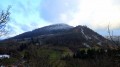
(4) Turn left, walking alongside the battery. At the last casemate, turn sharply right onto the path blocked by a metal post, which takes you back to the picnic area. Walk between the two tables and head towards the left-hand corner of the metal fence bordering the ditches. Follow the ditches to the fort entrance and the viewpoint overlooking the Besançon mountains.
(5) Return to the fort’s entrance and set off again to the left along the small tarmac road. Turn left onto the nearby stony path, going round the metal fence. Then, shortly afterwards, at the signpost, head down to the right towards Les Équegney.
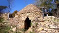
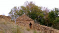
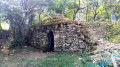
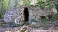
(6) Caution! 200 m further down, don’t miss the log steps on the right (which may be hidden under the leaves) leading to the Équegney shelters. About ten steps after the steps, the path forks. Carry on straight ahead, passing two sets of steps. At the last set, turn left for a short round trip of a few metres to the first shelter. Head to the second caborde, then go down to the right to join the small tarmac road, which you follow to the left for about 200 m. At signpost 145, go down to the right along the path. At the next fork (signpost 148), turn left towards the clearing which offers a view of the rock face of the Bout du Monde waterfall.
(7) Walk alongside a moss-covered wall on your left and, twenty-five to thirty paces further on, look out for the clearly marked little path that climbs up the hillside to the left. When you reach the tarmac road, head down to the right along this lovely little forest track. Shortly after a gate, before you emerge from the woods, look out for signpost no. 142 on the left, which directs you uphill towards Fort de Planoise. You’ll come across a signposted path at a right angle; follow it down to the right, towards Rosemont. 150 metres further down, at the fork, head up to the left. Almost at the foot of the hill, at the fork (no. 164), head up to the left towards La Bousserote to reach an X-shaped crossroads. Head down to the right. Shortly afterwards, on the right, you’ll come to a few log steps. Head down towards Rue Blaise Pascal. At the dead-end street, turn left and carefully make your way down the embankment to reach the car park via the steep little path. If it seems too steep, walk round the block (S/E).

 Visorando Member

 Easy
Easy